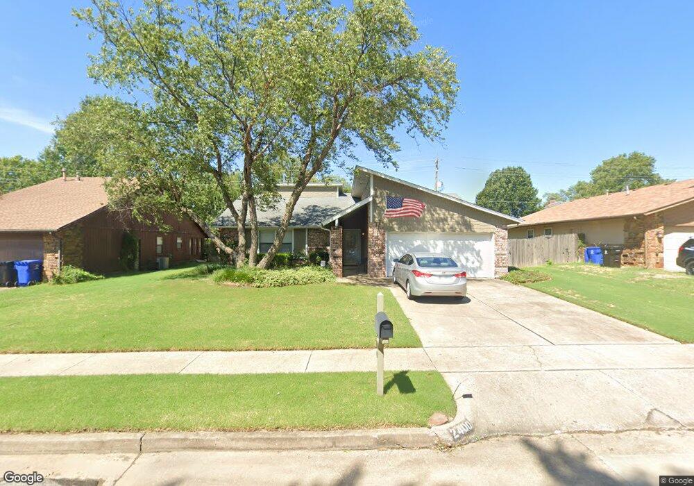
2400 S Fir Ave Broken Arrow, OK 74012
Wolf Creek Estates NeighborhoodEstimated Value: $242,000 - $251,000
3
Beds
2
Baths
1,804
Sq Ft
$136/Sq Ft
Est. Value
About This Home
This home is located at 2400 S Fir Ave, Broken Arrow, OK 74012 and is currently estimated at $245,800, approximately $136 per square foot. 2400 S Fir Ave is a home located in Tulsa County with nearby schools including Wolf Creek Elementary School, Oliver Middle School, and Broken Arrow Freshman Academy.
Ownership History
Date
Name
Owned For
Owner Type
Purchase Details
Closed on
Dec 31, 2007
Sold by
Cline Dorothy M
Bought by
Cline Dorothy Mae and The Dorothy Mae Cline Trust
Current Estimated Value
Purchase Details
Closed on
Sep 30, 2005
Sold by
Mclain Eric and Mclain Cheryl
Bought by
Cline Dorothy M
Purchase Details
Closed on
May 30, 2000
Sold by
Storts Donald Gary and Storts Klista Ann
Bought by
Mclain Eric and Mclain Cheryl
Purchase Details
Closed on
Aug 1, 1981
Create a Home Valuation Report for This Property
The Home Valuation Report is an in-depth analysis detailing your home's value as well as a comparison with similar homes in the area
Home Values in the Area
Average Home Value in this Area
Purchase History
| Date | Buyer | Sale Price | Title Company |
|---|---|---|---|
| Cline Dorothy Mae | -- | None Available | |
| Cline Dorothy M | $123,500 | The Executives Title & Escro | |
| Mclain Eric | $101,000 | -- | |
| -- | $67,000 | -- |
Source: Public Records
Tax History Compared to Growth
Tax History
| Year | Tax Paid | Tax Assessment Tax Assessment Total Assessment is a certain percentage of the fair market value that is determined by local assessors to be the total taxable value of land and additions on the property. | Land | Improvement |
|---|---|---|---|---|
| 2025 | $2,475 | $19,235 | $2,688 | $16,547 |
| 2024 | $2,242 | $18,320 | $2,857 | $15,463 |
| 2023 | $2,242 | $17,448 | $2,691 | $14,757 |
| 2022 | $2,154 | $16,616 | $3,158 | $13,458 |
| 2021 | $2,052 | $15,826 | $3,008 | $12,818 |
| 2020 | $1,988 | $15,072 | $3,417 | $11,655 |
| 2019 | $1,726 | $13,072 | $2,964 | $10,108 |
| 2018 | $1,702 | $13,072 | $2,964 | $10,108 |
| 2017 | $1,711 | $15,072 | $3,417 | $11,655 |
| 2016 | $1,791 | $14,701 | $3,333 | $11,368 |
| 2015 | $1,720 | $14,273 | $3,236 | $11,037 |
| 2014 | $1,684 | $13,857 | $3,142 | $10,715 |
Source: Public Records
Map
Nearby Homes
- 2811 W Atlanta Place
- 2416 S Elder Ave
- 2712 S Fir Ave
- 2400 W Atlanta Ct
- 3904 S Gardenia Ave
- 1812 S Gardenia Ave
- 2323 W Atlanta Ct
- 2615 W Canton St
- 2901 S Gardenia Ave
- 3304 W Atlanta Ct
- 3306 W Atlanta St
- 1802 S Fir Place
- Sawyer Plan at Pine Valley Ranch
- Phoenix Plan at Pine Valley Ranch
- Luna Plan at Pine Valley Ranch
- Eden Plan at Pine Valley Ranch
- Leighton Plan at Pine Valley Ranch
- Juniper Plan at Pine Valley Ranch
- Yorkshire Plan at Pine Valley Ranch
- Wren Plan at Pine Valley Ranch
- 2312 S Fir Ave
- 2404 S Fir Ave
- 2403 S Gardenia Ave
- 2407 S Gardenia Ave
- 2308 S Fir Ave
- 2408 S Fir Ave
- 2323 S Gardenia Ave
- 2629 W Atlanta Place
- 2411 S Gardenia Ave
- 2319 S Gardenia Ave
- 2304 S Fir Ave
- 2405 S Fir Ave
- 2628 W Atlanta Place
- 2412 S Fir Ave
- 2415 S Gardenia Ave
- 2625 W Atlanta Place
- 2315 S Gardenia Ave
- 2624 W Atlanta Ct
- 2624 W Atlanta Place
- 2300 S Fir Ave
