Estimated Value: $321,518 - $362,000
3
Beds
2
Baths
2,170
Sq Ft
$157/Sq Ft
Est. Value
About This Home
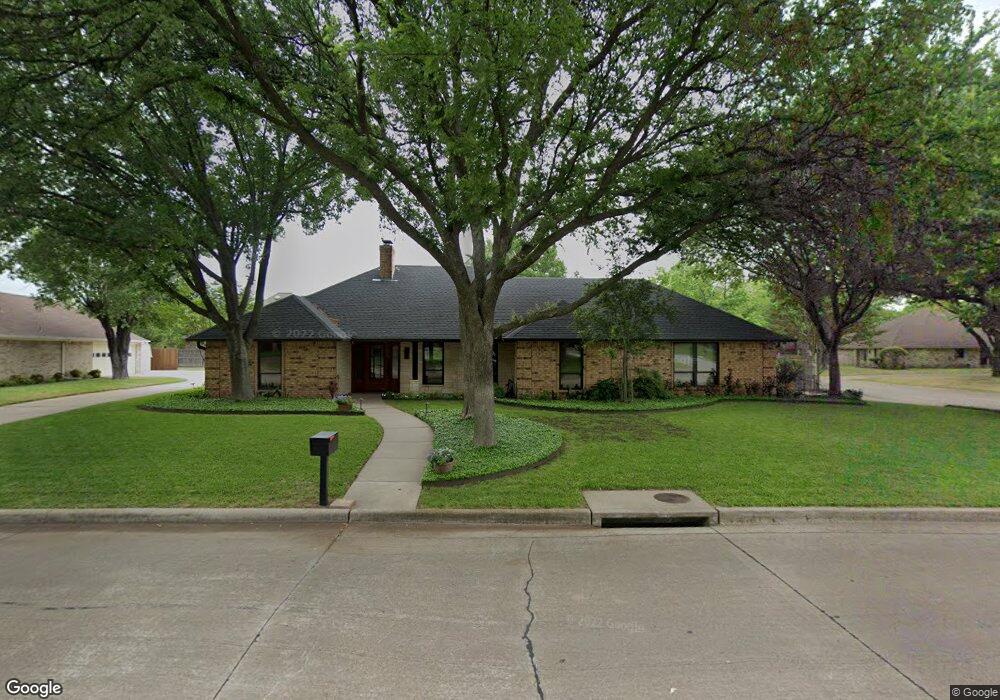
This home is located at 2400 Saint Andrews Dr, Ennis, TX 75119 and is currently estimated at $341,759, approximately $157 per square foot. 2400 Saint Andrews Dr is a home located in Ellis County with nearby schools including Austin Elementary School, Dorie Miller Int, and Ennis Junior High School.
Ownership History
Date
Name
Owned For
Owner Type
Purchase Details
Closed on
Dec 10, 2020
Sold by
Levacy Patricia and Liska Charles Patrick
Bought by
Mcdaniel Randy Jun and Mcdaniel Bobbie Compton
Current Estimated Value
Home Financials for this Owner
Home Financials are based on the most recent Mortgage that was taken out on this home.
Original Mortgage
$102,000
Outstanding Balance
$73,416
Interest Rate
2.3%
Mortgage Type
Future Advance Clause Open End Mortgage
Estimated Equity
$268,343
Create a Home Valuation Report for This Property
The Home Valuation Report is an in-depth analysis detailing your home's value as well as a comparison with similar homes in the area
Home Values in the Area
Average Home Value in this Area
Purchase History
| Date | Buyer | Sale Price | Title Company |
|---|---|---|---|
| Mcdaniel Randy Jun | -- | None Available |
Source: Public Records
Mortgage History
| Date | Status | Borrower | Loan Amount |
|---|---|---|---|
| Open | Mcdaniel Randy Jun | $102,000 |
Source: Public Records
Tax History Compared to Growth
Tax History
| Year | Tax Paid | Tax Assessment Tax Assessment Total Assessment is a certain percentage of the fair market value that is determined by local assessors to be the total taxable value of land and additions on the property. | Land | Improvement |
|---|---|---|---|---|
| 2025 | $2,313 | $329,496 | -- | -- |
| 2024 | $2,313 | $299,542 | -- | -- |
| 2023 | $2,313 | $272,311 | $0 | $0 |
| 2022 | $5,925 | $247,555 | $0 | $0 |
| 2021 | $5,666 | $225,050 | $38,500 | $186,550 |
| 2020 | $5,323 | $206,850 | $30,000 | $176,850 |
| 2019 | $5,182 | $197,740 | $0 | $0 |
| 2018 | $3,706 | $183,590 | $30,000 | $153,590 |
| 2017 | $4,534 | $170,920 | $30,000 | $140,920 |
| 2016 | $4,361 | $164,420 | $30,000 | $134,420 |
| 2015 | $3,791 | $159,990 | $30,000 | $129,990 |
| 2014 | $3,791 | $153,970 | $0 | $0 |
Source: Public Records
Map
Nearby Homes
- 2503 Saint Andrews Dr
- 2703 Sleepy Hollow Rd
- 2402 Country Club Rd
- 1709 Carnoustie Dr
- 1703 Carnoustie Dr
- 1207 Louise Ln
- 2900 Terrytown Dr
- 2800 Boyd St
- 2904 Terrytown Dr
- 1002 Hoylake Ct
- 2100 Lakeridge Cir
- 2308 Louise Ln
- 000 Sleepy Hollow Rd
- 2410 Linda Dr
- 1103 Sunset Dr
- 1509 Lyndale Dr
- 2810 Belmont Dr
- 536 Lakeshore Dr
- Lavon Plan at The Hollow
- Bowie Plan at The Hollow
- 2402 Saint Andrews Dr
- 2401 Inverrary Dr
- 2403 Inverrary Dr
- 2805 Gleneagles Dr
- 2401 Saint Andrews Dr
- 2404 Saint Andrews Dr
- 2803 Gleneagles Dr
- 2403 Saint Andrews Dr
- 2405 Inverrary Dr
- 2901 Gleneagles Dr
- 2801 Gleneagles Dr
- 2405 Saint Andrews Dr
- 2400 Inverrary Dr
- 2906 Gleneagles Dr
- 2402 Inverrary Dr
- 2501 Inverrary Dr
- 2500 St Andrews Dr
- 2404 Inverrary Dr
- 2500 Saint Andrews Dr
- 2705 Gleneagles Dr