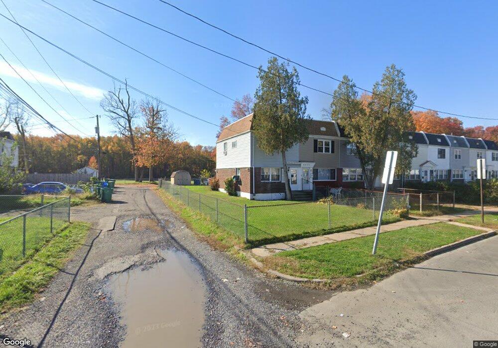
2401 Fleetwing Dr Levittown, PA 19057
Estimated Value: $149,000 - $209,029
3
Beds
2
Baths
960
Sq Ft
$197/Sq Ft
Est. Value
About This Home
This home is located at 2401 Fleetwing Dr, Levittown, PA 19057 and is currently estimated at $188,676, approximately $196 per square foot. 2401 Fleetwing Dr is a home located in Bucks County with nearby schools including Truman Senior High School, First Presbyterian Church School, and Hope Lutheran School.
Ownership History
Date
Name
Owned For
Owner Type
Purchase Details
Closed on
Dec 22, 1999
Sold by
Edwards Darlene R and Edwards Bey Giselle M
Bought by
Edwards Darlene R
Current Estimated Value
Home Financials for this Owner
Home Financials are based on the most recent Mortgage that was taken out on this home.
Original Mortgage
$31,450
Interest Rate
7.32%
Purchase Details
Closed on
Mar 11, 1996
Sold by
Edwards Marion
Bought by
Edwards Darlene R and Edwards Bey Giselle M
Create a Home Valuation Report for This Property
The Home Valuation Report is an in-depth analysis detailing your home's value as well as a comparison with similar homes in the area
Home Values in the Area
Average Home Value in this Area
Purchase History
| Date | Buyer | Sale Price | Title Company |
|---|---|---|---|
| Edwards Darlene R | -- | -- | |
| Edwards Darlene R | -- | -- |
Source: Public Records
Mortgage History
| Date | Status | Borrower | Loan Amount |
|---|---|---|---|
| Closed | Edwards Darlene R | $31,450 |
Source: Public Records
Tax History Compared to Growth
Tax History
| Year | Tax Paid | Tax Assessment Tax Assessment Total Assessment is a certain percentage of the fair market value that is determined by local assessors to be the total taxable value of land and additions on the property. | Land | Improvement |
|---|---|---|---|---|
| 2025 | $1,564 | $5,760 | $2,160 | $3,600 |
| 2024 | $1,564 | $5,760 | $2,160 | $3,600 |
| 2023 | $1,553 | $5,760 | $2,160 | $3,600 |
| 2022 | $1,553 | $5,760 | $2,160 | $3,600 |
| 2021 | $1,553 | $5,760 | $2,160 | $3,600 |
| 2020 | $1,553 | $5,760 | $2,160 | $3,600 |
| 2019 | $1,547 | $5,760 | $2,160 | $3,600 |
| 2018 | $1,522 | $5,760 | $2,160 | $3,600 |
| 2017 | $1,499 | $5,760 | $2,160 | $3,600 |
| 2016 | $1,499 | $5,760 | $2,160 | $3,600 |
| 2015 | $889 | $5,760 | $2,160 | $3,600 |
| 2014 | $889 | $5,760 | $2,160 | $3,600 |
Source: Public Records
Map
Nearby Homes
- 5711 Mustang St
- 2205 Liberator St
- 5604 Fleetwing Dr
- 1019 Green Ln
- 5617 Beaver Dam Rd
- 150 Naomi Ct Unit 811
- 246 Colette Ct
- 86 Wildflower Rd
- 1201 Pacific Ave
- 2519 Woodlawn Dr
- 5 Green Ln
- 5605 Toga St
- 5517 Schumacher Dr
- 84 Whitewood Dr
- 55 Cedar Ln
- 35 Cedar Ln
- 86 Cedar Ln
- 23 Misty Pine Rd
- 3021 Bath Rd
- 101 Idlewild Rd
- 2405 Fleetwing Dr
- 2403 Fleetwing Dr
- 2407 Fleetwing Dr
- 2409 Fleetwing Dr
- 2411 Fleetwing Dr
- 5627 Mitchell Rd
- 2413 Fleetwing Dr
- 5623 Mitchell Rd
- 5625 Mitchell Rd
- 5621 Mitchell Rd
- 2415 Fleetwing Dr
- 5629 Mitchell Rd
- 2417 Fleetwing Dr
- 2419 Fleetwing Dr
- 2400 Fleetwing Dr
- 2421 Fleetwing Dr
- 2402 Fleetwing Dr
- 2404 Fleetwing Dr
- 2406 Fleetwing Dr
- 2423 Fleetwing Dr