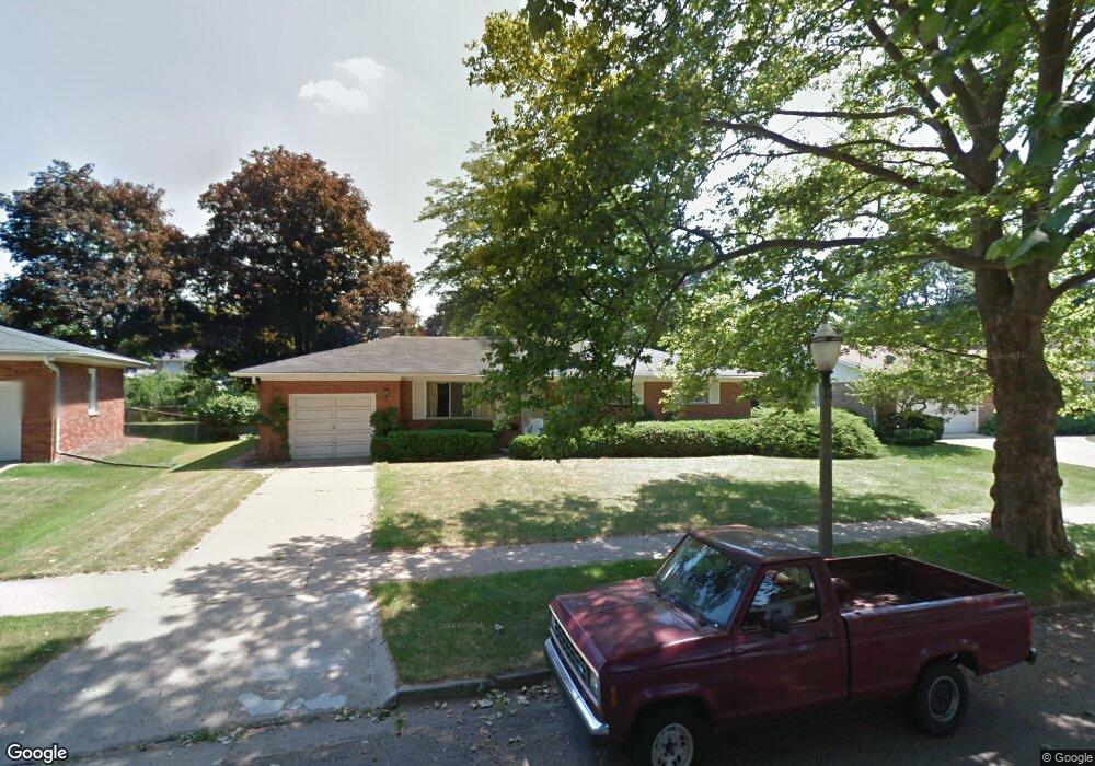
2401 Hanover Dr Lansing, MI 48911
Lewton Rich NeighborhoodEstimated Value: $197,121 - $241,000
--
Bed
1
Bath
1,338
Sq Ft
$162/Sq Ft
Est. Value
About This Home
This home is located at 2401 Hanover Dr, Lansing, MI 48911 and is currently estimated at $216,530, approximately $161 per square foot. 2401 Hanover Dr is a home located in Ingham County with nearby schools including Averill Elementary School, Attwood School, and J.W. Sexton High School.
Ownership History
Date
Name
Owned For
Owner Type
Purchase Details
Closed on
Apr 25, 2018
Sold by
Linn David W and Linn Thomas J
Bought by
Linn Thomas J
Current Estimated Value
Purchase Details
Closed on
Jun 17, 2014
Sold by
Linn David William
Bought by
Linn Thomas Joseph
Purchase Details
Closed on
May 27, 2010
Sold by
Linn Thomas J
Bought by
Linn Thomas J and Linn David W
Create a Home Valuation Report for This Property
The Home Valuation Report is an in-depth analysis detailing your home's value as well as a comparison with similar homes in the area
Home Values in the Area
Average Home Value in this Area
Purchase History
| Date | Buyer | Sale Price | Title Company |
|---|---|---|---|
| Linn Thomas J | -- | None Available | |
| Linn Thomas Joseph | -- | None Available | |
| Linn Thomas J | -- | None Available |
Source: Public Records
Tax History Compared to Growth
Tax History
| Year | Tax Paid | Tax Assessment Tax Assessment Total Assessment is a certain percentage of the fair market value that is determined by local assessors to be the total taxable value of land and additions on the property. | Land | Improvement |
|---|---|---|---|---|
| 2025 | $3,532 | $102,300 | $15,100 | $87,200 |
| 2024 | $28 | $92,000 | $15,100 | $76,900 |
| 2023 | $3,311 | $81,200 | $15,100 | $66,100 |
| 2022 | $2,983 | $71,200 | $13,100 | $58,100 |
| 2021 | $2,921 | $65,800 | $12,100 | $53,700 |
| 2020 | $2,546 | $62,200 | $12,100 | $50,100 |
| 2019 | $4,844 | $56,400 | $12,100 | $44,300 |
| 2018 | $2,608 | $53,200 | $12,100 | $41,100 |
| 2017 | $2,497 | $53,200 | $12,100 | $41,100 |
| 2016 | $4,357 | $46,800 | $12,100 | $34,700 |
| 2015 | $4,357 | $44,000 | $24,202 | $19,798 |
| 2014 | $4,357 | $42,600 | $24,202 | $18,398 |
Source: Public Records
Map
Nearby Homes
- 2505 Hanover Dr
- 2200 Rossiter Place
- 2201 Pamela Place
- 2409 Victor Ave
- 2812 Pleasant Grove Rd
- 2710 Bedford Rd
- 2920 Pleasant Grove Rd Unit 1
- 2039 Holly Way
- 1533 Cambridge Rd
- 2905 S Catherine St
- 3125 Boston Blvd
- 1740 Wellington Rd Unit 103
- 3310 W Mount Hope Ave
- 1618 Loraine Ave
- 3214 Gingersnap Ln
- 3425 Cooley Dr
- 3421 Troon Cir Unit 29
- 3212 Ingham St
- 3333 Moores River Dr Unit 812
- 3508 Muirfield Dr
- 2319 Hanover Dr
- 2407 Hanover Dr
- 2326 Hampshire Rd
- 2400 Hampshire Rd
- 2320 Hampshire Rd
- 2311 Hanover Dr
- 2400 Hanover Dr
- 2415 Hanover Dr
- 2406 Hanover Dr
- 2312 Hampshire Rd
- 2316 Hanover Dr
- 2414 Hanover Dr
- 2301 Hanover Dr
- 2310 Hanover Dr
- 2214 Hampden Dr
- 2425 Hanover Dr
- 2323 Hampshire Rd
- 2215 Wellesley Dr
- 2023 Wellesley Dr