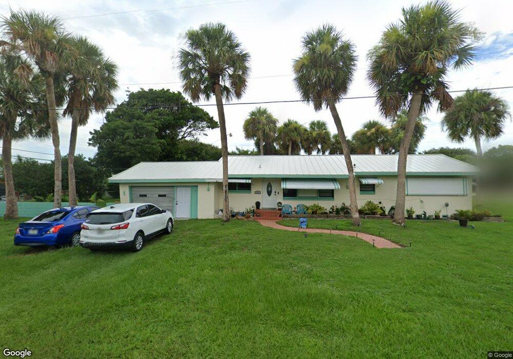
2401 Sea Oats Rd Fort Pierce, FL 34949
Hutchinson Island North NeighborhoodEstimated Value: $456,000 - $519,000
3
Beds
1
Bath
1,378
Sq Ft
$350/Sq Ft
Est. Value
About This Home
This home is located at 2401 Sea Oats Rd, Fort Pierce, FL 34949 and is currently estimated at $481,967, approximately $349 per square foot. 2401 Sea Oats Rd is a home with nearby schools including Chester A. Moore Elementary School, St. Lucie Elementary School, and Lawnwood Elementary School.
Ownership History
Date
Name
Owned For
Owner Type
Purchase Details
Closed on
Feb 3, 2021
Sold by
Wilcox Robert L
Bought by
Wilcox Mitchell L and Wilcox Ginger
Current Estimated Value
Purchase Details
Closed on
Jan 9, 2017
Sold by
Wilcox Robert L
Bought by
Wilcox Robert L and Wilcox Mitchell L
Create a Home Valuation Report for This Property
The Home Valuation Report is an in-depth analysis detailing your home's value as well as a comparison with similar homes in the area
Home Values in the Area
Average Home Value in this Area
Purchase History
| Date | Buyer | Sale Price | Title Company |
|---|---|---|---|
| Wilcox Mitchell L | -- | Accommodation | |
| Wilcox Ginger | $100 | None Listed On Document | |
| Wilcox Robert L | -- | Accommodation | |
| Wilcox Robert L | $100 | None Listed On Document | |
| Wilcox Robert L | -- | Attorney |
Source: Public Records
Tax History Compared to Growth
Tax History
| Year | Tax Paid | Tax Assessment Tax Assessment Total Assessment is a certain percentage of the fair market value that is determined by local assessors to be the total taxable value of land and additions on the property. | Land | Improvement |
|---|---|---|---|---|
| 2024 | $5,469 | $414,600 | $325,400 | $89,200 |
| 2023 | $5,469 | $324,400 | $242,000 | $82,400 |
| 2022 | $4,922 | $291,900 | $220,000 | $71,900 |
| 2021 | $4,174 | $193,200 | $132,000 | $61,200 |
| 2020 | $3,856 | $174,400 | $121,000 | $53,400 |
| 2019 | $3,909 | $174,800 | $121,000 | $53,800 |
| 2018 | $3,434 | $159,000 | $88,700 | $70,300 |
| 2017 | $3,244 | $152,000 | $88,700 | $63,300 |
| 2016 | $2,907 | $132,300 | $76,100 | $56,200 |
| 2015 | $2,823 | $125,100 | $76,100 | $49,000 |
| 2014 | $2,642 | $118,300 | $0 | $0 |
Source: Public Records
Map
Nearby Homes
- 0 Tamarind Dr
- 2325 Tamarind Dr
- 0 N Ocean Dr
- 2507 N Ocean Dr
- 2504 Atlantic Beach Blvd Unit 2b
- 2504 Atlantic Ave Unit 2b
- 2600 N Highway A1a
- 2700 N Highway A1a Unit 207
- 2700 N Highway A1a Unit 806
- 2700 N Highway A1a Unit 1308
- 2700 N Highway A1a
- 2700 N Highway A1a Unit 506
- 2700 N Highway A1a Unit 307
- 1000 Shorewinds Dr
- 2611 Flotilla Terrace
- 2800 N Highway A1a Unit 408
- 2800 N Highway A1a Unit 302
- 2800 N Highway A1a Unit 401
- 2800 N Highway A1a
- 2801 N Highway A1a Unit E
- 2304 Tamarind Dr
- 2400 Atlantic Beach Blvd
- 2406 Atlantic Beach Blvd
- 2407 Tamarind Dr
- 2402 Tamarind Dr
- 2408 Atlantic Beach Blvd
- 2406 Tamarind Dr
- 2409 Tamarind Dr
- 2408 Tamarind Dr
- 2319 Tamarind Dr Unit 201
- 2319 Tamarind Dr Unit 103
- 2319 Tamarind Dr Unit 102
- 2319 Tamarind Dr Unit 101
- 2319 Tamarind Dr Unit 5 Units
- 2319 Tamarind Dr
- 2319 Tamarind Dr
- 2319 Tamarind Dr
- 2319 Tamarind Dr
- 2319 Tamarind Dr
- 2404 Tamarind Dr