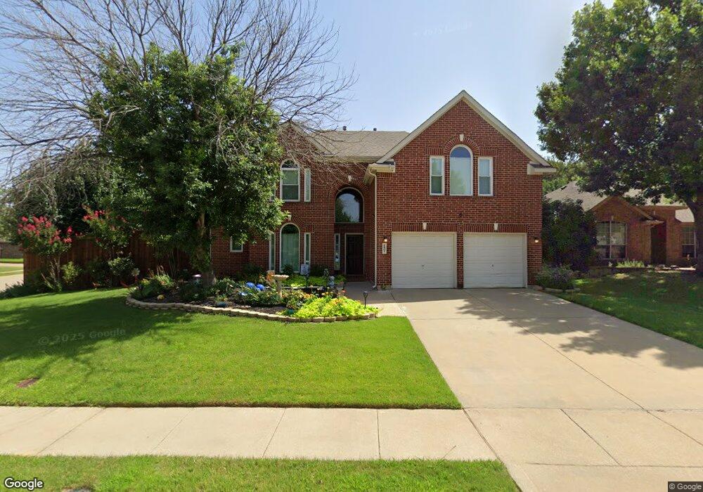
2401 Summit Ct Denton, TX 76210
South Denton NeighborhoodEstimated Value: $396,000 - $433,000
About This Home
This home is located at 2401 Summit Ct, Denton, TX 76210 and is currently estimated at $421,757, approximately $157 per square foot. 2401 Summit Ct is a home located in Denton County with nearby schools including Houston Elementary School, McMath Middle School, and Denton High School.
Ownership History
We collect this data history from publicly available records. To have your information removed, we recommend requesting removal directly through your county’s website.
Purchase Details
Home Financials for this Owner
Home Financials are based on the most recent Mortgage that was taken out on this home.Purchase Details
Purchase Details
Home Financials for this Owner
Home Financials are based on the most recent Mortgage that was taken out on this home.Home Values in the Area
Average Home Value in this Area
Purchase History
We collect this data history from publicly available records. To have your information removed, we recommend requesting removal directly through your county’s website.
| Date | Buyer | Sale Price | Title Company |
|---|---|---|---|
| -- | Freedom Title | ||
| -- | Freedom Title | ||
| -- | -- |
Mortgage History
We collect this data history from publicly available records. To have your information removed, we recommend requesting removal directly through your county’s website.
| Date | Status | Borrower | Loan Amount |
|---|---|---|---|
| Open | $247,000 | ||
| Previous Owner | $151,850 |
Tax History
We collect this data history from publicly available records. To have your information removed, we recommend requesting removal directly through your county’s website.
| Year | Tax Paid | Tax Assessment Tax Assessment Total Assessment is a certain percentage of the fair market value that is determined by local assessors to be the total taxable value of land and additions on the property. | Land | Improvement |
|---|---|---|---|---|
| 2025 | $6,745 | $425,587 | $91,224 | $334,363 |
| 2024 | $7,941 | $411,401 | $0 | $0 |
| 2023 | $5,944 | $374,001 | $91,224 | $316,794 |
| 2022 | $7,218 | $340,001 | $91,224 | $316,509 |
| 2021 | $6,871 | $311,971 | $67,589 | $244,382 |
| 2020 | $6,423 | $280,993 | $67,589 | $213,404 |
| 2019 | $6,516 | $273,089 | $67,589 | $205,500 |
| 2018 | $6,293 | $260,523 | $67,589 | $192,934 |
| 2017 | $5,898 | $238,598 | $39,559 | $199,039 |
| 2016 | $5,423 | $219,383 | $39,559 | $184,704 |
| 2015 | $4,365 | $199,439 | $39,559 | $159,880 |
| 2013 | -- | $172,799 | $39,559 | $133,240 |
Map
- 3724 Ranchman Blvd
- 3717 Ranchman Blvd
- 2708 Weslayan Dr
- 2700 Hereford Rd
- 2617 Hereford Rd
- 3513 Sundown Blvd
- 2804 Hollow Ridge Dr
- 3509 Mustang Dr
- 3825 Chimney Rock Dr
- 2821 Weslayan Dr
- 3829 Chimney Rock Dr
- 2805 Hereford Rd
- 3817 Kirby Dr
- 2108 Moonsail Ln
- 2716 Frontier Dr
- 2721 Clubhouse Dr
- 3321 Monte Carlo Ln
- 3529 Tuscan Hills Cir
- 3000 Bella Lago Dr
- 3017 Bella Lago Dr
- 2405 Summit Ct
- 3729 Ranchman Blvd
- 3728 Ranchman Blvd
- 2409 Summit Ct
- 3725 Ranchman Blvd
- 2400 Summit Ct
- 3800 Ranchman Blvd
- 2404 Summit Ct
- 3721 Ranchman Blvd
- 2413 Summit Ct
- 3724 Dunlavy Rd
- 3720 Dunlavy Rd
- 3804 Ranchman Blvd
- 3716 Ranchman Blvd
- 3728 Dunlavy Rd
- 3716 Dunlavy Rd
- 2408 Summit Ct
- 2412 Summit Ct
- 3805 Ranchman Blvd
- 3800 Dunlavy Rd
Ask me questions while you tour the home.