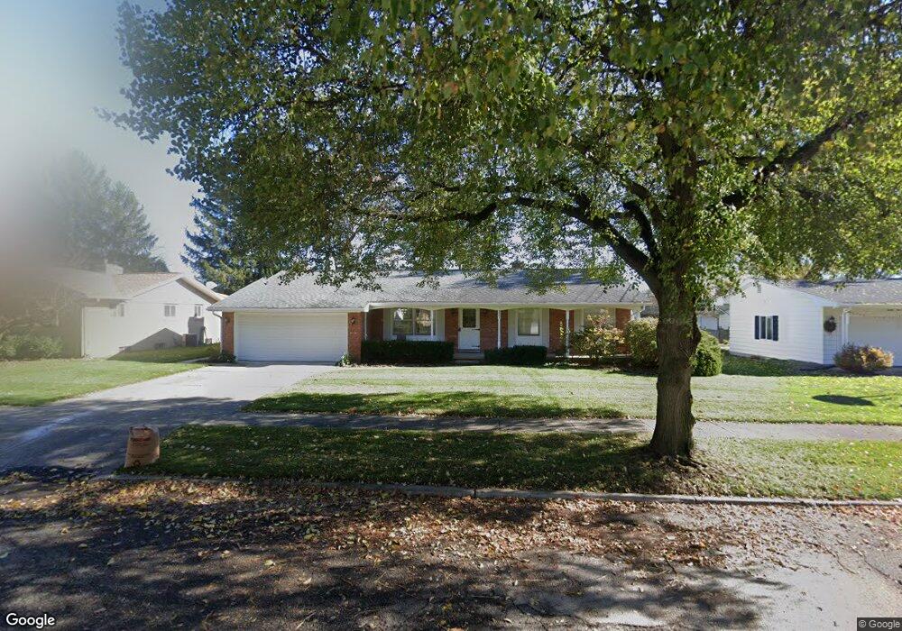
2401 Wellesley Dr Lansing, MI 48911
Lewton Rich NeighborhoodEstimated Value: $207,345 - $251,000
Studio
1
Bath
1,489
Sq Ft
$153/Sq Ft
Est. Value
About This Home
This home is located at 2401 Wellesley Dr, Lansing, MI 48911 and is currently estimated at $228,086, approximately $153 per square foot. 2401 Wellesley Dr is a home located in Ingham County with nearby schools including Averill Elementary School, Attwood School, and J.W. Sexton High School.
Ownership History
Date
Name
Owned For
Owner Type
Purchase Details
Closed on
Jan 27, 2016
Sold by
Kindervater Richard A
Bought by
Kindervater Richard A and The Richard Alan Kindervater Trust
Current Estimated Value
Purchase Details
Closed on
Dec 4, 2006
Sold by
Kindervater Richard F and Kindervater Yvonne J
Bought by
Kindervater Richard F and Kindervater Yvonne J
Create a Home Valuation Report for This Property
The Home Valuation Report is an in-depth analysis detailing your home's value as well as a comparison with similar homes in the area
Home Values in the Area
Average Home Value in this Area
Purchase History
| Date | Buyer | Sale Price | Title Company |
|---|---|---|---|
| Kindervater Richard A | -- | None Available | |
| Kindervater Richard A | -- | None Available | |
| Kindervater Richard F | -- | None Available |
Source: Public Records
Tax History
| Year | Tax Paid | Tax Assessment Tax Assessment Total Assessment is a certain percentage of the fair market value that is determined by local assessors to be the total taxable value of land and additions on the property. | Land | Improvement |
|---|---|---|---|---|
| 2025 | $3,588 | $104,900 | $13,400 | $91,500 |
| 2024 | $29 | $94,200 | $13,400 | $80,800 |
| 2023 | $3,363 | $82,800 | $13,400 | $69,400 |
| 2022 | $3,030 | $72,700 | $11,600 | $61,100 |
| 2021 | $2,967 | $67,000 | $10,700 | $56,300 |
| 2020 | $2,949 | $64,300 | $10,700 | $53,600 |
| 2019 | $2,828 | $58,000 | $10,700 | $47,300 |
| 2018 | $2,649 | $52,800 | $10,700 | $42,100 |
| 2017 | $2,537 | $52,800 | $10,700 | $42,100 |
| 2016 | $2,426 | $46,300 | $10,700 | $35,600 |
| 2015 | $2,426 | $44,100 | $21,466 | $22,634 |
| 2014 | $2,426 | $43,300 | $21,466 | $21,834 |
Source: Public Records
Map
Nearby Homes
- 2200 Rossiter Place
- 2519 Belaire Dr
- 2409 Victor Ave
- 2505 Fairfax Rd
- 2924 Woodview Dr
- 2500 Skye Rd
- 3125 Boston Blvd
- 1533 Cambridge Rd
- 3215 S Cambridge Rd
- 1618 Loraine Ave
- 1740 Wellington Rd Unit 103
- 3425 Cooley Dr
- 3508 Muirfield Dr
- 1517 Lenore Ave
- 3601 Muirfield Dr
- 3522 Saint Andrews Cir Unit 33
- 0 S Deerfield Ave
- 3612 Muirfield Dr Unit 5
- 3230 S Deerfield Ave
- 1323 Cooper Ave
- 2301 Wellesley Dr
- 2411 Wellesley Dr
- 2416 Woodview Dr
- 2411 Hampshire Rd
- 2400 Wellesley Dr
- 2410 Woodview Dr
- 2308 Wellesley Dr
- 2300 Wellesley Dr
- 2400 Woodview Dr
- 2223 Wellesley Dr
- 2310 Hampshire Cir
- 2405 Hampshire Rd
- 2427 Woodview Dr
- 2226 Wellesley Dr
- 2501 Woodview Dr
- 2501 Woodview Dr
- 2614 Woodview Dr
- 2415 Rossiter Place
Your Personal Tour Guide
Ask me questions while you tour the home.