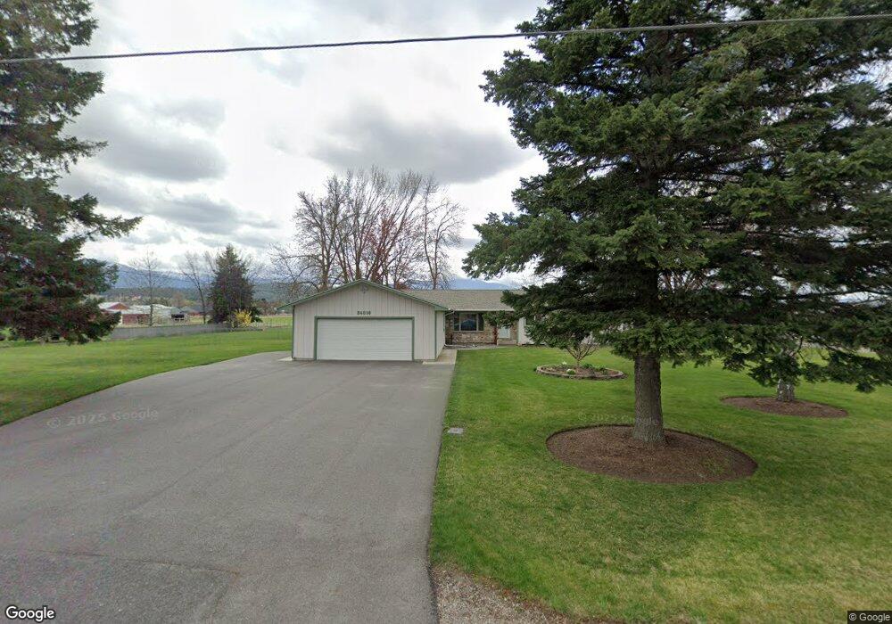
24016 E Garland Ave Otis Orchards, WA 99027
Otis Orchards-East Farms NeighborhoodEstimated Value: $609,000 - $715,000
2
Beds
2
Baths
1,941
Sq Ft
$347/Sq Ft
Est. Value
About This Home
This home is located at 24016 E Garland Ave, Otis Orchards, WA 99027 and is currently estimated at $672,811, approximately $346 per square foot. 24016 E Garland Ave is a home located in Spokane County with nearby schools including Otis Orchards School, East Valley Middle School, and East Valley High School & Extension.
Ownership History
Date
Name
Owned For
Owner Type
Purchase Details
Closed on
Aug 21, 1995
Sold by
Locnikar Julian M and Locnikar Jody A
Bought by
Konkle John K and Konkle Deborah L
Current Estimated Value
Home Financials for this Owner
Home Financials are based on the most recent Mortgage that was taken out on this home.
Original Mortgage
$92,000
Interest Rate
7.5%
Create a Home Valuation Report for This Property
The Home Valuation Report is an in-depth analysis detailing your home's value as well as a comparison with similar homes in the area
Home Values in the Area
Average Home Value in this Area
Purchase History
| Date | Buyer | Sale Price | Title Company |
|---|---|---|---|
| Konkle John K | $141,999 | Stewart Title |
Source: Public Records
Mortgage History
| Date | Status | Borrower | Loan Amount |
|---|---|---|---|
| Closed | Konkle John K | $92,000 |
Source: Public Records
Tax History Compared to Growth
Tax History
| Year | Tax Paid | Tax Assessment Tax Assessment Total Assessment is a certain percentage of the fair market value that is determined by local assessors to be the total taxable value of land and additions on the property. | Land | Improvement |
|---|---|---|---|---|
| 2025 | $5,323 | $568,000 | $191,900 | $376,100 |
| 2024 | $5,323 | $544,200 | $186,900 | $357,300 |
| 2023 | $5,180 | $544,200 | $186,900 | $357,300 |
| 2022 | $4,922 | $531,600 | $186,900 | $344,700 |
| 2021 | $4,753 | $377,500 | $129,600 | $247,900 |
| 2020 | $4,287 | $320,940 | $120,140 | $200,800 |
| 2019 | $3,645 | $276,160 | $101,760 | $174,400 |
| 2018 | $3,533 | $248,840 | $77,840 | $171,000 |
| 2017 | $3,383 | $239,340 | $77,840 | $161,500 |
| 2016 | $3,127 | $223,510 | $69,510 | $154,000 |
| 2015 | $3,157 | $217,910 | $69,510 | $148,400 |
| 2014 | -- | $218,910 | $69,510 | $149,400 |
| 2013 | -- | $0 | $0 | $0 |
Source: Public Records
Map
Nearby Homes
- 24005 E Garland Ave
- 4806 N Drury Rd
- 24672 Hawkstone Loop
- 24443 E Pinnacle Ct Unit 24443
- 24872 E Hawkstone Loop
- 24672 E Hawkstone Loop
- 2669 N Talon Ln
- 2669 Talon Ln
- 24503 E Feather Loop
- Yukon Plan at Stonehill - Haven Collection
- Briarwood Plan at Stonehill - Cottage Collection
- Sedona Plan at Stonehill - Haven Collection
- 24662 E Hawkstone Loop
- Goldenwood Plan at Stonehill - Cottage Collection
- Willow Plan at Stonehill - Cottage Collection
- Hazelwood Plan at Stonehill - Cottage Collection
- Sherwood Plan at Stonehill - Cottage Collection
- Birch Plan at Stonehill - Haven Collection
- Colorado Plan at Stonehill - Haven Collection
- Winnipeg-Inspiration Plan at Stonehill - Haven Collection
- 24025 E Garland Ave
- 24108 E Garland Ave
- 24015 E Garland Ave
- 24105 E Garland Ave
- 24123 E Garland Ave
- 23905 E Garland Ave
- 3916 N Stevenson Rd
- 3904 N Stevenson Rd
- 3721 N Malvern Rd
- 3921 N Stevens St
- 3808 N Stevenson Rd
- 3927 N Simpson Rd
- 3909 N Stevenson Rd
- 3823 N Stevenson Rd
- 3713 N Malvern Rd
- 3722 N Stevenson Rd
- 3817 N Simpson Rd
- 23806 E Garland Ave
- 3805 N Stevenson Rd
- 4111 N Simpson Rd