Estimated Value: $442,000 - $604,000
3
Beds
2
Baths
1,760
Sq Ft
$281/Sq Ft
Est. Value
About This Home
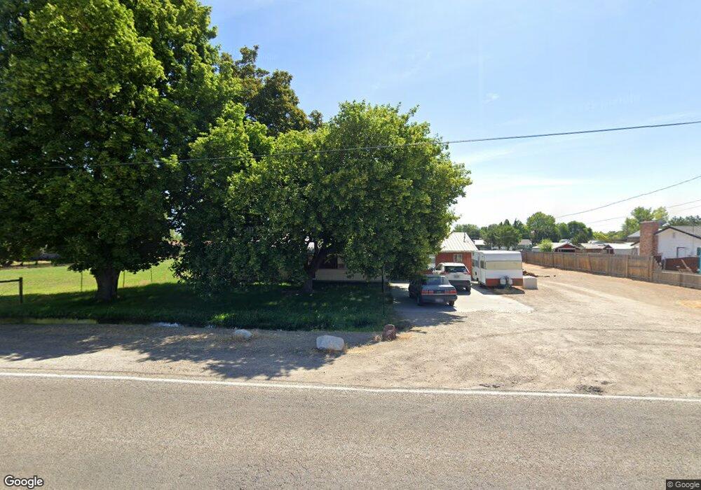
This home is located at 2402 S Powerline Rd, Nampa, ID 83686 and is currently estimated at $494,605, approximately $281 per square foot. 2402 S Powerline Rd is a home located in Canyon County with nearby schools including Greenhurst Elementary School, South Middle School, and Skyview High School.
Ownership History
Date
Name
Owned For
Owner Type
Purchase Details
Closed on
Mar 18, 2016
Sold by
Burtlow Marcia K
Bought by
Burtlow Frank
Current Estimated Value
Home Financials for this Owner
Home Financials are based on the most recent Mortgage that was taken out on this home.
Original Mortgage
$159,000
Outstanding Balance
$125,848
Interest Rate
3.65%
Mortgage Type
New Conventional
Estimated Equity
$368,757
Purchase Details
Closed on
Apr 25, 2007
Sold by
Nay Patricia R
Bought by
Burtlow Frank J
Home Financials for this Owner
Home Financials are based on the most recent Mortgage that was taken out on this home.
Original Mortgage
$203,250
Interest Rate
6.11%
Mortgage Type
Purchase Money Mortgage
Create a Home Valuation Report for This Property
The Home Valuation Report is an in-depth analysis detailing your home's value as well as a comparison with similar homes in the area
Home Values in the Area
Average Home Value in this Area
Purchase History
| Date | Buyer | Sale Price | Title Company |
|---|---|---|---|
| Burtlow Frank | -- | Fidelity National Title Bois | |
| Burtlow Frank J | -- | Pioneer Title Company |
Source: Public Records
Mortgage History
| Date | Status | Borrower | Loan Amount |
|---|---|---|---|
| Open | Burtlow Frank | $159,000 | |
| Closed | Burtlow Frank J | $203,250 |
Source: Public Records
Tax History Compared to Growth
Tax History
| Year | Tax Paid | Tax Assessment Tax Assessment Total Assessment is a certain percentage of the fair market value that is determined by local assessors to be the total taxable value of land and additions on the property. | Land | Improvement |
|---|---|---|---|---|
| 2025 | $1,903 | $438,200 | $200,000 | $238,200 |
| 2024 | $1,903 | $432,300 | $200,000 | $232,300 |
| 2023 | $1,961 | $455,100 | $200,000 | $255,100 |
| 2022 | $2,372 | $446,400 | $180,000 | $266,400 |
| 2021 | $2,207 | $312,300 | $90,000 | $222,300 |
| 2020 | $2,155 | $266,400 | $80,000 | $186,400 |
| 2019 | $2,003 | $216,200 | $50,000 | $166,200 |
| 2018 | $1,754 | $0 | $0 | $0 |
| 2017 | $1,648 | $0 | $0 | $0 |
| 2016 | $1,554 | $0 | $0 | $0 |
| 2015 | $1,526 | $0 | $0 | $0 |
| 2014 | $1,371 | $120,700 | $26,000 | $94,700 |
Source: Public Records
Map
Nearby Homes
- 2714 S Almond Ct
- 946 S Almond Ct
- 945 S Almond Ct
- 2121 Lambert Dr
- 1612 E York Ave
- 1835 E Kentucky Ave
- 2019 Kentucky Dr
- 1801 E Iowa Ave
- 1921 E Explorer Ct
- 709 E Trail Creek Dr
- 525 E Greenhurst Rd
- 1157 S Powerline Rd
- 2020 E Lost River Ave
- 2622 Boulder Ave
- 1426 E Sharons Loop
- 1515 Primrose Dr
- 1300 Diamond Ct
- 1426 Chicago St
- 1912 S Locust St
- 2308 E Elm Grove Dr
- 2420 S Powerline Rd
- TBD S Powerline Rd
- 210 S Powerline Rd
- 2312 S Powerline Rd
- 2403 S Florence St
- 2305 S Powerline Rd
- 2313 S Florence St
- 2421 S Florence St
- 2314 S Florence St
- 2512 S Powerline Rd
- 2404 S Florence St
- 2520 S Florence St
- 2500 S Florence St
- 2329 S Meyer St
- 2409 S Meyer St
- 2317 S Meyer St
- 2516 S Florence St
- 2421 S Meyer St
- 1404 E Greenhurst Rd
- 2520 S Powerline Rd