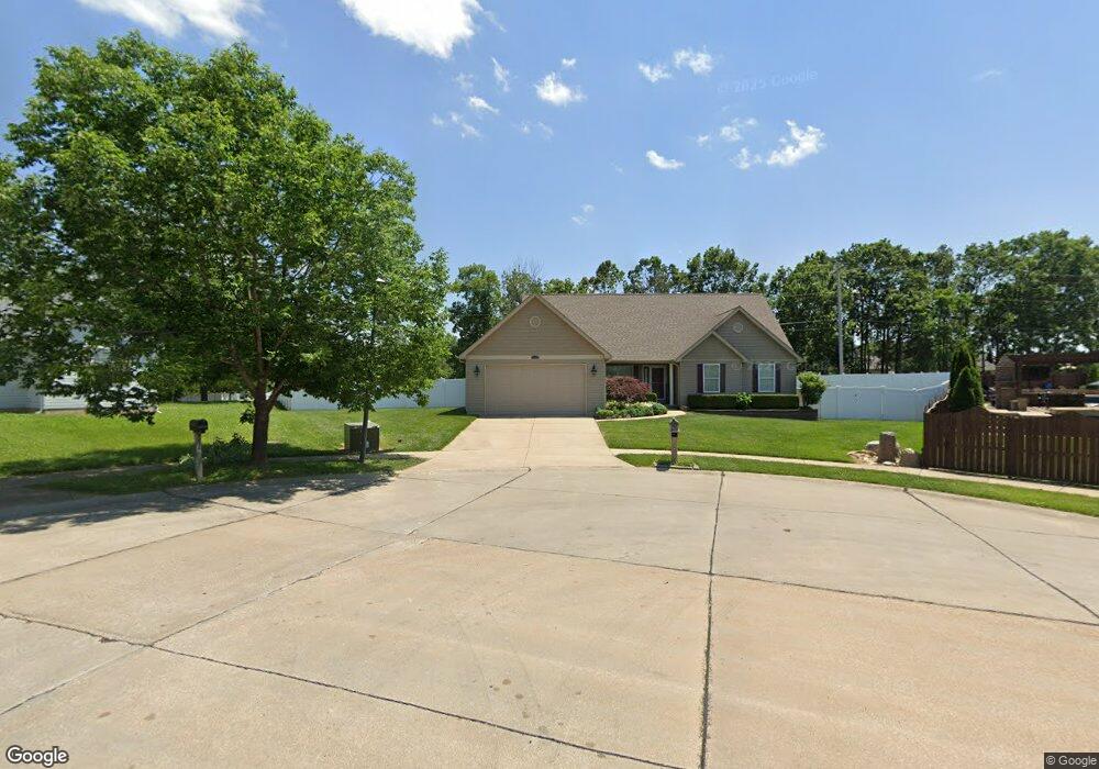
2404 Mountain Range Ct Pacific, MO 63069
Estimated Value: $326,334 - $360,000
3
Beds
4
Baths
1,672
Sq Ft
$208/Sq Ft
Est. Value
About This Home
This home is located at 2404 Mountain Range Ct, Pacific, MO 63069 and is currently estimated at $347,111, approximately $207 per square foot. 2404 Mountain Range Ct is a home located in Franklin County with nearby schools including Pacific High School and St Bridget Elementary School.
Ownership History
Date
Name
Owned For
Owner Type
Purchase Details
Closed on
Nov 4, 2005
Sold by
Jasensky Stephen C and Jacensky Stephen C
Bought by
Jasensky Stephen C and Jasensky Angela
Current Estimated Value
Home Financials for this Owner
Home Financials are based on the most recent Mortgage that was taken out on this home.
Original Mortgage
$170,000
Interest Rate
5.75%
Mortgage Type
Construction
Purchase Details
Closed on
Aug 8, 2005
Sold by
Mcdaniel & Sons Inc
Bought by
Jacensky Stephen C
Create a Home Valuation Report for This Property
The Home Valuation Report is an in-depth analysis detailing your home's value as well as a comparison with similar homes in the area
Home Values in the Area
Average Home Value in this Area
Purchase History
| Date | Buyer | Sale Price | Title Company |
|---|---|---|---|
| Jasensky Stephen C | -- | None Available | |
| Jacensky Stephen C | -- | None Available |
Source: Public Records
Mortgage History
| Date | Status | Borrower | Loan Amount |
|---|---|---|---|
| Closed | Jasensky Stephen C | $170,000 |
Source: Public Records
Tax History
| Year | Tax Paid | Tax Assessment Tax Assessment Total Assessment is a certain percentage of the fair market value that is determined by local assessors to be the total taxable value of land and additions on the property. | Land | Improvement |
|---|---|---|---|---|
| 2025 | $3,093 | $47,483 | $0 | $0 |
| 2024 | $3,093 | $40,084 | $0 | $0 |
| 2023 | $3,027 | $39,509 | $0 | $0 |
| 2022 | $2,947 | $42,476 | $0 | $0 |
| 2021 | $2,934 | $42,476 | $0 | $0 |
| 2020 | $2,656 | $38,424 | $0 | $0 |
| 2019 | $2,652 | $38,424 | $0 | $0 |
| 2018 | $2,488 | $35,304 | $0 | $0 |
| 2017 | $2,470 | $35,304 | $0 | $0 |
| 2016 | $2,299 | $32,524 | $0 | $0 |
| 2015 | $2,236 | $32,524 | $0 | $0 |
| 2014 | $2,216 | $32,792 | $0 | $0 |
Source: Public Records
Map
Nearby Homes
- 2420 Silver Lake Estates Dr
- 668 #12 Highlands Ct Ct
- 667 #9 Highlands Rd
- 53 Cedar Field Dr
- 42 Cedar Ledge
- 1837 Oak St
- 2141 Smoke Signal Rd
- 1796 Meade Ct
- 1808 Westlake Ct
- 1985 Heritage Farms Dr
- 121 Western Ave
- 1709 W Hawthorne Dr
- 707 S Hawthorne Dr
- 1505 Cypress Dr
- 1501 Cypress Dr
- 127 Phelan St
- 2161 Young Rd
- 806 W Congress St
- 6727 Eagles View Dr
- 508 Pacific Estates Dr
- 2456 Silver Lake Estates Dr
- 2452 Silver Lake Estates Dr
- 2452 Silver Lake Estates Dr Unit ESTATES
- 2405 Mountain Range Ct
- 2409 Mountain Range Ct
- 2448 Silver Lake Estates Dr
- 2448 Silver Lake Estates Dr Unit ESTATES
- 2502 Silver Lake Estates Dr
- 2444 Silver Lake Estates Dr
- 901 Sierra Ridge Ave
- 905 Sierra Ridge Ave
- 815 Sierra Ridge Ave
- 2402 Smokey Mountain Ln
- 2406 Smokey Mountain Ln
- 2506 Silver Lake Estates Dr
- 909 Sierra Ridge Ave
- 2410 Smokey Mountain Ln
- 811 Sierra Ridge Ave
- 2440 Silver Lake Estates Dr
- 2455 Silver Lake Estates Dr
Your Personal Tour Guide
Ask me questions while you tour the home.