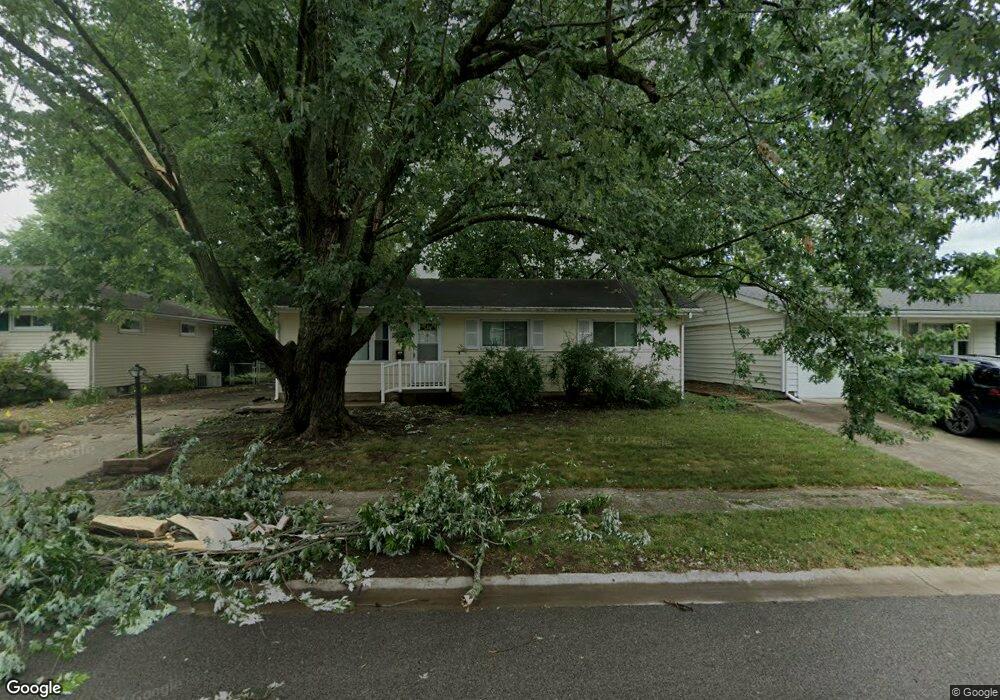
2404 Queensway Rd Springfield, IL 62703
Estimated Value: $136,000 - $342,000
3
Beds
2
Baths
1,660
Sq Ft
$121/Sq Ft
Est. Value
About This Home
This home is located at 2404 Queensway Rd, Springfield, IL 62703 and is currently estimated at $200,224, approximately $120 per square foot. 2404 Queensway Rd is a home located in Sangamon County with nearby schools including Hazel Dell Elementary School, Jefferson Middle School, and Springfield Southeast High School.
Ownership History
Date
Name
Owned For
Owner Type
Purchase Details
Closed on
Jan 5, 2026
Sold by
Guthrie Marilyn E
Bought by
S And Z Property Brothers Of Central Illinois
Current Estimated Value
Home Financials for this Owner
Home Financials are based on the most recent Mortgage that was taken out on this home.
Original Mortgage
$106,500
Outstanding Balance
$106,399
Interest Rate
6.26%
Mortgage Type
New Conventional
Estimated Equity
$93,825
Purchase Details
Closed on
Jan 14, 2009
Purchase Details
Closed on
Jun 24, 2002
Purchase Details
Closed on
Jul 25, 2000
Create a Home Valuation Report for This Property
The Home Valuation Report is an in-depth analysis detailing your home's value as well as a comparison with similar homes in the area
Purchase History
| Date | Buyer | Sale Price | Title Company |
|---|---|---|---|
| S And Z Property Brothers Of Central Illinois | $350,000 | None Listed On Document | |
| -- | -- | -- | |
| -- | $90,500 | -- | |
| -- | $82,600 | -- |
Source: Public Records
Mortgage History
| Date | Status | Borrower | Loan Amount |
|---|---|---|---|
| Open | S And Z Property Brothers Of Central Illinois | $106,500 |
Source: Public Records
Tax History
| Year | Tax Paid | Tax Assessment Tax Assessment Total Assessment is a certain percentage of the fair market value that is determined by local assessors to be the total taxable value of land and additions on the property. | Land | Improvement |
|---|---|---|---|---|
| 2024 | $2,098 | $45,730 | $6,374 | $39,356 |
| 2023 | $2,208 | $41,770 | $5,822 | $35,948 |
| 2022 | $2,238 | $39,278 | $5,523 | $33,755 |
| 2021 | $2,248 | $37,807 | $5,316 | $32,491 |
| 2020 | $2,200 | $37,864 | $5,324 | $32,540 |
| 2019 | $2,167 | $37,732 | $5,305 | $32,427 |
| 2018 | $2,110 | $37,433 | $5,279 | $32,154 |
| 2017 | $2,094 | $36,949 | $5,211 | $31,738 |
| 2016 | $2,083 | $36,410 | $5,135 | $31,275 |
| 2015 | $2,088 | $35,975 | $5,074 | $30,901 |
| 2014 | $2,502 | $35,742 | $5,041 | $30,701 |
| 2013 | $2,446 | $36,188 | $5,041 | $31,147 |
Source: Public Records
Map
Nearby Homes
- 3518 Sheffield Rd Unit 1
- 2100 E Hood St Unit 1
- 2025 E Hood St Unit 1
- 3100 Butler St Unit 1833
- 3300 Stanton St Unit 1
- 3301 Stanton St Unit 1
- 3012 Taylor Ave Unit 58
- 10 Radcliff Rd
- 2900 Taylor Ave Unit 4
- 2906 Taylor Ave Unit 11
- 180 E Hazel Dell Unit 1
- 3001 Hoover Ave
- 2875 Taylor Ave
- 2800 Via Rosso St Unit 147
- 2800 Via Rosso St Unit 605
- 2208 Trowbridge Rd
- 4013 S Milan Rd
- 1527 Chalmers St Unit 1
- 2632 Steiler Place
- 2709 Carl Prairie Dr
- 2408 Queensway Rd
- 2400 Queensway Rd
- 2412 Queensway Rd
- 2405 Queensway Rd
- 2332 Queensway Rd
- 2401 Queensway Rd
- 2333 Queensway Rd
- 2409 Queensway Rd
- 2328 Queensway Rd
- 2321 Huntington Rd Unit 1
- 2416 Queensway Rd
- 2401 Huntington Rd
- 2325 Huntington Rd Unit 1
- 2407 Huntington Rd Unit 1
- 2317 Huntington Rd
- 2413 Queensway Rd
- 2329 Queensway Rd
- 2311 Huntington Rd Unit 1
- 2324 Queensway Rd
- 2420 Queensway Rd
Your Personal Tour Guide
Ask me questions while you tour the home.