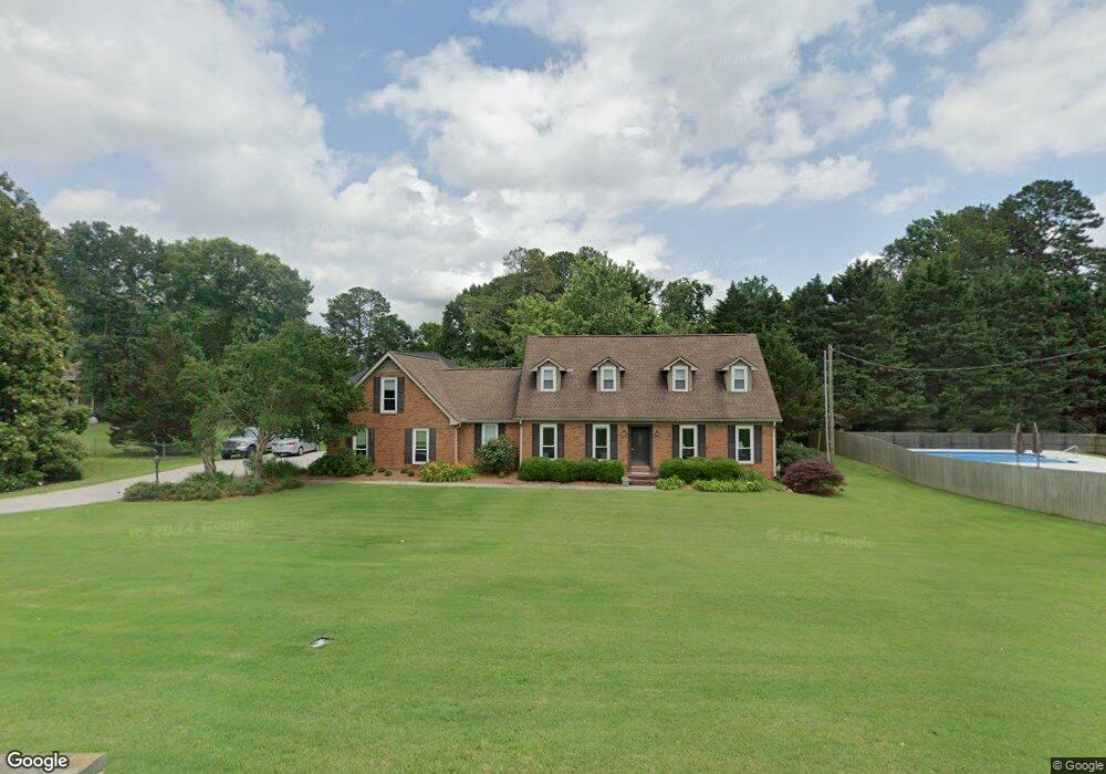
2404 Scott Dr Dalton, GA 30720
Estimated Value: $345,000 - $430,000
3
Beds
3
Baths
2,648
Sq Ft
$151/Sq Ft
Est. Value
About This Home
This home is located at 2404 Scott Dr, Dalton, GA 30720 and is currently estimated at $399,406, approximately $150 per square foot. 2404 Scott Dr is a home located in Whitfield County with nearby schools including Dug Gap Elementary School, Valley Point Middle School, and Southeast Whitfield County High School.
Ownership History
Date
Name
Owned For
Owner Type
Purchase Details
Closed on
Feb 29, 2008
Sold by
Not Provided
Bought by
Relaford John Susan and Minna Ann
Current Estimated Value
Purchase Details
Closed on
May 31, 2007
Sold by
Relaford John T
Bought by
Relaford Minna Ann
Purchase Details
Closed on
Jul 3, 2002
Sold by
Gordon William J
Bought by
Relaford John T and Relaford Susan H
Purchase Details
Closed on
May 1, 1996
Bought by
Gordon William J
Create a Home Valuation Report for This Property
The Home Valuation Report is an in-depth analysis detailing your home's value as well as a comparison with similar homes in the area
Purchase History
| Date | Buyer | Sale Price | Title Company |
|---|---|---|---|
| Relaford John Susan | $157,000 | -- | |
| Relaford Minna Ann | $20,000 | -- | |
| Relaford John T | $175,900 | -- | |
| Gordon William J | -- | -- |
Source: Public Records
Tax History
| Year | Tax Paid | Tax Assessment Tax Assessment Total Assessment is a certain percentage of the fair market value that is determined by local assessors to be the total taxable value of land and additions on the property. | Land | Improvement |
|---|---|---|---|---|
| 2025 | $1,187 | $156,772 | $18,000 | $138,772 |
| 2024 | $1,187 | $156,772 | $18,000 | $138,772 |
| 2023 | $3,234 | $114,724 | $14,800 | $99,924 |
| 2022 | $2,948 | $108,513 | $11,500 | $97,013 |
| 2021 | $2,597 | $96,569 | $11,500 | $85,069 |
| 2020 | $2,289 | $83,973 | $10,000 | $73,973 |
| 2019 | $2,321 | $83,973 | $10,000 | $73,973 |
| 2018 | $2,353 | $83,973 | $10,000 | $73,973 |
| 2017 | $1,229 | $83,973 | $10,000 | $73,973 |
| 2016 | $996 | $78,820 | $6,831 | $71,989 |
| 2014 | $659 | $73,663 | $6,384 | $67,279 |
| 2013 | -- | $73,663 | $6,384 | $67,279 |
Source: Public Records
Map
Nearby Homes
- 0 Shannon Dr Unit 131263
- 120 Foothill Dr
- 608 Brookview Ln
- 2001 Brook Way
- 124 Levi Dr
- 1902 W Brookhaven Cir
- 389 Lower Dug Gap Rd SW
- 1923 Valley Brook Dr
- 506 Lavista Rd
- 303 Shady Dr
- 301 Shady Dr
- 103 Southwind Terrace
- 0 Courtland Ln Unit 131551
- 1929 Sourwood Dr
- 439 Florence Ave
- 1909 Sourwood Dr
- 0 Five Springs Rd
- 1541 Threadmill Rd
- 153 Lillian Dr
- 450 Florence Ave
Your Personal Tour Guide
Ask me questions while you tour the home.