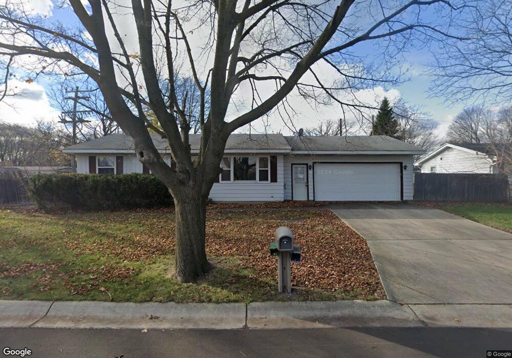
2405 15th Ave Port Huron, MI 48060
Estimated Value: $160,000 - $186,364
3
Beds
1
Bath
936
Sq Ft
$183/Sq Ft
Est. Value
About This Home
This home is located at 2405 15th Ave, Port Huron, MI 48060 and is currently estimated at $171,341, approximately $183 per square foot. 2405 15th Ave is a home located in St. Clair County with nearby schools including H.D. Crull Elementary School, Holland Woods Middle School, and Port Huron Northern High School.
Ownership History
Date
Name
Owned For
Owner Type
Purchase Details
Closed on
Feb 16, 2009
Sold by
Cf Bancorp Mortgage Company
Bought by
Federal Home Loan Mortgage Corp
Current Estimated Value
Purchase Details
Closed on
Apr 26, 2005
Sold by
Hall Douglas C and Hall Lynn M
Bought by
Lucas John H and Lucas Jodi L
Home Financials for this Owner
Home Financials are based on the most recent Mortgage that was taken out on this home.
Original Mortgage
$91,200
Interest Rate
6.05%
Mortgage Type
New Conventional
Create a Home Valuation Report for This Property
The Home Valuation Report is an in-depth analysis detailing your home's value as well as a comparison with similar homes in the area
Home Values in the Area
Average Home Value in this Area
Purchase History
| Date | Buyer | Sale Price | Title Company |
|---|---|---|---|
| Federal Home Loan Mortgage Corp | -- | E Title Agency | |
| Lucas John H | $114,000 | Metropolitan Title Company |
Source: Public Records
Mortgage History
| Date | Status | Borrower | Loan Amount |
|---|---|---|---|
| Previous Owner | Lucas John H | $91,200 |
Source: Public Records
Tax History Compared to Growth
Tax History
| Year | Tax Paid | Tax Assessment Tax Assessment Total Assessment is a certain percentage of the fair market value that is determined by local assessors to be the total taxable value of land and additions on the property. | Land | Improvement |
|---|---|---|---|---|
| 2025 | $2,910 | $79,600 | $0 | $0 |
| 2024 | $2,588 | $73,500 | $0 | $0 |
| 2023 | $2,450 | $66,600 | $0 | $0 |
| 2022 | $2,493 | $59,100 | $0 | $0 |
| 2021 | $2,380 | $54,400 | $0 | $0 |
| 2020 | $2,390 | $51,600 | $51,600 | $0 |
| 2019 | $2,347 | $40,500 | $0 | $0 |
| 2018 | $2,294 | $40,500 | $0 | $0 |
| 2017 | $2,105 | $36,100 | $0 | $0 |
| 2016 | $1,880 | $36,100 | $0 | $0 |
| 2015 | $1,849 | $34,800 | $34,800 | $0 |
| 2014 | $1,849 | $35,300 | $35,300 | $0 |
| 2013 | -- | $34,600 | $0 | $0 |
Source: Public Records
Map
Nearby Homes
- 2215 Hancock St
- 1907 Riverside Dr
- 1819 Riverside Dr
- 2812 19th Ave
- 1434 Schumaker St
- 1649 Whipple St
- 1620 McBrady St
- 1116 Hancock St
- 1531 Robinson St
- 2400 Stone St Unit 2414
- 1218 Garfield St
- 2549 Riverwood Dr
- 2838 Elmwood St
- 2913 11th Ave
- 2806 Woodstock Dr
- 1534 12th Ave
- 0000 Campau Ave
- 2857 Riverside Dr
- 0000 Water St
- V/L #4 Water St
- 1909 Elmwood St
- 2413 15th Ave
- 1917 Elmwood St
- 1904 Elmwood St
- 2421 15th Ave
- 1921 Elmwood St
- 2423 15th Ave
- 2424 16th Ave
- 1910 Elmwood St
- 2427 15th Ave
- 1920 Elmwood St
- 1924 Elmwood St
- 2428 16th Ave
- 2003 Elmwood St
- 2429 15th Ave
- 2007 Elmwood St
- 2002 Elmwood St
- 2415 16th Ave
- 2008 Elmwood St
- 2436 16th Ave