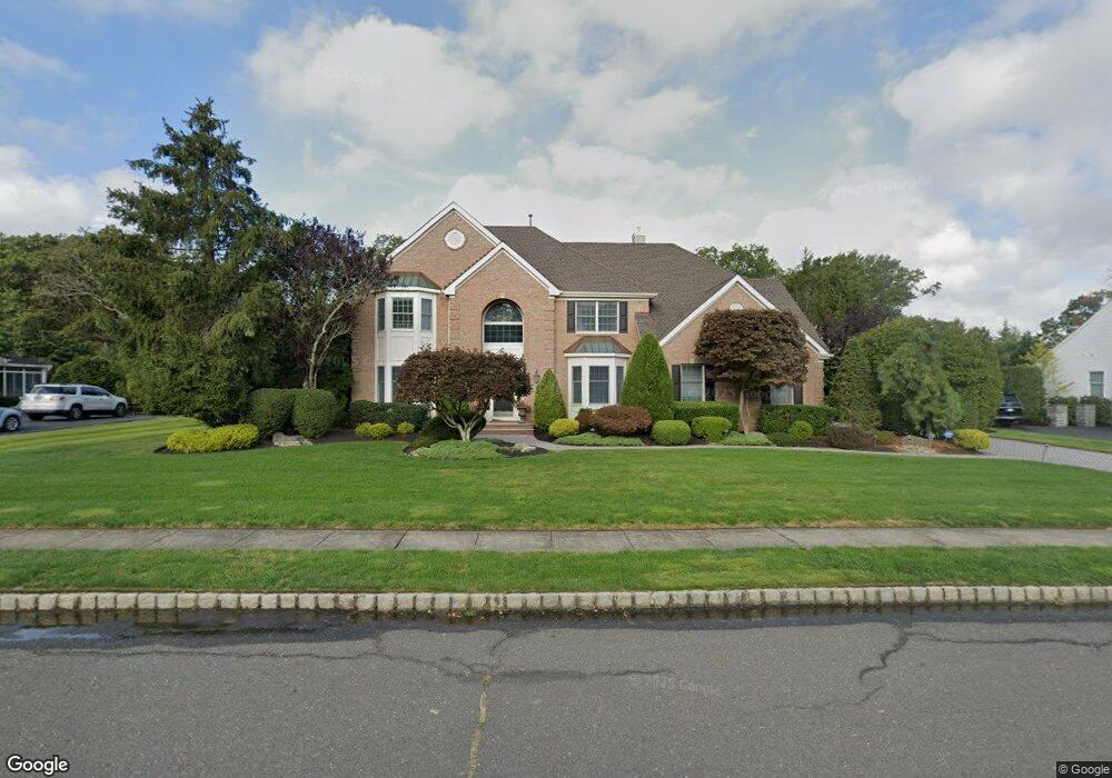
2405 Apple Ridge Cir Manasquan, NJ 08736
Estimated Value: $1,453,000 - $1,677,000
4
Beds
3
Baths
3,518
Sq Ft
$438/Sq Ft
Est. Value
About This Home
This home is located at 2405 Apple Ridge Cir, Manasquan, NJ 08736 and is currently estimated at $1,542,544, approximately $438 per square foot. 2405 Apple Ridge Cir is a home located in Monmouth County with nearby schools including Wall High School and The Brookside School.
Ownership History
Date
Name
Owned For
Owner Type
Purchase Details
Closed on
Jul 14, 2017
Sold by
Venables Brian J and Venables Sara
Bought by
Venables Brian J and Venables Sara
Current Estimated Value
Purchase Details
Closed on
Aug 31, 1995
Sold by
Matzel & Mumford Apple Ridge
Bought by
Vanables Brian and Venables Sara
Home Financials for this Owner
Home Financials are based on the most recent Mortgage that was taken out on this home.
Original Mortgage
$287,000
Interest Rate
7.8%
Create a Home Valuation Report for This Property
The Home Valuation Report is an in-depth analysis detailing your home's value as well as a comparison with similar homes in the area
Home Values in the Area
Average Home Value in this Area
Purchase History
| Date | Buyer | Sale Price | Title Company |
|---|---|---|---|
| Venables Brian J | -- | None Available | |
| Vanables Brian | $358,559 | -- |
Source: Public Records
Mortgage History
| Date | Status | Borrower | Loan Amount |
|---|---|---|---|
| Closed | Vanables Brian | $287,000 |
Source: Public Records
Tax History Compared to Growth
Tax History
| Year | Tax Paid | Tax Assessment Tax Assessment Total Assessment is a certain percentage of the fair market value that is determined by local assessors to be the total taxable value of land and additions on the property. | Land | Improvement |
|---|---|---|---|---|
| 2025 | $17,467 | $827,800 | $263,300 | $564,500 |
| 2024 | $16,945 | $827,800 | $263,300 | $564,500 |
| 2023 | $16,945 | $827,800 | $263,300 | $564,500 |
| 2022 | $16,531 | $827,800 | $263,300 | $564,500 |
| 2021 | $16,531 | $827,800 | $263,300 | $564,500 |
| 2020 | $16,332 | $827,800 | $263,300 | $564,500 |
| 2019 | $16,134 | $827,800 | $263,300 | $564,500 |
| 2018 | $15,993 | $827,800 | $263,300 | $564,500 |
| 2017 | $15,679 | $827,800 | $263,300 | $564,500 |
| 2016 | $15,347 | $827,800 | $263,300 | $564,500 |
| 2015 | $16,281 | $551,900 | $174,900 | $377,000 |
| 2014 | $15,839 | $517,100 | $172,200 | $344,900 |
Source: Public Records
Map
Nearby Homes
- 1347 Winter View Rd
- 1215 Church St
- 2378 Orchard Crest Blvd
- 1422 Lakewood Rd
- 2412 Greentree Dr
- 1412 Winesap Dr
- 1210 Bayberry Rd
- 1207 Bayberry Rd
- 2311 Camden Ave
- 2404 Lenape Trail
- 203 Lenape Trail
- 1551 Holly Blvd
- 1209 Lenape Trail
- 14 Lebanon Dr
- 1307 W Union Ln Unit A4
- 2253 Wagner Ln
- 142 Oval Rd
- 1919 Atlantic Ave Unit 26
- 1919 Atlantic Ave Unit 15
- 1590 Holly Blvd
- 2407 Apple Ridge Cir
- 2403 Apple Ridge Cir
- 2404 Colts Foot Trail
- 2402 Colts Foot Trail
- 2409 Apple Ridge Cir
- 2401 Apple Ridge Cir
- 2406 Colts Foot Trail
- 2404 Apple Ridge Cir
- 2402 Apple Ridge Cir
- 2406 Apple Ridge Cir
- 2400 Colts Foot Trail
- 2411 Apple Ridge Cir
- 2408 Apple Ridge Cir
- 2400 Apple Ridge Cir
- 2408 Colts Foot Trail
- 2410 Apple Ridge Cir
- 2403 Colts Foot Trail
- 1350 Winter View Rd
- 2413 Apple Ridge Cir
- 1357 Winter View Rd