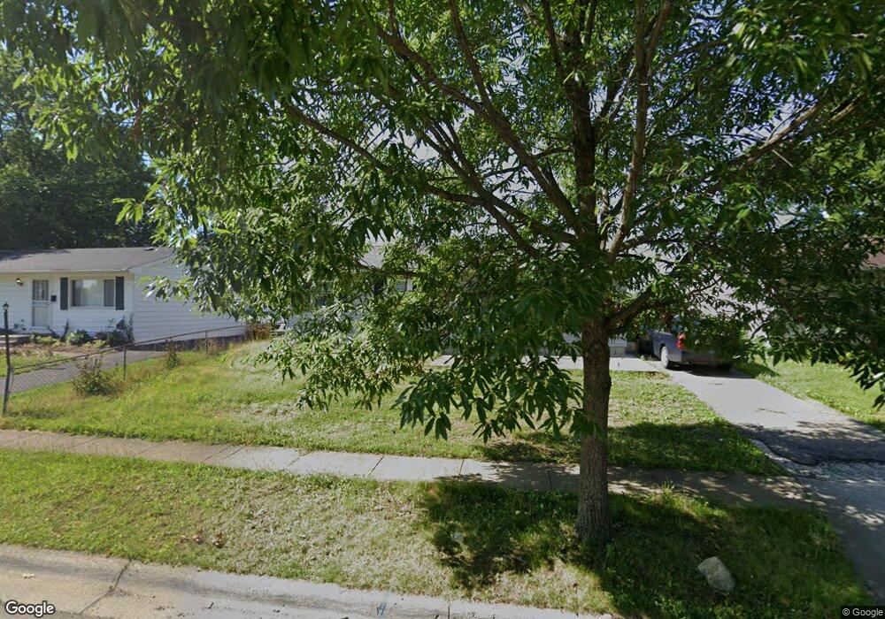
2405 Dunkirk Dr Columbus, OH 43219
Brittany Hills NeighborhoodEstimated Value: $149,000 - $195,000
3
Beds
1
Bath
960
Sq Ft
$176/Sq Ft
Est. Value
About This Home
This home is located at 2405 Dunkirk Dr, Columbus, OH 43219 and is currently estimated at $168,943, approximately $175 per square foot. 2405 Dunkirk Dr is a home located in Franklin County with nearby schools including South Mifflin Stem Academy (K-6), Linden-Mckinley Stem School On Arcadia, and Cesar Chavez College Preparatory School.
Ownership History
Date
Name
Owned For
Owner Type
Purchase Details
Closed on
Sep 20, 2015
Sold by
Calloway Properties Llc
Bought by
Prattstone Enterprises Lp
Current Estimated Value
Purchase Details
Closed on
Mar 18, 2014
Sold by
Seales Norama W and Woods Cove Llc
Bought by
Calloway Properties Llc
Purchase Details
Closed on
Oct 24, 1984
Bought by
Scales Norma W
Create a Home Valuation Report for This Property
The Home Valuation Report is an in-depth analysis detailing your home's value as well as a comparison with similar homes in the area
Home Values in the Area
Average Home Value in this Area
Purchase History
| Date | Buyer | Sale Price | Title Company |
|---|---|---|---|
| Prattstone Enterprises Lp | -- | Capcity Title Box | |
| Calloway Properties Llc | $15,499 | None Available | |
| Scales Norma W | -- | -- |
Source: Public Records
Tax History
| Year | Tax Paid | Tax Assessment Tax Assessment Total Assessment is a certain percentage of the fair market value that is determined by local assessors to be the total taxable value of land and additions on the property. | Land | Improvement |
|---|---|---|---|---|
| 2025 | $2,072 | $45,220 | $10,710 | $34,510 |
| 2024 | $2,072 | $45,220 | $10,710 | $34,510 |
| 2023 | $2,046 | $45,220 | $10,710 | $34,510 |
| 2022 | $986 | $18,560 | $2,350 | $16,210 |
| 2021 | $988 | $18,560 | $2,350 | $16,210 |
| 2020 | $990 | $18,560 | $2,350 | $16,210 |
| 2019 | $976 | $14,810 | $1,890 | $12,920 |
| 2018 | $1,469 | $14,810 | $1,890 | $12,920 |
| 2017 | $921 | $14,810 | $1,890 | $12,920 |
| 2016 | $1,185 | $17,440 | $2,560 | $14,880 |
| 2015 | $2,019 | $17,440 | $2,560 | $14,880 |
| 2014 | $1,081 | $17,440 | $2,560 | $14,880 |
| 2013 | $592 | $19,355 | $2,835 | $16,520 |
Source: Public Records
Map
Nearby Homes
- 2350 Edenburgh Dr S
- 1816 Brentnell Ave
- 1897 Daisyfield Dr Unit 212
- 2526 Queenswood Dr
- 0 Mock Rd
- 1771 Marston Rd
- 2144 Toni St
- 2145 Argyle Dr
- 2131 Argyle Dr
- 0 Danby Dr
- 1575 Vendome Dr S
- 2054 Jermain Dr
- 1642 Marina Dr
- 2424 Holt Ave
- 2299 Holt Ave
- 1588 Marina Dr
- 2227 Marcia Dr
- 2803 Ballyvaughn Dr Unit 48
- 2080 Parkwood Ave Unit 2090
- 1477 Dove Dr
- 2397 Dunkirk Dr
- 2411 Dunkirk Dr
- 2389 Dunkirk Dr
- 2417 Dunkirk Dr
- 2408 Dunkirk Dr
- 2381 Dunkirk Dr
- 2414 Dunkirk Dr
- 2390 Dunkirk Dr
- 2429 Dunkirk Dr
- 1837 Bar Harbor Rd
- 2373 Dunkirk Dr
- 1833 Bar Harbor Rd
- 2382 Dunkirk Dr
- 1821 Bar Harbor Rd
- 1815 Bar Harbor Rd
- 2367 Dunkirk Dr
- 2374 Dunkirk Dr
- 2399 Edenburgh Dr S
- 1863 Bar Harbor Rd
- 2393 Edenburgh Dr S
Your Personal Tour Guide
Ask me questions while you tour the home.