Estimated Value: $143,000 - $164,000
3
Beds
1
Bath
1,244
Sq Ft
$124/Sq Ft
Est. Value
About This Home
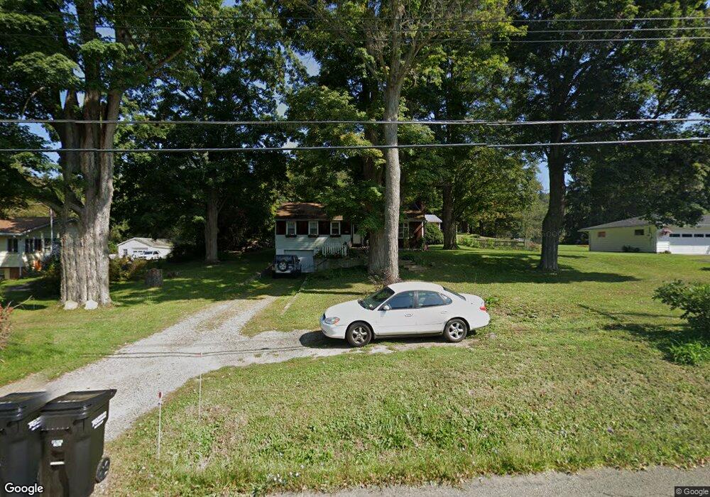
This home is located at 2405 State Route 17c, Owego, NY 13827 and is currently estimated at $154,282, approximately $124 per square foot. 2405 State Route 17c is a home located in Tioga County with nearby schools including Apalachin Elementary School, Owego-Apalachin Middle School, and Owego Free Academy.
Ownership History
Date
Name
Owned For
Owner Type
Purchase Details
Closed on
Dec 20, 2011
Sold by
Perestam Alan R
Bought by
Brown Renda Lisa A
Current Estimated Value
Home Financials for this Owner
Home Financials are based on the most recent Mortgage that was taken out on this home.
Original Mortgage
$86,743
Outstanding Balance
$58,381
Interest Rate
4.25%
Mortgage Type
FHA
Estimated Equity
$95,901
Purchase Details
Closed on
Mar 23, 2009
Sold by
Smith Gregory G
Bought by
Perestam Alan R Perestam, John I
Home Financials for this Owner
Home Financials are based on the most recent Mortgage that was taken out on this home.
Original Mortgage
$68,800
Interest Rate
5.25%
Mortgage Type
Purchase Money Mortgage
Purchase Details
Closed on
Sep 27, 2002
Sold by
Vallilee Jonathan S
Bought by
Smith Gregory G
Purchase Details
Closed on
May 26, 2000
Sold by
Lasater Randy J
Bought by
Vallilee Jonathan S
Create a Home Valuation Report for This Property
The Home Valuation Report is an in-depth analysis detailing your home's value as well as a comparison with similar homes in the area
Home Values in the Area
Average Home Value in this Area
Purchase History
| Date | Buyer | Sale Price | Title Company |
|---|---|---|---|
| Brown Renda Lisa A | $89,000 | Angelina Cutrona | |
| Perestam Alan R Perestam, John I | $86,000 | Adam Schumacher | |
| Smith Gregory G | $58,000 | Haley | |
| Vallilee Jonathan S | $51,000 | Mark A Dixson |
Source: Public Records
Mortgage History
| Date | Status | Borrower | Loan Amount |
|---|---|---|---|
| Open | Brown Renda Lisa A | $86,743 | |
| Previous Owner | Perestam Alan R Perestam, John I | $68,800 |
Source: Public Records
Tax History Compared to Growth
Tax History
| Year | Tax Paid | Tax Assessment Tax Assessment Total Assessment is a certain percentage of the fair market value that is determined by local assessors to be the total taxable value of land and additions on the property. | Land | Improvement |
|---|---|---|---|---|
| 2024 | $2,860 | $56,300 | $5,200 | $51,100 |
| 2023 | $28 | $56,300 | $5,200 | $51,100 |
| 2022 | $2,873 | $56,300 | $5,200 | $51,100 |
| 2021 | $2,781 | $55,300 | $5,200 | $50,100 |
| 2020 | $2,730 | $55,300 | $5,200 | $50,100 |
| 2019 | $1,559 | $55,300 | $5,200 | $50,100 |
| 2018 | $2,613 | $55,300 | $5,200 | $50,100 |
| 2017 | $2,553 | $55,300 | $5,200 | $50,100 |
| 2016 | $2,521 | $55,300 | $5,200 | $50,100 |
| 2015 | -- | $55,300 | $5,200 | $50,100 |
| 2014 | -- | $55,300 | $5,200 | $50,100 |
Source: Public Records
Map
Nearby Homes
- 2744 State Route 17c
- 2912 New York 17c
- 63 Holmes Rd Unit 65
- 68 Degroat Rd
- 3 Lincolnshire Blvd
- 00 Sunnyside Dr S
- 0 Sunnyside Dr S
- 797 Lisle Rd
- 945 Forest Hill Rd
- 563 Lisle Rd
- 21 Sunnyside Dr
- 21 King Point Cir S
- 499 E Front St
- 525 E Main St
- 2145 Lisle Rd Unit Lot B
- 2145 Lisle Rd Unit Lot H
- 2145 Lisle Rd Unit Lot K
- 2145 Lisle Rd Unit Lot I
- 2145 Lisle Rd Unit Lot G
- 2145 Lisle Rd Unit Lot A
- 2431 State Route 17c
- 2420 State Route 17c
- 2400 State Route 17c
- 2453 State Route 17c
- 2369 State Route 17c
- 2386 State Route 17c
- 2387 State Route 17c
- 2374 State Route 17c
- 2456 State Route 17c
- 2491 State Route 17c
- 2491 State Route 17c
- 2332 State Route 17c
- 2318 State Route 17c
- 2482 State Route 17c
- 2293 State Route 17c
- 2292 State Route 17c
- 2273 State Route 17c
- 2603 State Route 17c
- 2591 State Route 17c
- 2612 New York 17c