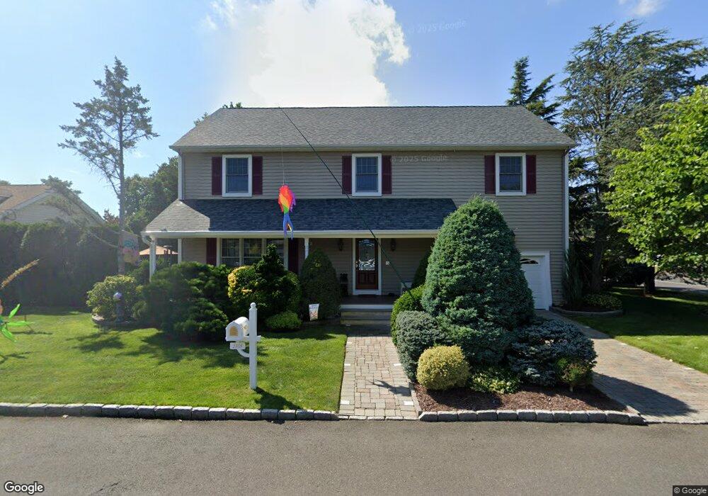
2408 Allen St Point Pleasant Boro, NJ 08742
Estimated Value: $847,582 - $1,620,000
4
Beds
4
Baths
3,276
Sq Ft
$350/Sq Ft
Est. Value
About This Home
This home is located at 2408 Allen St, Point Pleasant Boro, NJ 08742 and is currently estimated at $1,145,146, approximately $349 per square foot. 2408 Allen St is a home located in Ocean County with nearby schools including Point Pleasant High School, St Dominic School, and St. Peter School.
Ownership History
Date
Name
Owned For
Owner Type
Purchase Details
Closed on
Jan 30, 2002
Sold by
Maliszewski Joseph
Bought by
Oriuolo Steven and Orciuolo Amy
Current Estimated Value
Home Financials for this Owner
Home Financials are based on the most recent Mortgage that was taken out on this home.
Original Mortgage
$100,000
Outstanding Balance
$41,612
Interest Rate
7.15%
Estimated Equity
$1,103,534
Purchase Details
Closed on
Jul 1, 1998
Sold by
Orciuolo Ernest and Orciuolo Edith
Bought by
Orciuolo Steven M and Orciuolo Amy
Create a Home Valuation Report for This Property
The Home Valuation Report is an in-depth analysis detailing your home's value as well as a comparison with similar homes in the area
Home Values in the Area
Average Home Value in this Area
Purchase History
| Date | Buyer | Sale Price | Title Company |
|---|---|---|---|
| Oriuolo Steven | $150,000 | -- | |
| Orciuolo Steven M | -- | -- |
Source: Public Records
Mortgage History
| Date | Status | Borrower | Loan Amount |
|---|---|---|---|
| Open | Oriuolo Steven | $100,000 |
Source: Public Records
Tax History Compared to Growth
Tax History
| Year | Tax Paid | Tax Assessment Tax Assessment Total Assessment is a certain percentage of the fair market value that is determined by local assessors to be the total taxable value of land and additions on the property. | Land | Improvement |
|---|---|---|---|---|
| 2025 | $10,923 | $477,600 | $173,800 | $303,800 |
| 2024 | $10,440 | $477,600 | $173,800 | $303,800 |
| 2023 | $10,225 | $477,600 | $173,800 | $303,800 |
| 2022 | $10,225 | $477,600 | $173,800 | $303,800 |
| 2021 | $10,068 | $477,600 | $173,800 | $303,800 |
| 2020 | $9,963 | $477,600 | $173,800 | $303,800 |
| 2019 | $9,829 | $477,600 | $173,800 | $303,800 |
| 2018 | $9,538 | $477,600 | $173,800 | $303,800 |
| 2017 | $9,328 | $477,600 | $173,800 | $303,800 |
| 2016 | $9,256 | $477,600 | $173,800 | $303,800 |
| 2015 | $9,146 | $477,600 | $173,800 | $303,800 |
| 2014 | $8,936 | $477,600 | $173,800 | $303,800 |
Source: Public Records
Map
Nearby Homes
- 1027 Ocean Rd
- 709 Albert E Clifton Ave
- 305 Barbara Dr
- 103 River Ave
- 519 Curtis Ave
- 602 Boulton Ave
- 2409 Cedar St
- 713 Beaver Dam Rd
- 2001 Veterans Memorial Dr
- 2704 Route 88
- 611 Boulton Ave
- 2201 River Rd Unit 4401
- 2607 Spruce St
- 803 Beaver Dam Rd
- 3006 Herbertsville Rd
- 1100 Bradford Dr
- 3000 River Rd Unit 3000 & 3000A
- 2406 Chestnut St
- 837 Beaver Dam Rd
- 239 Jaehnel Pkwy
- 2406 Allen St
- 404 River Ave
- 406 River Ave
- 406 River Ave
- 314 River Ave
- 401 River Ave
- 312 River Ave
- 2405 Herbertsville Rd
- 403 Maxson Ave
- 2502 Allen St
- 2409 Herbertsville Rd
- 315 Maxson Ave
- 310 River Ave
- 405 Maxson Ave
- 2504 Allen St
- 313 Maxson Ave
- 2503 Allen St
- 2401 Herbertsville Rd
- 308 River Ave
- 409 River Ave