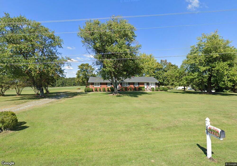
2408 Mccray Rd Burlington, NC 27217
Estimated Value: $287,000 - $314,000
3
Beds
2
Baths
1,900
Sq Ft
$157/Sq Ft
Est. Value
About This Home
This home is located at 2408 Mccray Rd, Burlington, NC 27217 and is currently estimated at $299,079, approximately $157 per square foot. 2408 Mccray Rd is a home located in Alamance County with nearby schools including Pleasant Grove Elementary School, Woodlawn Middle School, and Eastern Alamance High School.
Ownership History
Date
Name
Owned For
Owner Type
Purchase Details
Closed on
May 10, 2025
Sold by
Wyatt Donna J
Bought by
Wyatt David L and Wyatt Gary C
Current Estimated Value
Purchase Details
Closed on
Jan 28, 2002
Sold by
Corbett Etrulia
Bought by
Wyatt Charlie A
Home Financials for this Owner
Home Financials are based on the most recent Mortgage that was taken out on this home.
Original Mortgage
$15,000
Interest Rate
7.08%
Mortgage Type
New Conventional
Create a Home Valuation Report for This Property
The Home Valuation Report is an in-depth analysis detailing your home's value as well as a comparison with similar homes in the area
Purchase History
| Date | Buyer | Sale Price | Title Company |
|---|---|---|---|
| Wyatt David L | $54,000 | None Listed On Document | |
| Wyatt David L | $54,000 | None Listed On Document | |
| Wyatt Charlie A | $15,000 | -- |
Source: Public Records
Mortgage History
| Date | Status | Borrower | Loan Amount |
|---|---|---|---|
| Previous Owner | Wyatt Charlie A | $15,000 |
Source: Public Records
Tax History
| Year | Tax Paid | Tax Assessment Tax Assessment Total Assessment is a certain percentage of the fair market value that is determined by local assessors to be the total taxable value of land and additions on the property. | Land | Improvement |
|---|---|---|---|---|
| 2025 | $1,485 | $250,050 | $39,989 | $210,061 |
| 2024 | $1,380 | $250,050 | $39,989 | $210,061 |
| 2023 | $1,281 | $250,050 | $39,989 | $210,061 |
| 2022 | $1,148 | $149,841 | $30,794 | $119,047 |
| 2021 | $1,133 | $149,841 | $30,794 | $119,047 |
| 2020 | $1,148 | $149,841 | $30,794 | $119,047 |
| 2019 | $1,154 | $149,841 | $30,794 | $119,047 |
| 2018 | $0 | $149,841 | $30,794 | $119,047 |
| 2017 | $1,019 | $149,841 | $30,794 | $119,047 |
| 2016 | $1,039 | $152,776 | $28,744 | $124,032 |
| 2015 | $1,003 | $152,776 | $28,744 | $124,032 |
| 2014 | $927 | $152,776 | $28,744 | $124,032 |
Source: Public Records
Map
Nearby Homes
- 2619 William Allen Rd
- 2513 William Allen Rd
- 2220 Foxfire Ln
- 2200 State Highway 49
- 134 Pillow Ln
- 284 Donelson Way
- 372 Donelson Way
- 0 Barnett Rd Unit 10148309
- 0 Haith Fuller Trail
- 1800 State Highway 49
- 2858 John Lewis Rd
- 0 Pack Ln
- Lot 2 Mebane Rogers Rd
- 1420 Mccray Rd
- 2974 Barnett Rd
- 00 Haith Fuller Trail
- 2135 Meadow Ridge Rd
- 7411 N Carolina 62
- 2248 Roney Lineberry Rd
- 0 Mount Vernon Rd
- 2428 Mccray Rd
- 3032 Annabelles Way
- 3026 Annabelles Way
- 2450 Mccray Rd
- 3020 Annabelles Way
- 2460 Mccray Rd
- 3014 Annabelles Way
- 2665 Albert Jeffries Rd
- 2480 Mccray Rd
- 2730 Ellis Jeffries Rd
- 2600 Albert Jeffries Rd Unit 1
- 2645 Albert Jeffries Rd
- 2481 Mccray Rd
- 2621 Albert Jeffries Rd
- 2503 Mccray Rd
- 2658 William Allen Rd
- 2725 Ellis Jeffries Rd
- 2650 William Allen Rd
- 2765 Ellis Jeffries Rd
- 2705 Ellis Jeffries Rd
Your Personal Tour Guide
Ask me questions while you tour the home.