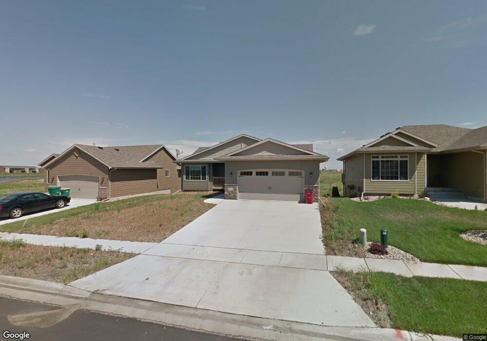
2408 S Lancaster Dr Sioux Falls, SD 57106
Northwest Sioux Falls NeighborhoodEstimated Value: $399,000 - $428,000
5
Beds
3
Baths
2,242
Sq Ft
$182/Sq Ft
Est. Value
About This Home
This home is located at 2408 S Lancaster Dr, Sioux Falls, SD 57106 and is currently estimated at $408,870, approximately $182 per square foot. 2408 S Lancaster Dr is a home located in Minnehaha County with nearby schools including Tea Area Legacy Elementary School, Tea Area Middle School, and Tea Area High School.
Ownership History
Date
Name
Owned For
Owner Type
Purchase Details
Closed on
May 26, 2015
Sold by
Christopher S Christopher S
Bought by
Mccoy Brandan and Forest Amanda
Current Estimated Value
Home Financials for this Owner
Home Financials are based on the most recent Mortgage that was taken out on this home.
Original Mortgage
$198,963
Interest Rate
4.12%
Mortgage Type
FHA
Create a Home Valuation Report for This Property
The Home Valuation Report is an in-depth analysis detailing your home's value as well as a comparison with similar homes in the area
Home Values in the Area
Average Home Value in this Area
Purchase History
| Date | Buyer | Sale Price | Title Company |
|---|---|---|---|
| Mccoy Brandan | $204,500 | -- |
Source: Public Records
Mortgage History
| Date | Status | Borrower | Loan Amount |
|---|---|---|---|
| Closed | Mccoy Brandan | $198,963 |
Source: Public Records
Tax History Compared to Growth
Tax History
| Year | Tax Paid | Tax Assessment Tax Assessment Total Assessment is a certain percentage of the fair market value that is determined by local assessors to be the total taxable value of land and additions on the property. | Land | Improvement |
|---|---|---|---|---|
| 2024 | $5,525 | $359,600 | $35,300 | $324,300 |
| 2023 | $5,762 | $353,500 | $25,800 | $327,700 |
| 2022 | $5,338 | $310,600 | $25,800 | $284,800 |
| 2021 | $4,447 | $253,800 | $0 | $0 |
| 2020 | $4,447 | $248,500 | $0 | $0 |
| 2019 | $4,333 | $240,108 | $0 | $0 |
| 2018 | $3,421 | $228,180 | $0 | $0 |
| 2017 | $3,143 | $182,592 | $24,559 | $158,033 |
| 2016 | $3,143 | $174,347 | $24,559 | $149,788 |
| 2015 | $3,920 | $164,727 | $24,559 | $140,168 |
| 2014 | -- | $160,605 | $24,559 | $136,046 |
Source: Public Records
Map
Nearby Homes
- 9402 W Broek Dr
- 9308 W 32nd St Unit 7
- 9308 W 32nd St Unit 10
- 9308 W 32nd St Unit 4
- 9308 W 32nd St Unit 6
- 9308 W 32nd St Unit 9
- 9308 W 32nd St Unit 8
- 9308 W 32nd St Unit 5
- 9308 W 32nd St Unit 2
- 9502 W Broek Dr
- 2321 S Katie Ave
- 9064 W Ark Place
- 9010 W Wisdom Place
- 2317 S Katie Ave
- 2800 S Julia Place
- 2800 S Broek Dr
- 2802 S Broek Dr
- 2806 S Broek Dr
- 9201 W Ark Place
- 9425 W Liam St
- 2404 S Lancaster Dr
- 2412 S Lancaster Dr
- 2412 S Lancaster Dr Dr
- 2405 S Kierra Ct
- 2416 S Lancaster Dr
- 2409 S Kierra Ct
- 2401 S Kierra Ct
- 2409 S Lancaster Dr
- 2409 S Lancaster Dr Dr
- 2420 S Lancaster Dr
- 2420 S Lancaster Dr Dr
- 2413 S Lancaster Dr
- 2413 S Lancaster Dr Dr
- 2405 S Lancaster Dr
- 2417 S Lancaster Dr
- 2417 S Lancaster Dr Dr
- 9323 W 32nd St
- 2500 S Lancaster Dr
- 2421 S Lancaster Dr
- 9321 W 32nd St