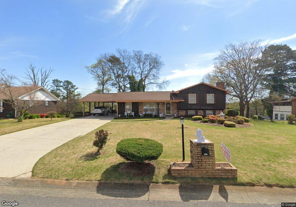
2409 Crossbow Dr Birmingham, AL 35214
Forestdale NeighborhoodEstimated Value: $165,000 - $243,000
3
Beds
3
Baths
1,344
Sq Ft
$145/Sq Ft
Est. Value
About This Home
This home is located at 2409 Crossbow Dr, Birmingham, AL 35214 and is currently estimated at $195,218, approximately $145 per square foot. 2409 Crossbow Dr is a home located in Jefferson County with nearby schools including Minor Middle School, Minor High School, and Gloryland Christian Academy.
Ownership History
Date
Name
Owned For
Owner Type
Purchase Details
Closed on
Jun 15, 2000
Sold by
Byrd Thomas Ray and Byrd Audrey C
Bought by
Taylor Rufus and Taylor Vera
Current Estimated Value
Home Financials for this Owner
Home Financials are based on the most recent Mortgage that was taken out on this home.
Original Mortgage
$101,900
Outstanding Balance
$36,768
Interest Rate
8.55%
Estimated Equity
$158,450
Create a Home Valuation Report for This Property
The Home Valuation Report is an in-depth analysis detailing your home's value as well as a comparison with similar homes in the area
Home Values in the Area
Average Home Value in this Area
Purchase History
| Date | Buyer | Sale Price | Title Company |
|---|---|---|---|
| Taylor Rufus | $121,900 | -- |
Source: Public Records
Mortgage History
| Date | Status | Borrower | Loan Amount |
|---|---|---|---|
| Open | Taylor Rufus | $101,900 |
Source: Public Records
Tax History Compared to Growth
Tax History
| Year | Tax Paid | Tax Assessment Tax Assessment Total Assessment is a certain percentage of the fair market value that is determined by local assessors to be the total taxable value of land and additions on the property. | Land | Improvement |
|---|---|---|---|---|
| 2024 | $680 | $15,780 | -- | -- |
| 2023 | $321 | $15,780 | $2,390 | $13,390 |
| 2022 | $680 | $16,210 | $2,390 | $13,820 |
| 2021 | $499 | $12,050 | $2,390 | $9,660 |
| 2020 | $499 | $12,050 | $2,390 | $9,660 |
| 2019 | $499 | $12,060 | $0 | $0 |
| 2018 | $473 | $11,460 | $0 | $0 |
| 2017 | $473 | $11,460 | $0 | $0 |
| 2016 | $473 | $11,460 | $0 | $0 |
| 2015 | $521 | $11,460 | $0 | $0 |
| 2014 | $473 | $10,400 | $0 | $0 |
| 2013 | $473 | $10,400 | $0 | $0 |
Source: Public Records
Map
Nearby Homes
- 2509 Bow String Dr
- 2525 Bow String Dr
- 50 W Carriage Dr
- 340 Carriage Dr
- 2132 Arcadia Rd
- 2133 Arcadia Rd
- 2108 Maywood Dr
- 2057 Forestdale Blvd
- 2352 Pershing Place Loop
- 429 Lemuel Dr
- 2353 Pershing Place Loop
- 2357 Pershing Place Loop
- 2361 Pershing Place Loop
- Arizona Plan at Pershing Place Community
- California Plan at Pershing Place Community
- Colorado Plan at Pershing Place Community
- Alabama Plan at Pershing Place Community
- 448 Laurie Dr
- 229 Varden Hill Dr
- 2441 Forest Hill Dr
- 2413 Crossbow Dr
- 2405 Crossbow Dr
- 2406 Longbow Dr
- 2410 Longbow Dr
- 2402 Longbow Dr
- 2400 Crossbow Dr
- 2417 Crossbow Dr
- 2412 Crossbow Dr
- 2414 Longbow Dr
- 110 Merrywood Cir
- 117 Merrywood Cir
- 2416 Crossbow Dr
- 107 Della Rose Dr
- 2421 Crossbow Dr
- 2407 Longbow Dr
- 2418 Longbow Dr
- 118 Della Rose Dr
- 2411 Longbow Dr
- 106 Merrywood Cir
- 2420 Crossbow Dr