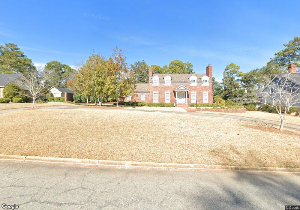
2409 Pheasant Dr Albany, GA 31707
Westover NeighborhoodEstimated Value: $321,414 - $375,000
4
Beds
4
Baths
2,946
Sq Ft
$119/Sq Ft
Est. Value
About This Home
This home is located at 2409 Pheasant Dr, Albany, GA 31707 and is currently estimated at $351,854, approximately $119 per square foot. 2409 Pheasant Dr is a home located in Dougherty County with nearby schools including Lake Park Elementary School, Merry Acres Middle School, and Westover High School.
Ownership History
Date
Name
Owned For
Owner Type
Purchase Details
Closed on
Aug 29, 2001
Sold by
Handelman Deborah Joy
Bought by
Preller Laura Virginia
Current Estimated Value
Purchase Details
Closed on
Nov 24, 1997
Sold by
Handelman Todd S
Bought by
Handelman Deborah Joy
Purchase Details
Closed on
Jul 25, 1997
Sold by
Mckemie Clarence Rogers
Bought by
Handelman Todd S
Purchase Details
Closed on
May 15, 1995
Sold by
Sperry John H
Bought by
Mckemie Clarence Rogers
Purchase Details
Closed on
Jun 9, 1965
Sold by
Northside Packing Co
Bought by
Sperry John and Sperry Wife
Create a Home Valuation Report for This Property
The Home Valuation Report is an in-depth analysis detailing your home's value as well as a comparison with similar homes in the area
Home Values in the Area
Average Home Value in this Area
Purchase History
| Date | Buyer | Sale Price | Title Company |
|---|---|---|---|
| Preller Laura Virginia | $210,000 | -- | |
| Handelman Deborah Joy | -- | -- | |
| Handelman Todd S | $185,000 | -- | |
| Mckemie Clarence Rogers | $158,000 | -- | |
| Sperry John | -- | -- |
Source: Public Records
Tax History Compared to Growth
Tax History
| Year | Tax Paid | Tax Assessment Tax Assessment Total Assessment is a certain percentage of the fair market value that is determined by local assessors to be the total taxable value of land and additions on the property. | Land | Improvement |
|---|---|---|---|---|
| 2024 | $4,032 | $86,520 | $13,200 | $73,320 |
| 2023 | $3,099 | $86,520 | $13,200 | $73,320 |
| 2022 | $3,952 | $86,520 | $13,200 | $73,320 |
| 2021 | $3,664 | $86,520 | $13,200 | $73,320 |
| 2020 | $3,673 | $86,520 | $13,200 | $73,320 |
| 2019 | $3,687 | $86,520 | $13,200 | $73,320 |
| 2018 | $0 | $86,520 | $13,200 | $73,320 |
| 2017 | $3,449 | $86,520 | $13,200 | $73,320 |
| 2016 | $3,451 | $86,520 | $13,200 | $73,320 |
| 2015 | $3,460 | $86,520 | $13,200 | $73,320 |
| 2014 | $3,445 | $87,200 | $13,880 | $73,320 |
Source: Public Records
Map
Nearby Homes
- 2506 Ridgewood Ln
- 2508 Pheasant Dr
- 2205 Star Ln
- 2012 W Lakeridge Dr
- 607 Summit Dr
- 1826 Green Valley Ln
- 418 Meadowlark Dr
- 1009 Summit Dr
- 2613 Partridge Dr
- 427 S Audubon Dr
- 415 Forest Glen Dr
- 1812 Robinhood Rd
- 2304 Pineridge Ln
- 1021 Summit Dr
- 1814 Green Valley Ln
- 2203 Hanover St
- 2310 Pineridge Ln
- 2304 Tuxedo Ln
- 2303 Pineridge Ln
- 1911 Lynwood Ln
- 2407 Pheasant Dr
- 2413 Pheasant Dr
- 602 Partridge Dr
- 2417 Pheasant Dr
- 604 Partridge Dr
- 2406 Pheasant Dr
- 2416 Pheasant Dr
- 606 Partridge Dr
- 2401 Pheasant Dr
- 521 Whippoorwill Rd
- 2400 Pheasant Dr
- 2501 Pheasant Dr
- 608 Partridge Dr
- 2500 Ridgewood Ln
- 520 Partridge Dr
- 605 Partridge Dr
- 519 Meadowlark Dr
- 516 Whippoorwill Rd
- 610 Partridge Dr
- 2500 Pheasant Dr