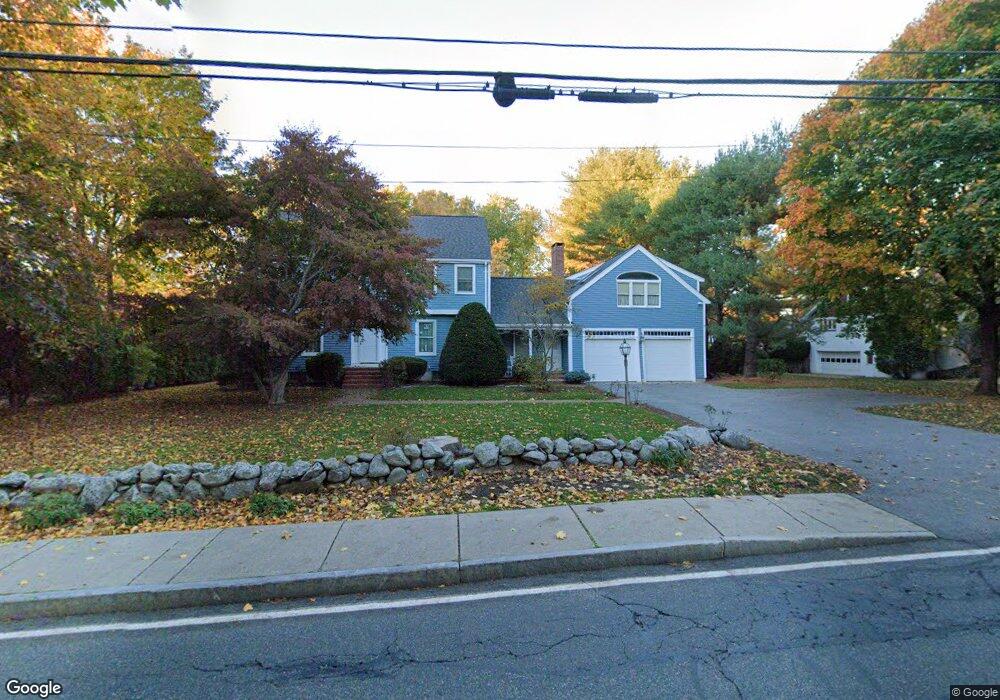
241 Bacon St Natick, MA 01760
Estimated Value: $1,270,000 - $1,347,000
4
Beds
2
Baths
3,067
Sq Ft
$428/Sq Ft
Est. Value
About This Home
This home is located at 241 Bacon St, Natick, MA 01760 and is currently estimated at $1,313,217, approximately $428 per square foot. 241 Bacon St is a home located in Middlesex County with nearby schools including Natick High School, Wilson Middle School, and Bennett-Hemenway (Ben-Hem) Elementary School.
Ownership History
Date
Name
Owned For
Owner Type
Purchase Details
Closed on
Mar 31, 2023
Sold by
Rufo Barbara A
Bought by
Barbara A Rufo Ret and Rufo
Current Estimated Value
Create a Home Valuation Report for This Property
The Home Valuation Report is an in-depth analysis detailing your home's value as well as a comparison with similar homes in the area
Home Values in the Area
Average Home Value in this Area
Purchase History
| Date | Buyer | Sale Price | Title Company |
|---|---|---|---|
| Barbara A Rufo Ret | -- | None Available |
Source: Public Records
Tax History
| Year | Tax Paid | Tax Assessment Tax Assessment Total Assessment is a certain percentage of the fair market value that is determined by local assessors to be the total taxable value of land and additions on the property. | Land | Improvement |
|---|---|---|---|---|
| 2025 | $12,780 | $1,068,600 | $481,700 | $586,900 |
| 2024 | $12,358 | $1,008,000 | $455,100 | $552,900 |
| 2023 | $11,899 | $941,400 | $425,400 | $516,000 |
| 2022 | $11,595 | $869,200 | $385,600 | $483,600 |
| 2021 | $11,059 | $812,600 | $364,500 | $448,100 |
| 2020 | $10,843 | $796,700 | $348,600 | $448,100 |
| 2019 | $10,126 | $796,700 | $348,600 | $448,100 |
| 2018 | $9,587 | $734,600 | $316,900 | $417,700 |
| 2017 | $9,393 | $696,300 | $286,200 | $410,100 |
| 2016 | $9,194 | $677,500 | $271,200 | $406,300 |
| 2015 | $8,900 | $644,000 | $271,200 | $372,800 |
Source: Public Records
Map
Nearby Homes
- 43 Charles St
- 41 Charles St
- 7 Jackson Ct Unit B
- 293 Bacon St Unit A
- 27 2nd St
- 50 Wethersfield Rd
- 142 Bacon St
- 9 Bellevue Rd
- 4 Richard Rd
- 20 Florence St Unit B
- 25 Irving Rd
- 16 Harvard St
- 17 Florence St
- 29 Irving Rd
- 12 Bay State Rd
- 44 Harwood Rd
- 49 Summer St
- 8 Liberty St
- 53 Harvard Street Extension
- 3 Vale St Unit A
Your Personal Tour Guide
Ask me questions while you tour the home.