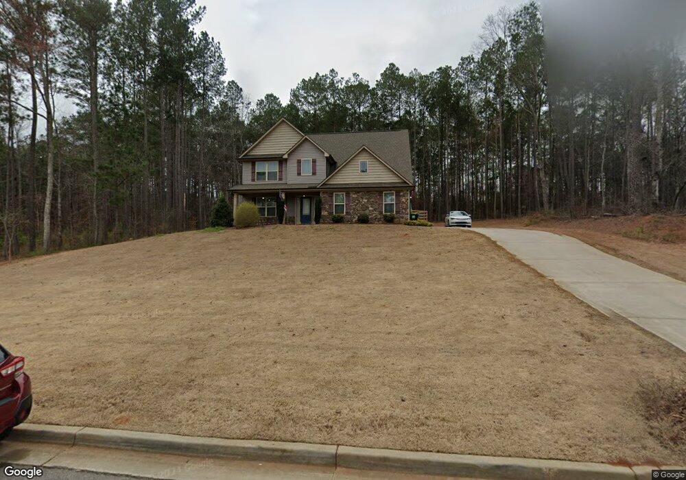
241 Cecil Way Unit 57 McDonough, GA 30252
Estimated Value: $352,000 - $366,000
4
Beds
3
Baths
2,134
Sq Ft
$169/Sq Ft
Est. Value
About This Home
This home is located at 241 Cecil Way Unit 57, McDonough, GA 30252 and is currently estimated at $359,657, approximately $168 per square foot. 241 Cecil Way Unit 57 is a home located in Henry County with nearby schools including Rock Spring Elementary School, Ola Middle School, and Ola High School.
Ownership History
Date
Name
Owned For
Owner Type
Purchase Details
Closed on
May 29, 2024
Sold by
Werts Charlie William
Bought by
Harper Truston
Current Estimated Value
Purchase Details
Closed on
Nov 4, 2021
Sold by
Bruce Evan Scott
Bought by
Werts Charles William and Werts Katie Renee
Home Financials for this Owner
Home Financials are based on the most recent Mortgage that was taken out on this home.
Original Mortgage
$276,000
Interest Rate
2.99%
Mortgage Type
New Conventional
Purchase Details
Closed on
Jun 8, 2017
Sold by
K
Bought by
Boyd Bruce Evan Scott and Boyd Bruce Lindsey
Home Financials for this Owner
Home Financials are based on the most recent Mortgage that was taken out on this home.
Original Mortgage
$193,410
Interest Rate
4.05%
Mortgage Type
New Conventional
Create a Home Valuation Report for This Property
The Home Valuation Report is an in-depth analysis detailing your home's value as well as a comparison with similar homes in the area
Home Values in the Area
Average Home Value in this Area
Purchase History
| Date | Buyer | Sale Price | Title Company |
|---|---|---|---|
| Harper Truston | $359,000 | -- | |
| Werts Charles William | $345,000 | -- | |
| Boyd Bruce Evan Scott | $214,900 | -- |
Source: Public Records
Mortgage History
| Date | Status | Borrower | Loan Amount |
|---|---|---|---|
| Previous Owner | Werts Charles William | $276,000 | |
| Previous Owner | Boyd Bruce Evan Scott | $193,410 |
Source: Public Records
Tax History Compared to Growth
Tax History
| Year | Tax Paid | Tax Assessment Tax Assessment Total Assessment is a certain percentage of the fair market value that is determined by local assessors to be the total taxable value of land and additions on the property. | Land | Improvement |
|---|---|---|---|---|
| 2024 | $5,634 | $139,680 | $24,000 | $115,680 |
| 2023 | $5,481 | $140,680 | $18,000 | $122,680 |
| 2022 | $4,919 | $126,040 | $18,000 | $108,040 |
| 2021 | $3,384 | $99,160 | $18,000 | $81,160 |
| 2020 | $3,214 | $91,960 | $14,800 | $77,160 |
| 2019 | $3,136 | $88,640 | $14,000 | $74,640 |
| 2018 | $3,011 | $83,360 | $12,000 | $71,360 |
Source: Public Records
Map
Nearby Homes
- 106 Loam Dr
- 209 Amber Ct
- 1908 Munford Place
- 1120 Stroud Rd
- 1100 Stroud Rd
- 4904 Highway 81 E
- 0 Highway 81 St E Unit 10597150
- 124 Wynn Rd
- 41 Giles Dr
- 4075 O Henry Ct
- 518 Gallantry Trail
- 180 Mackey Rd
- 170 Mackey Rd
- 501 Barhams Ridge Dr
- 3000 Keeneland Blvd
- 5168 Highway 81 E
- 227 Aves Ct
- 507 Judith Ct Unit 3
- 415 Pamela Ct
- 241 Cecil Way
- 245 Cecil Way
- 237 Cecil Way Unit 56
- 237 Cecil Way
- 244 Cecil Way
- 240 Cecil Way
- 240 Cecil Way Unit 67
- 249 Cecil Way Unit 59
- 249 Cecil Way
- 233 Cecil Way Unit 55
- 233 Cecil Way
- 250 Cecil Way
- 236 Cecil Way Unit 68
- 253 Cecil Way
- 428 Sandy Ridge Rd
- 229 Cecil Way Unit 54
- 570 Sandy Ridge Rd
- 341 Helena Place Unit 77
- 254 Cecil Way
- 0 Cecil Way Unit 7373576