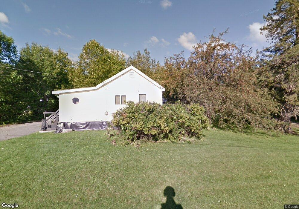
241 Dow Rd Orrington, ME 04474
Estimated Value: $192,000 - $318,000
1
Bed
2
Baths
896
Sq Ft
$258/Sq Ft
Est. Value
About This Home
This home is located at 241 Dow Rd, Orrington, ME 04474 and is currently estimated at $231,495, approximately $258 per square foot. 241 Dow Rd is a home located in Penobscot County with nearby schools including Center Drive School and Calvary Chapel Christian School.
Ownership History
Date
Name
Owned For
Owner Type
Purchase Details
Closed on
May 16, 2016
Sold by
Dean Laurel C and Ehrman Pauline
Bought by
Soucia Andrew
Current Estimated Value
Home Financials for this Owner
Home Financials are based on the most recent Mortgage that was taken out on this home.
Original Mortgage
$47,000
Outstanding Balance
$37,476
Interest Rate
3.71%
Mortgage Type
New Conventional
Estimated Equity
$194,019
Purchase Details
Closed on
Oct 21, 2014
Sold by
Prahm Harris G Est
Bought by
Wilson Weymouth B and Wilson Patricia L
Create a Home Valuation Report for This Property
The Home Valuation Report is an in-depth analysis detailing your home's value as well as a comparison with similar homes in the area
Home Values in the Area
Average Home Value in this Area
Purchase History
| Date | Buyer | Sale Price | Title Company |
|---|---|---|---|
| Soucia Andrew | -- | -- | |
| Wilson Weymouth B | -- | -- |
Source: Public Records
Mortgage History
| Date | Status | Borrower | Loan Amount |
|---|---|---|---|
| Open | Soucia Andrew | $47,000 |
Source: Public Records
Tax History Compared to Growth
Tax History
| Year | Tax Paid | Tax Assessment Tax Assessment Total Assessment is a certain percentage of the fair market value that is determined by local assessors to be the total taxable value of land and additions on the property. | Land | Improvement |
|---|---|---|---|---|
| 2024 | $1,759 | $161,400 | $48,400 | $113,000 |
| 2023 | $1,674 | $152,200 | $45,000 | $107,200 |
| 2022 | $1,775 | $139,200 | $49,900 | $89,300 |
| 2021 | $1,949 | $129,900 | $49,900 | $80,000 |
| 2020 | $1,980 | $124,500 | $49,900 | $74,600 |
| 2019 | $1,980 | $124,500 | $49,900 | $74,600 |
| 2018 | $1,453 | $124,500 | $49,900 | $74,600 |
| 2017 | $1,731 | $124,500 | $49,900 | $74,600 |
| 2016 | $2,530 | $91,400 | $31,100 | $60,300 |
| 2015 | $1,312 | $91,400 | $31,100 | $60,300 |
| 2014 | $1,353 | $94,300 | $31,100 | $63,200 |
| 2013 | $1,268 | $94,300 | $31,100 | $63,200 |
Source: Public Records
Map
Nearby Homes
- 12 Harvest Dr
- 38 Harvest Dr
- 290 Center Dr
- 245 Center Dr
- Lot 3 00 Stonewall Dr
- Lot 4 00 Stonewall Dr
- 473 Center Dr
- 173 Center Dr
- 101 Oak Hill Rd
- 197 Arctic Station Rd
- 23 Carver Rd
- 21 Betts Rd
- 314 Main Rd N
- 304 Main Rd N
- 108 Marina Rd
- 12 Rowell Rd
- 15 Harbor Dr
- 10 Bald Eagle Dr Unit 10
- 33 Hillside Dr
- 99 Old County Rd
- 243 Johnson Mill Rd
- 228 Johnson Mill Rd
- 16 Omega Ln
- 250 Johnson Mill Rd
- 211 Dow Rd
- 225 Dow Rd
- 253 Johnson Mill Rd
- 222 Johnson Mill Rd
- M5 L86A Johnson Mill Rd
- 212 Johnson Mill Rd
- 266 Johnson Mill Rd
- 273 Dow Rd
- 203 Johnson Mill Rd
- 283 Dow Rd
- 44 Sirrah Ln
- 287 Johnson Mill Rd
- 286 Dow Rd
- 286 Johnson Mill Rd
- 290 Johnson Mill Rd