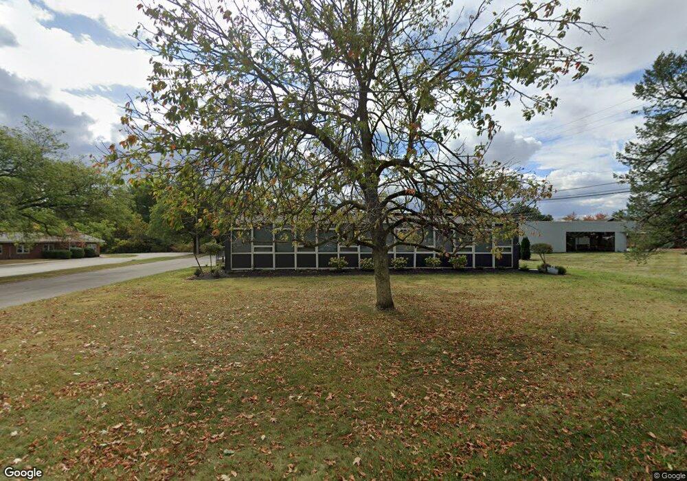
241 Executive Dr Marion, OH 43302
Estimated Value: $727,829
--
Bed
--
Bath
640
Sq Ft
$1,137/Sq Ft
Est. Value
About This Home
This home is located at 241 Executive Dr, Marion, OH 43302 and is currently estimated at $727,829, approximately $1,137 per square foot. 241 Executive Dr is a home located in Marion County with nearby schools including Benjamin Harrison Elementary School, Ulysses S. Grant Middle School, and Harding High School.
Ownership History
Date
Name
Owned For
Owner Type
Purchase Details
Closed on
Aug 2, 2021
Sold by
Killdeer Hunt Farm Llc
Bought by
Straight Wire Real Estate Llc
Current Estimated Value
Home Financials for this Owner
Home Financials are based on the most recent Mortgage that was taken out on this home.
Original Mortgage
$459,000
Outstanding Balance
$417,561
Interest Rate
2.93%
Mortgage Type
Commercial
Estimated Equity
$310,268
Purchase Details
Closed on
Jun 2, 2005
Sold by
Smith Carol M
Bought by
Killdeer Hunt Farm Llc
Home Financials for this Owner
Home Financials are based on the most recent Mortgage that was taken out on this home.
Original Mortgage
$360,000
Interest Rate
5.82%
Mortgage Type
Construction
Create a Home Valuation Report for This Property
The Home Valuation Report is an in-depth analysis detailing your home's value as well as a comparison with similar homes in the area
Home Values in the Area
Average Home Value in this Area
Purchase History
| Date | Buyer | Sale Price | Title Company |
|---|---|---|---|
| Straight Wire Real Estate Llc | $540,000 | None Available | |
| Killdeer Hunt Farm Llc | $225,000 | A C S Title |
Source: Public Records
Mortgage History
| Date | Status | Borrower | Loan Amount |
|---|---|---|---|
| Open | Straight Wire Real Estate Llc | $459,000 | |
| Previous Owner | Killdeer Hunt Farm Llc | $360,000 |
Source: Public Records
Tax History Compared to Growth
Tax History
| Year | Tax Paid | Tax Assessment Tax Assessment Total Assessment is a certain percentage of the fair market value that is determined by local assessors to be the total taxable value of land and additions on the property. | Land | Improvement |
|---|---|---|---|---|
| 2024 | $5,473 | $118,240 | $12,740 | $105,500 |
| 2023 | $5,473 | $118,240 | $12,740 | $105,500 |
| 2022 | $4,458 | $101,840 | $12,740 | $89,100 |
| 2021 | $4,742 | $101,840 | $12,740 | $89,100 |
| 2020 | $4,908 | $101,840 | $12,740 | $89,100 |
| 2019 | $4,887 | $101,840 | $12,740 | $89,100 |
| 2018 | $4,813 | $102,340 | $12,740 | $89,600 |
| 2017 | $4,835 | $102,340 | $12,740 | $89,600 |
| 2016 | $4,860 | $102,340 | $12,740 | $89,600 |
| 2015 | $4,912 | $102,340 | $12,740 | $89,600 |
| 2014 | $4,902 | $102,340 | $12,740 | $89,600 |
| 2012 | $3,971 | $81,670 | $7,960 | $73,710 |
Source: Public Records
Map
Nearby Homes
- 1043 Harding Memorial Pkwy
- 0 Independence Ave
- 363 S Prospect St
- 334 Edgewood Dr
- 324 Carner Ave
- 604 S Prospect St
- 193 E Walnut St
- 127 E Walnut St
- 701 Brightwood Dr
- 556 S Vine St
- Tract 1-6 Southland Pkwy
- 559 Pearl St
- 618 Windsor St
- 1290 Old Pond Dr
- 769 Summit St
- 593 Windsor St
- 546 Cherry St
- 0 Marion-Waldo Rd Unit 224033985
- 1716 Marion-Waldo Rd
- 4.5 Acres Marion-Waldo Rd
- 1071 Harding Memorial Pkwy
- 1063 Harding Memorial Pkwy
- 1063 Harding Memorial Pkwy Unit B
- 250 Executive Dr Unit A&E
- 250 Executive Dr Unit C
- 250E 250 Executive Dr
- 250 Executive Dr
- 250 Executive Dr
- 1136 Independence Ave
- 1073 Harding Memorial Pkwy Unit 5B
- 1073 Harding Memorial Pkwy Unit 5A
- 1043 Harding Memorial Pkwy Unit 2-C
- 310 Executive Dr
- 1021 Harding Memorial Pkwy
- 1199 Delaware Ave - Ste 101c (Rear)
- 0000 Confidential Ave
- 1199 Delaware Ave
- 1199 Delaware Ave Unit 101 G
- 1199 Delaware Ave Unit 110
- 1203 Delaware Ave
