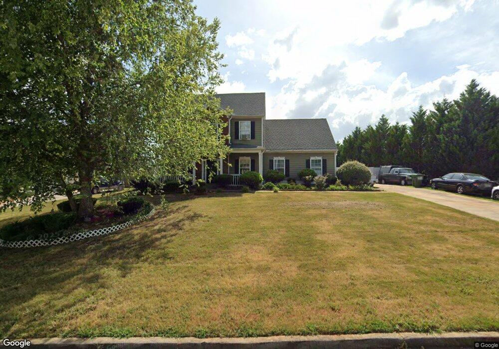
241 Forrest Dr Palmetto, GA 30268
Estimated Value: $274,000 - $319,000
3
Beds
3
Baths
1,802
Sq Ft
$167/Sq Ft
Est. Value
About This Home
This home is located at 241 Forrest Dr, Palmetto, GA 30268 and is currently estimated at $301,317, approximately $167 per square foot. 241 Forrest Dr is a home located in Coweta County with nearby schools including Brooks Elementary School, Madras Middle School, and Northgate High School.
Ownership History
Date
Name
Owned For
Owner Type
Purchase Details
Closed on
Apr 26, 2011
Sold by
Secretary Of Housing & Urban D
Bought by
Alvarado Mayra
Current Estimated Value
Purchase Details
Closed on
Feb 2, 2010
Sold by
Flagstar Bk Fsb
Bought by
Hud-Housing Of Urban Dev
Purchase Details
Closed on
Oct 15, 2002
Sold by
Forrest Homes Inc
Bought by
Stewart Alvin and Stewart Cheryl
Home Financials for this Owner
Home Financials are based on the most recent Mortgage that was taken out on this home.
Original Mortgage
$154,107
Interest Rate
8.89%
Mortgage Type
New Conventional
Purchase Details
Closed on
Sep 21, 2001
Sold by
Palmetto Properties Inc
Bought by
Forrest Homes Inc
Purchase Details
Closed on
Jan 24, 2000
Sold by
Lischkoff Herman L
Bought by
Palmetto Properties Inc
Create a Home Valuation Report for This Property
The Home Valuation Report is an in-depth analysis detailing your home's value as well as a comparison with similar homes in the area
Home Values in the Area
Average Home Value in this Area
Purchase History
| Date | Buyer | Sale Price | Title Company |
|---|---|---|---|
| Alvarado Mayra | $75,000 | -- | |
| Hud-Housing Of Urban Dev | -- | -- | |
| Flagstar Bk Fsb | $173,786 | -- | |
| Stewart Alvin | $151,800 | -- | |
| Forrest Homes Inc | -- | -- | |
| Palmetto Properties Inc | $363,000 | -- |
Source: Public Records
Mortgage History
| Date | Status | Borrower | Loan Amount |
|---|---|---|---|
| Previous Owner | Stewart Alvin | $154,107 |
Source: Public Records
Tax History Compared to Growth
Tax History
| Year | Tax Paid | Tax Assessment Tax Assessment Total Assessment is a certain percentage of the fair market value that is determined by local assessors to be the total taxable value of land and additions on the property. | Land | Improvement |
|---|---|---|---|---|
| 2025 | $3,298 | $114,210 | $20,000 | $94,210 |
| 2024 | $3,137 | $109,696 | $20,000 | $89,696 |
| 2023 | $3,137 | $107,990 | $16,000 | $91,990 |
| 2022 | $1,942 | $91,257 | $12,000 | $79,257 |
| 2021 | $1,808 | $77,585 | $12,000 | $65,585 |
| 2020 | $1,750 | $77,585 | $12,000 | $65,585 |
| 2019 | $1,601 | $65,737 | $8,000 | $57,737 |
| 2018 | $1,610 | $65,737 | $8,000 | $57,737 |
| 2017 | $1,508 | $61,856 | $8,000 | $53,856 |
| 2016 | $1,298 | $54,092 | $8,000 | $46,092 |
| 2015 | $857 | $37,111 | $8,000 | $29,111 |
| 2014 | $815 | $35,111 | $6,000 | $29,111 |
Source: Public Records
Map
Nearby Homes
- 594 Collinsworth Rd
- 234 Fayetteville Rd
- 212 Greensprings Ct Unit 2
- 205 Cobb St
- 211 Cobb St
- 518 Main St
- 207 Morris St
- 502 Bavarian Dr
- 518 Toombs St
- 80 Menefee St
- 0 Phipps Rd Unit 10559280
- 0 Phipps Rd
- 0 Phipps Rd Unit 7611236
- 10904 Serenbe Ln
- 2460 N Highway 29 Unit 2
- 8393 Columbia Ct
- 8387 Columbia Ct
- 8395 Columbia Ct Unit LOT 3
- 8381 Columbia Ct
- 8373 Columbia Ct
- 239 Forrest Dr
- 243 Forrest Dr
- 237 Forrest Dr
- 204 Forrest Ln
- 245 Forrest Dr
- 245 Forrest Dr
- 245 Forrest Dr Unit LOT 84
- 202 Forrest Ln
- 242 Forrest Dr
- 208 Forrest Way
- 246 Forrest Dr Unit (LOT 106)
- 244 Forrest Dr
- 208 Forrest Way
- 206 Forrest Ln
- 200 Forrest Ln
- 200 Forrest Ln
- 246 Forest Dr Lot 106 Unit LOT 106
- 247 Forrest Dr Unit 84
- 247 Forrest Dr
- 247 Forrest Dr Unit LOT 83