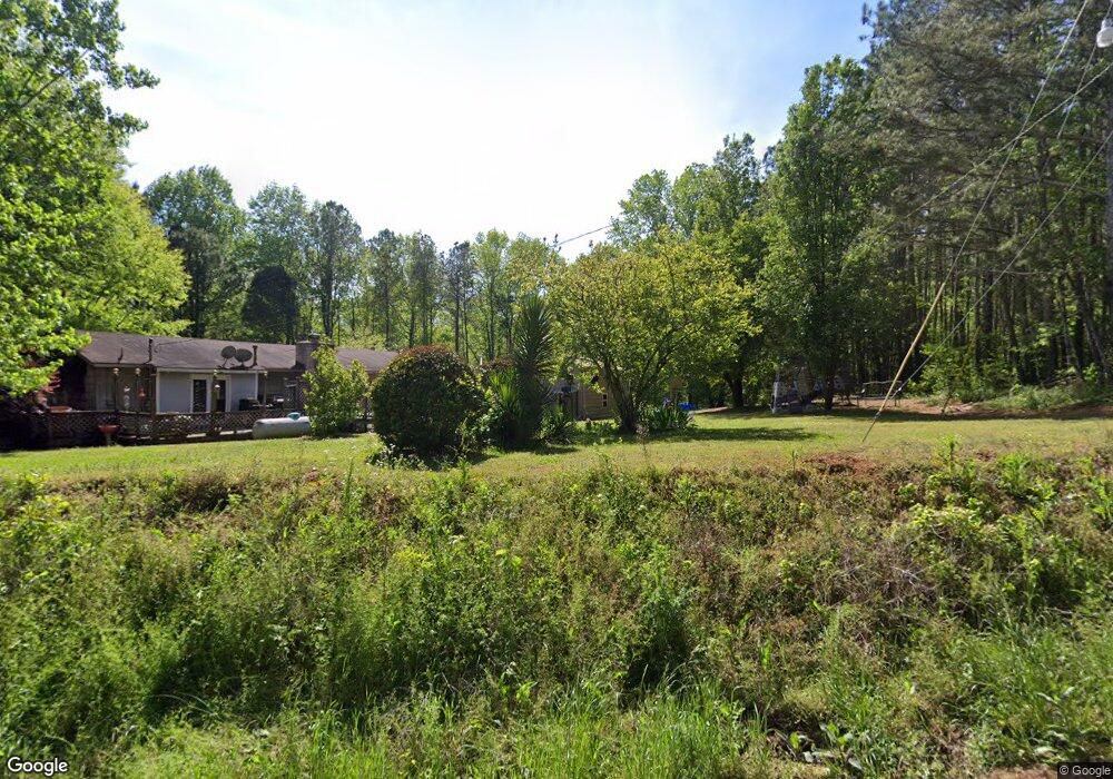
241 Hobart Smith Rd Canton, GA 30114
Estimated Value: $316,000 - $383,000
3
Beds
2
Baths
1,564
Sq Ft
$218/Sq Ft
Est. Value
About This Home
This home is located at 241 Hobart Smith Rd, Canton, GA 30114 and is currently estimated at $340,745, approximately $217 per square foot. 241 Hobart Smith Rd is a home located in Cherokee County with nearby schools including R. M. Moore Elementary School, Teasley Middle School, and Cherokee High School.
Ownership History
Date
Name
Owned For
Owner Type
Purchase Details
Closed on
Oct 6, 2023
Sold by
Mccoy James William
Bought by
Mccoy James W and Mccoy Wanda Gail
Current Estimated Value
Home Financials for this Owner
Home Financials are based on the most recent Mortgage that was taken out on this home.
Original Mortgage
$158,000
Outstanding Balance
$154,602
Interest Rate
7.12%
Mortgage Type
New Conventional
Estimated Equity
$186,143
Create a Home Valuation Report for This Property
The Home Valuation Report is an in-depth analysis detailing your home's value as well as a comparison with similar homes in the area
Home Values in the Area
Average Home Value in this Area
Purchase History
| Date | Buyer | Sale Price | Title Company |
|---|---|---|---|
| Mccoy James W | -- | -- |
Source: Public Records
Mortgage History
| Date | Status | Borrower | Loan Amount |
|---|---|---|---|
| Open | Mccoy James W | $158,000 |
Source: Public Records
Tax History Compared to Growth
Tax History
| Year | Tax Paid | Tax Assessment Tax Assessment Total Assessment is a certain percentage of the fair market value that is determined by local assessors to be the total taxable value of land and additions on the property. | Land | Improvement |
|---|---|---|---|---|
| 2025 | $516 | $106,240 | $25,800 | $80,440 |
| 2024 | $498 | $96,920 | $14,560 | $82,360 |
| 2023 | $313 | $81,960 | $12,280 | $69,680 |
| 2022 | $408 | $62,120 | $10,480 | $51,640 |
| 2021 | $405 | $52,600 | $9,120 | $43,480 |
| 2020 | $389 | $48,000 | $9,120 | $38,880 |
| 2019 | $383 | $45,600 | $9,120 | $36,480 |
| 2018 | $376 | $44,120 | $9,120 | $35,000 |
| 2017 | $391 | $111,800 | $9,120 | $35,600 |
| 2016 | $334 | $93,700 | $9,120 | $28,360 |
| 2015 | $348 | $94,700 | $9,120 | $28,760 |
| 2014 | $338 | $91,600 | $8,640 | $28,000 |
Source: Public Records
Map
Nearby Homes
- 240 Land Rd
- 2020 Darby Rd
- 544 Sardis Cir
- 1723 Darby Rd
- 1717 Darby Rd
- 6231 Reinhardt College Pkwy
- 735 Sardis Cir
- 737 Sardis Cir
- 1017 Cable Rd
- 6434 Reinhardt College Pkwy
- 994 Cable Rd
- 990 Cable Rd
- 1010 Cable Rd
- 134 Brookwood Trail
- 908 Sardis Rd
- 932 Sardis Rd
- 437 Mccurry Trail
- 4441 Fincher Rd
- 156 Puckett Rd
- 158 Puckett Rd
- 5692 Reinhardt College Pkwy
- 5571 Reinhardt College Pkwy
- 5637 Reinhardt College Pkwy
- 297 Hobart Smith Rd
- 5557 Reinhardt College Pkwy
- 5521 Reinhardt College Pkwy
- 5669 Reinhardt College Pkwy
- 412 Hobart Smith Rd
- 5758 Reinhardt College Pkwy
- 5439 Reinhardt College Pkwy
- 416 Hobart Smith Rd
- 5379 Reinhardt College Pkwy
- 5804 Reinhardt College Pkwy
- 425 Hobart Smith Rd
- 5305 Reinhardt College Pkwy
- 5936 Reinhardt College Pkwy
- 956 Sardis Cir
- 173 Sardis Creek Dr
- 173 Sardis Creek Dr Unit Lot 3
- 5845 Reinhardt College Pkwy