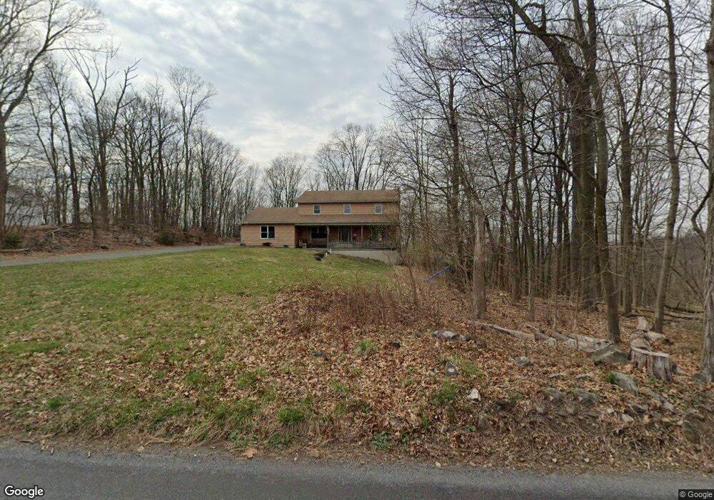
241 Landis Store Rd Boyertown, PA 19512
Estimated Value: $524,000 - $588,520
4
Beds
3
Baths
2,723
Sq Ft
$204/Sq Ft
Est. Value
About This Home
This home is located at 241 Landis Store Rd, Boyertown, PA 19512 and is currently estimated at $555,130, approximately $203 per square foot. 241 Landis Store Rd is a home located in Berks County with nearby schools including Brandywine Heights Elementary School, Brandywine Intermediate School, and Brandywine Heights High School.
Ownership History
Date
Name
Owned For
Owner Type
Purchase Details
Closed on
Jan 15, 2003
Sold by
Gordon Friedman Harriet D and Gordon Harriet D
Bought by
Hersh Daniel E and Hersch Tracey L
Current Estimated Value
Home Financials for this Owner
Home Financials are based on the most recent Mortgage that was taken out on this home.
Original Mortgage
$41,427
Outstanding Balance
$17,635
Interest Rate
5.99%
Estimated Equity
$537,495
Create a Home Valuation Report for This Property
The Home Valuation Report is an in-depth analysis detailing your home's value as well as a comparison with similar homes in the area
Home Values in the Area
Average Home Value in this Area
Purchase History
| Date | Buyer | Sale Price | Title Company |
|---|---|---|---|
| Hersh Daniel E | $58,800 | -- |
Source: Public Records
Mortgage History
| Date | Status | Borrower | Loan Amount |
|---|---|---|---|
| Open | Hersh Daniel E | $41,427 |
Source: Public Records
Tax History Compared to Growth
Tax History
| Year | Tax Paid | Tax Assessment Tax Assessment Total Assessment is a certain percentage of the fair market value that is determined by local assessors to be the total taxable value of land and additions on the property. | Land | Improvement |
|---|---|---|---|---|
| 2025 | $2,600 | $245,000 | $48,700 | $196,300 |
| 2024 | $11,216 | $245,000 | $48,700 | $196,300 |
| 2023 | $10,831 | $245,000 | $48,700 | $196,300 |
| 2022 | $10,578 | $245,000 | $48,700 | $196,300 |
| 2021 | $10,495 | $245,000 | $48,700 | $196,300 |
| 2020 | $10,290 | $245,000 | $48,700 | $196,300 |
| 2019 | $10,155 | $245,000 | $48,700 | $196,300 |
| 2018 | $10,018 | $245,000 | $48,700 | $196,300 |
| 2017 | $9,805 | $245,000 | $48,700 | $196,300 |
| 2016 | $1,854 | $245,000 | $48,700 | $196,300 |
| 2015 | $1,854 | $245,000 | $48,700 | $196,300 |
| 2014 | $1,854 | $245,000 | $48,700 | $196,300 |
Source: Public Records
Map
Nearby Homes
- 38 Lutz Rd
- 4 Baldy Hill Rd
- 454 Landis Rd
- 454 Landis Store Rd
- 297 Forgedale Rd
- 39 Lehmann Ln
- 637 Forgedale Rd
- 12 Lehland Dr
- 169 Dale Rd
- 2131 Weisstown Rd
- 22 Apache Run
- 70 Sugar Maple Rd
- 483 Water St
- 11 Bishop Pine Rd
- 131 Stauffer Rd
- 129 Stauffer Rd
- 127 Stauffer Rd
- 125 Stauffer Rd
- 115 Eagles Watch Dr S
- 2390 Old Route 100
- 253 Landis Store Rd
- 225 Landis Store Rd
- 259 Landis Store Rd
- 224 Landis Store Rd
- 220 Landis Store Rd
- 184 Weil Rd
- 214 Landis Store Rd
- 199 Landis Store Rd
- 8 Lutz Rd
- 0 Lutz Rd
- 00 Lutz Rd
- 26 Lutz Rd
- 210 Landis Store Rd
- 206 Landis Store Rd
- 197 Landis Store Rd
- 171 Weil Rd
- 200 Landis Store Rd
- 160 Weil Rd
- 35 Crag Ln
- 38 Crag Ln