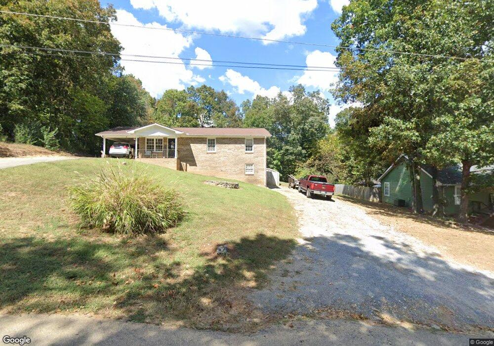
241 Langston Rd NE Calhoun, GA 30701
Estimated Value: $209,000 - $237,000
3
Beds
2
Baths
1,218
Sq Ft
$187/Sq Ft
Est. Value
About This Home
This home is located at 241 Langston Rd NE, Calhoun, GA 30701 and is currently estimated at $227,385, approximately $186 per square foot. 241 Langston Rd NE is a home located in Gordon County with nearby schools including Tolbert Elementary School, Ashworth Middle School, and Gordon Central High School.
Ownership History
Date
Name
Owned For
Owner Type
Purchase Details
Closed on
Apr 28, 2017
Sold by
Smith Debra T
Bought by
Sampson Timothy Lamar
Current Estimated Value
Home Financials for this Owner
Home Financials are based on the most recent Mortgage that was taken out on this home.
Original Mortgage
$95,144
Outstanding Balance
$79,211
Interest Rate
4.14%
Mortgage Type
FHA
Estimated Equity
$148,174
Purchase Details
Closed on
Apr 8, 2004
Sold by
Baker Baron
Bought by
Smith Debra T
Create a Home Valuation Report for This Property
The Home Valuation Report is an in-depth analysis detailing your home's value as well as a comparison with similar homes in the area
Home Values in the Area
Average Home Value in this Area
Purchase History
| Date | Buyer | Sale Price | Title Company |
|---|---|---|---|
| Sampson Timothy Lamar | $96,900 | -- | |
| Smith Debra T | $108,900 | -- |
Source: Public Records
Mortgage History
| Date | Status | Borrower | Loan Amount |
|---|---|---|---|
| Open | Sampson Timothy Lamar | $95,144 |
Source: Public Records
Tax History Compared to Growth
Tax History
| Year | Tax Paid | Tax Assessment Tax Assessment Total Assessment is a certain percentage of the fair market value that is determined by local assessors to be the total taxable value of land and additions on the property. | Land | Improvement |
|---|---|---|---|---|
| 2024 | $1,461 | $57,520 | $3,360 | $54,160 |
| 2023 | $1,384 | $54,480 | $3,360 | $51,120 |
| 2022 | $1,394 | $51,600 | $3,360 | $48,240 |
| 2021 | $1,227 | $43,800 | $3,360 | $40,440 |
| 2020 | $1,273 | $44,440 | $3,360 | $41,080 |
| 2019 | $1,319 | $45,777 | $3,360 | $42,417 |
| 2018 | $1,116 | $43,417 | $3,360 | $40,057 |
| 2017 | $1,174 | $41,617 | $3,360 | $38,257 |
| 2016 | $1,177 | $41,617 | $3,360 | $38,257 |
| 2015 | $1,170 | $41,017 | $3,360 | $37,657 |
| 2014 | $1,109 | $40,074 | $3,360 | $36,714 |
Source: Public Records
Map
Nearby Homes
- 307 Craigtown Rd NE
- 996 Chatsworth Highway 225 NE
- 128 Craigtown Rd NE
- 211 Birch Ln
- 308 Heritage Dr
- 205 Laurel Dr NE
- Brexley Manor Townhomes Floor Plan at Brexley Manor - Townhomes
- 453 Chatsworth Highway 225 NE
- 121 Sunset Dr NE
- 403 S Sequoyah Cir NE
- 228 Woodland Cir NW
- 198 Iracille Ln NE
- 624 Newtown Creek Loop NE
- 138 Landon Ct NE
- 2630 Chatsworth Highway 225 NE
- 111 Nike Dr
- 130 Red Oak Ln
- 229 Langston Rd NE
- 255 Langston Rd NE
- 236 Langston Rd NE
- 208 Langston Rd NE
- 344 Langston Dr NE
- 195 Langston Rd NE
- 260 Langston Rd NE
- 260 Langston Rd NE Unit 46
- 195 Langston Rd NE
- 354 Langston Dr NE
- 186 Langston Rd NE
- 185 Langston Rd NE
- 364 Langston Dr NE
- 312 Langston Dr NE
- 145 Langston Rd NE
- 299 Langston Dr NE
- 176 Langston Rd NE
- 380 Langston Dr NE
- 337 Langston Dr NE
- 347 Langston Dr NE