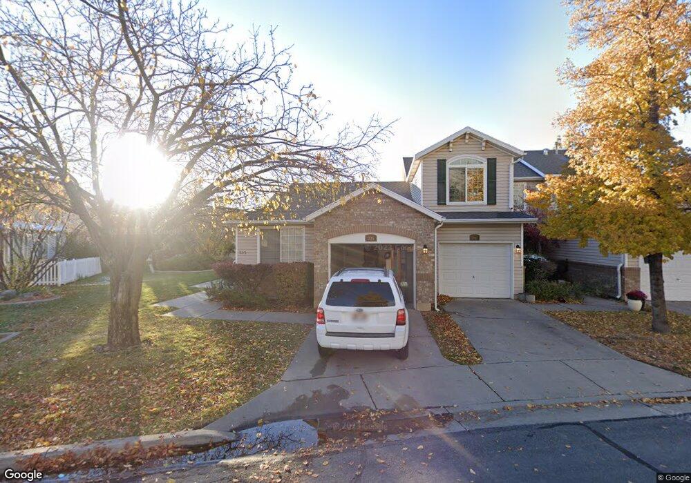
241 N 100 W Centerville, UT 84014
Estimated Value: $441,000 - $458,000
3
Beds
4
Baths
2,466
Sq Ft
$182/Sq Ft
Est. Value
About This Home
This home is located at 241 N 100 W, Centerville, UT 84014 and is currently estimated at $449,256, approximately $182 per square foot. 241 N 100 W is a home located in Davis County with nearby schools including J A Taylor Elementary School, Centerville Jr High, and Viewmont High School.
Ownership History
Date
Name
Owned For
Owner Type
Purchase Details
Closed on
Jul 1, 2019
Sold by
Micneill John R and John R Mcneill Trust
Bought by
Rust Brandon K and Rust Shauna K
Current Estimated Value
Home Financials for this Owner
Home Financials are based on the most recent Mortgage that was taken out on this home.
Original Mortgage
$260,000
Outstanding Balance
$227,659
Interest Rate
4%
Mortgage Type
New Conventional
Estimated Equity
$221,597
Purchase Details
Closed on
Dec 29, 2016
Sold by
Mcneill John
Bought by
Mcneill John R and Mcneill Trust
Purchase Details
Closed on
Oct 29, 2010
Sold by
Peterson Tracy A
Bought by
Peterson Tracy
Home Financials for this Owner
Home Financials are based on the most recent Mortgage that was taken out on this home.
Original Mortgage
$146,200
Interest Rate
4.33%
Mortgage Type
New Conventional
Purchase Details
Closed on
Aug 12, 2005
Sold by
Noar Patrick D and Kier Noar Kimi L
Bought by
Peterson Tracy A
Home Financials for this Owner
Home Financials are based on the most recent Mortgage that was taken out on this home.
Original Mortgage
$24,750
Interest Rate
5.61%
Mortgage Type
Credit Line Revolving
Purchase Details
Closed on
Apr 21, 2003
Sold by
Kier Noar Kimi L and Noar Patrick D
Bought by
Noar Patrick D and Kier Noar Kimi L
Home Financials for this Owner
Home Financials are based on the most recent Mortgage that was taken out on this home.
Original Mortgage
$121,800
Interest Rate
5.54%
Purchase Details
Closed on
Apr 16, 2001
Sold by
Kimi & James E Kier Family Ltd Prtnrshp
Bought by
Noar Patrick D and Kier Noar Kimi L
Home Financials for this Owner
Home Financials are based on the most recent Mortgage that was taken out on this home.
Original Mortgage
$90,000
Interest Rate
6.98%
Purchase Details
Closed on
Feb 27, 1996
Sold by
Kier Kimi
Bought by
Kier Kimi and James E Kier Family Ltd Partnership
Home Financials for this Owner
Home Financials are based on the most recent Mortgage that was taken out on this home.
Original Mortgage
$66,150
Interest Rate
7.04%
Create a Home Valuation Report for This Property
The Home Valuation Report is an in-depth analysis detailing your home's value as well as a comparison with similar homes in the area
Home Values in the Area
Average Home Value in this Area
Purchase History
| Date | Buyer | Sale Price | Title Company |
|---|---|---|---|
| Rust Brandon K | -- | Title One Inc | |
| Mcneill John R | -- | -- | |
| Peterson Tracy | -- | Vintage Title Ins Agency Inc | |
| Peterson Tracy A | -- | Home Abst & Title Co | |
| Noar Patrick D | -- | First American Title Co | |
| Noar Patrick D | -- | Associated Title Company | |
| Kier Kimi | -- | Associated Title Company | |
| Kier Kimi | -- | Associated Title Company |
Source: Public Records
Mortgage History
| Date | Status | Borrower | Loan Amount |
|---|---|---|---|
| Open | Rust Brandon K | $260,000 | |
| Previous Owner | Peterson Tracy | $146,200 | |
| Previous Owner | Peterson Tracy A | $24,750 | |
| Previous Owner | Peterson Tracy A | $133,960 | |
| Previous Owner | Noar Patrick D | $121,800 | |
| Previous Owner | Noar Patrick D | $90,000 | |
| Previous Owner | Kier Kimi | $66,150 |
Source: Public Records
Tax History Compared to Growth
Tax History
| Year | Tax Paid | Tax Assessment Tax Assessment Total Assessment is a certain percentage of the fair market value that is determined by local assessors to be the total taxable value of land and additions on the property. | Land | Improvement |
|---|---|---|---|---|
| 2025 | $2,415 | $231,000 | $72,050 | $158,950 |
| 2024 | $2,380 | $231,550 | $55,000 | $176,550 |
| 2023 | $2,406 | $423,000 | $98,000 | $325,000 |
| 2022 | $2,420 | $234,300 | $52,800 | $181,500 |
| 2021 | $2,129 | $321,000 | $69,000 | $252,000 |
| 2020 | $1,877 | $283,000 | $64,500 | $218,500 |
| 2019 | $1,861 | $274,000 | $62,000 | $212,000 |
| 2018 | $1,609 | $234,000 | $58,000 | $176,000 |
| 2016 | $1,372 | $110,880 | $20,350 | $90,530 |
| 2015 | $1,343 | $102,410 | $20,350 | $82,060 |
| 2014 | $1,363 | $106,358 | $18,333 | $88,025 |
| 2013 | -- | $118,378 | $15,675 | $102,703 |
Source: Public Records
Map
Nearby Homes
- 232 N 100 W
- 88 W 50 S Unit F9
- 147 N 360 W Unit 21
- 117 Cara Vella Ln
- 266 E Center St
- 171 W 650 N
- 360 E 400 N
- 360 E Center St
- 493 W 620 N Unit 122
- 353 Florentine Ln
- 252 N 400 E
- 833 N Lakeside Ln
- 67 W Pheasantbrook Dr
- 328 E 1100 S
- 775 Pheasantbrook Cir
- 751 Pheasantbrook Dr
- 763 Pheasantbrook Dr
- 781 Pheasantbrook Dr
- 22 Creekside Ln
- 147 W 925 N