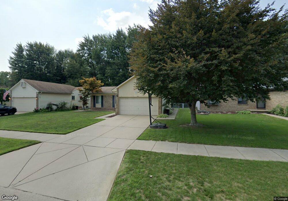
241 Pattingill St Westland, MI 48185
Estimated Value: $262,000 - $287,000
--
Bed
1
Bath
1,166
Sq Ft
$233/Sq Ft
Est. Value
About This Home
This home is located at 241 Pattingill St, Westland, MI 48185 and is currently estimated at $271,712, approximately $233 per square foot. 241 Pattingill St is a home located in Wayne County with nearby schools including Wildwood Elementary School, Marshall Upper Elementary School, and Adlai Stevenson Middle School.
Ownership History
Date
Name
Owned For
Owner Type
Purchase Details
Closed on
Oct 22, 2007
Sold by
Scott Robert W
Bought by
Scott Robert W
Current Estimated Value
Purchase Details
Closed on
Mar 23, 2007
Sold by
Scott Heather A
Bought by
Scott Robert W
Home Financials for this Owner
Home Financials are based on the most recent Mortgage that was taken out on this home.
Original Mortgage
$138,000
Interest Rate
6.2%
Mortgage Type
New Conventional
Create a Home Valuation Report for This Property
The Home Valuation Report is an in-depth analysis detailing your home's value as well as a comparison with similar homes in the area
Home Values in the Area
Average Home Value in this Area
Purchase History
| Date | Buyer | Sale Price | Title Company |
|---|---|---|---|
| Scott Robert W | -- | None Available | |
| Scott Robert W | -- | Multiple |
Source: Public Records
Mortgage History
| Date | Status | Borrower | Loan Amount |
|---|---|---|---|
| Closed | Scott Robert W | $138,000 |
Source: Public Records
Tax History Compared to Growth
Tax History
| Year | Tax Paid | Tax Assessment Tax Assessment Total Assessment is a certain percentage of the fair market value that is determined by local assessors to be the total taxable value of land and additions on the property. | Land | Improvement |
|---|---|---|---|---|
| 2025 | $2,615 | $120,600 | $0 | $0 |
| 2024 | $2,615 | $112,800 | $0 | $0 |
| 2023 | $2,497 | $103,300 | $0 | $0 |
| 2022 | $2,844 | $93,100 | $0 | $0 |
| 2021 | $2,773 | $90,300 | $0 | $0 |
| 2020 | $2,744 | $83,600 | $0 | $0 |
| 2019 | $2,644 | $81,500 | $0 | $0 |
| 2018 | $2,019 | $72,400 | $0 | $0 |
| 2017 | $845 | $66,000 | $0 | $0 |
| 2016 | $2,523 | $66,400 | $0 | $0 |
| 2015 | $4,998 | $60,680 | $0 | $0 |
| 2013 | $4,842 | $50,640 | $0 | $0 |
| 2012 | $2,300 | $52,370 | $0 | $0 |
Source: Public Records
Map
Nearby Homes
- 540 Dartmouth Crescent Ct
- 977 N Newburgh Rd
- 37575 Barkridge Cir Unit 54
- 404 N Sybald St
- 788 N Linville St
- 36034 Rolf St
- 38074 Hixford Place
- 336 Marigold Cir Unit 45
- 284 Marigold Cir Unit 17
- 639 N Harvey St
- 38122 Hixford Place
- 511 S Bryar St
- 36323 Monroe Ave
- 38030 Greenwood St
- 38066 Sherwood St
- 36293 Monroe Ave
- 38386 Maes St
- 36020 Glen St
- 38203 Avondale St
- 38227 Avondale St
- 221 Pattingill St
- 261 Pattingill St
- 201 Pattingill St
- 281 Pattingill St
- 181 Pattingill St
- 220 Pattingill St
- 200 Pattingill St
- 240 Pattingill St
- 180 Pattingill St
- 260 Pattingill St
- 301 Pattingill St
- 160 Pattingill St
- 280 Pattingill St
- 23622 Hickory Ln
- 300 Pattingill St
- 341 Pattingill St
- 361 Pattingill St
- 321 Pattingill St
- 0 Cherry Hill Rd Unit 4959160
- 0 Cherry Hill Rd Unit 213017423