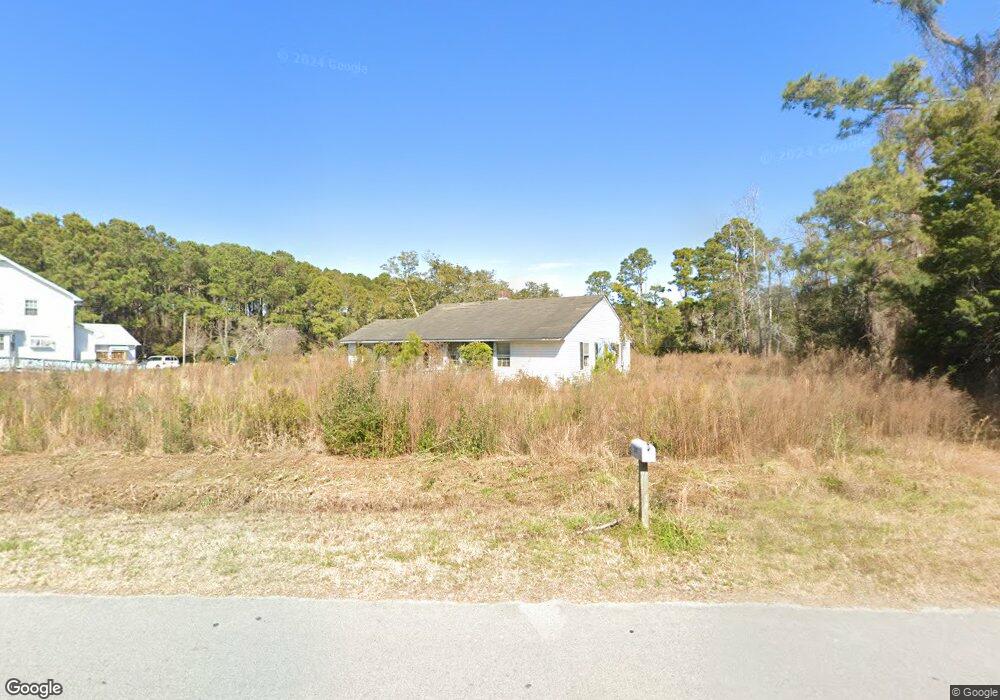
241 Pinners Point Rd Beaufort, NC 28516
Estimated Value: $156,000 - $304,000
3
Beds
1
Bath
1,295
Sq Ft
$191/Sq Ft
Est. Value
About This Home
This home is located at 241 Pinners Point Rd, Beaufort, NC 28516 and is currently estimated at $247,507, approximately $191 per square foot. 241 Pinners Point Rd is a home located in Carteret County with nearby schools including Beaufort Elementary School, Beaufort Middle School, and East Carteret High School.
Ownership History
Date
Name
Owned For
Owner Type
Purchase Details
Closed on
Dec 9, 2019
Sold by
Hudnall John and Hudnall Patricia
Bought by
Hines Marvin Arlynn and Hines Linda W
Current Estimated Value
Purchase Details
Closed on
May 12, 2010
Sold by
Sanford Mary Ann
Bought by
Sanford Mary Ann
Purchase Details
Closed on
Mar 9, 2006
Sold by
Klimacek Katherine A
Bought by
Sanford Mary Ann and Katherine A Klimacek Revocable Trust
Purchase Details
Closed on
Mar 7, 2006
Sold by
Hudnall Bertha B
Bought by
Hudnall Bertha B and Bertha B Hudnall Revocable Trust
Purchase Details
Closed on
Feb 8, 2001
Create a Home Valuation Report for This Property
The Home Valuation Report is an in-depth analysis detailing your home's value as well as a comparison with similar homes in the area
Home Values in the Area
Average Home Value in this Area
Purchase History
| Date | Buyer | Sale Price | Title Company |
|---|---|---|---|
| Hines Marvin Arlynn | $50,000 | None Available | |
| Sanford Mary Ann | -- | None Available | |
| Sanford Mary Ann | -- | None Available | |
| Hudnall Bertha B | -- | None Available | |
| -- | -- | -- |
Source: Public Records
Tax History Compared to Growth
Tax History
| Year | Tax Paid | Tax Assessment Tax Assessment Total Assessment is a certain percentage of the fair market value that is determined by local assessors to be the total taxable value of land and additions on the property. | Land | Improvement |
|---|---|---|---|---|
| 2025 | $597 | $170,541 | $85,613 | $84,928 |
| 2024 | $902 | $160,730 | $114,879 | $45,851 |
| 2023 | $976 | $160,730 | $114,879 | $45,851 |
| 2022 | $960 | $160,730 | $114,879 | $45,851 |
| 2021 | $960 | $160,730 | $114,879 | $45,851 |
| 2020 | $919 | $160,730 | $114,879 | $45,851 |
| 2019 | $910 | $168,744 | $114,879 | $53,865 |
| 2017 | $974 | $182,421 | $114,879 | $67,542 |
| 2016 | $946 | $182,421 | $114,879 | $67,542 |
| 2015 | $928 | $182,421 | $114,879 | $67,542 |
| 2014 | $783 | $189,527 | $122,891 | $66,636 |
Source: Public Records
Map
Nearby Homes
- 000 Live Oak Pinners Point Rd
- 0 Live Oak St Unit 100542378
- 235 Cline Way Unit 107, 1809 Live
- 231 Cline Way Unit 105, 1809 Live
- 228 Cline Way Unit 131, 1809 Live
- 237 Cline Way Unit 108, 1809 Live
- 230 Cline Way Unit 130, 1809 Live
- The Lookout Plan at 1809 Live Oak - Towns at Live Oak
- The Harbour Plan at 1809 Live Oak - Towns at Live Oak
- 500 Swan
- 702 Pirates Landing Dr
- 109 Sanctuary
- 556 Sheldrake Ct
- 535 Sheldrake
- 201 Sycamore Dr
- 534 Sheldrake
- 301 Courtyard E Unit 301
- 504 Swan
- 526 Sheldrake
- 530 Sheldrake Ct
- 257 Pinners Point Rd
- 231 Pinners Point Rd
- 271 Pinners Point Rd
- 215 Pinners Point Rd
- 207 Pinners Point Rd
- 283 Pinners Point Rd
- 152 Glenda Dr
- 293 Pinners Point Rd
- 150 Glenda Dr
- 155 Glenda Dr
- 101 Howland Pkwy
- 148 Glenda Dr
- 153 Glenda Dr
- 116 Mashburn Dr
- 146 Glenda Dr
- 151 Glenda Dr
- 114 Mashburn Dr
- 149 Glenda Dr
- 169 Pinners Point Rd
- 100 Howland Pkwy