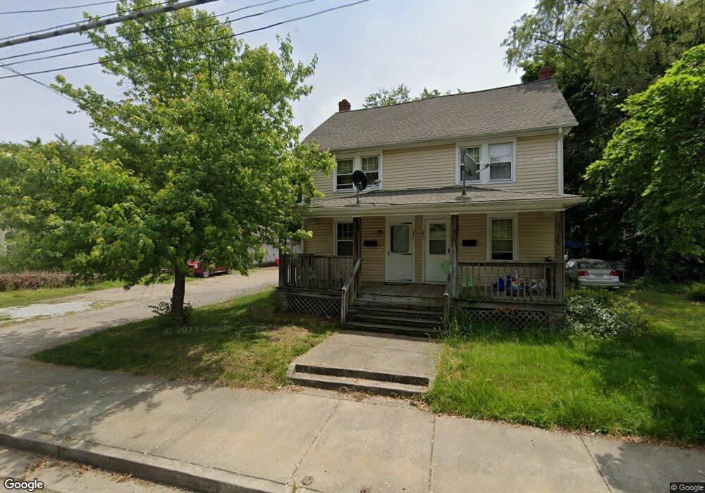
241 S Broad St Unit 243 Penns Grove, NJ 08069
Estimated Value: $184,358 - $322,000
3
Beds
1
Bath
1,176
Sq Ft
$207/Sq Ft
Est. Value
About This Home
This home is located at 241 S Broad St Unit 243, Penns Grove, NJ 08069 and is currently estimated at $243,840, approximately $207 per square foot. 241 S Broad St Unit 243 is a home located in Salem County with nearby schools including Lafayette-Pershing Elementary School, Paul W. Carleton Elementary School, and Field Street Elementary School.
Ownership History
Date
Name
Owned For
Owner Type
Purchase Details
Closed on
Sep 4, 2021
Sold by
Pomponi John and Pomponi Mary Jane
Bought by
Taft Manor Llc
Current Estimated Value
Purchase Details
Closed on
Dec 31, 1986
Bought by
Pomponi John F and Mary Jane
Create a Home Valuation Report for This Property
The Home Valuation Report is an in-depth analysis detailing your home's value as well as a comparison with similar homes in the area
Home Values in the Area
Average Home Value in this Area
Purchase History
| Date | Buyer | Sale Price | Title Company |
|---|---|---|---|
| Taft Manor Llc | $110,000 | Fifth Avenue Title Agcy Inc | |
| Pomponi John F | $25,000 | -- |
Source: Public Records
Tax History Compared to Growth
Tax History
| Year | Tax Paid | Tax Assessment Tax Assessment Total Assessment is a certain percentage of the fair market value that is determined by local assessors to be the total taxable value of land and additions on the property. | Land | Improvement |
|---|---|---|---|---|
| 2025 | $5,884 | $106,100 | $29,800 | $76,300 |
| 2024 | $5,687 | $106,100 | $29,800 | $76,300 |
| 2023 | $5,687 | $106,100 | $29,800 | $76,300 |
| 2022 | $5,482 | $106,100 | $29,800 | $76,300 |
| 2021 | $5,246 | $106,100 | $29,800 | $76,300 |
| 2020 | $5,315 | $106,100 | $29,800 | $76,300 |
| 2019 | $5,453 | $108,400 | $29,800 | $78,600 |
| 2018 | $5,821 | $144,300 | $32,900 | $111,400 |
| 2017 | $5,841 | $144,300 | $32,900 | $111,400 |
| 2016 | $5,620 | $144,300 | $32,900 | $111,400 |
| 2015 | $5,384 | $144,300 | $32,900 | $111,400 |
| 2014 | $5,325 | $144,300 | $32,900 | $111,400 |
Source: Public Records
Map
Nearby Homes
- 260 S Broad St
- 204 206 S Broad St
- 15 Spring St
- 213 Garnet St
- 49 Delaware Dr
- 65 S Broad St
- 0 Park Ave Unit NJSA2013690
- 121 Ash St
- 0 S Virginia Ave Unit NJSA2015906
- 0 Delaware Dr
- 32 Westminster Ave
- 106 S Broad St
- 85 State St
- 106 Sack Ave
- 15 Walnut St
- 5 Dixie Dr
- 83 Willis St
- 32 Walnut St
- 55 57 Walnut St
- 239 E St
- 243 S Broad St
- 249 S Broad St
- 255 S Broad St
- 261 S Broad St
- 9 E Maple Ave
- 11 E Maple Ave
- 21 E Maple Ave
- 1 Helms Cove Ln
- 1 Helms Cove Ln
- 19 W Maple Ave
- 4 W Maple Ave
- 214 S Broad St
- 265 S Broad St
- 25 W Maple Ave
- 8 W Maple Ave
- 23 E Maple Ave
- 10 E Maple Ave
- 12 W Maple Ave
- 210 S Broad St Unit 208
- 16 W Maple Ave