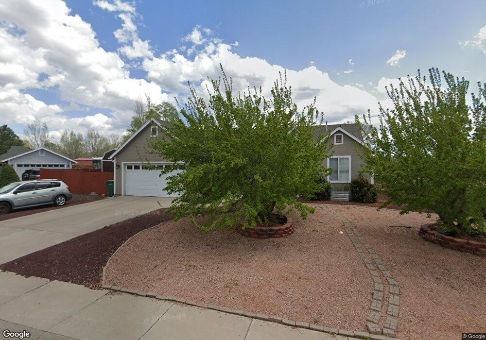
241 W Crystal Cir Show Low, AZ 85901
Estimated Value: $326,665 - $418,000
--
Bed
--
Bath
1,368
Sq Ft
$276/Sq Ft
Est. Value
About This Home
This home is located at 241 W Crystal Cir, Show Low, AZ 85901 and is currently estimated at $377,416, approximately $275 per square foot. 241 W Crystal Cir is a home located in Navajo County with nearby schools including Whipple Ranch Elementary School, Show Low High School, and Show Low Junior High School.
Ownership History
Date
Name
Owned For
Owner Type
Purchase Details
Closed on
Feb 13, 2024
Sold by
Mcinelly Robert A and Mcinelly Heather
Bought by
Rainstorm Family Trust and Mcinelly
Current Estimated Value
Purchase Details
Closed on
Feb 5, 2007
Sold by
Hancock Douglas Leroy and Hancock Mildred Jean
Bought by
Mcinelly Robert A and Mcinelly Heather
Home Financials for this Owner
Home Financials are based on the most recent Mortgage that was taken out on this home.
Original Mortgage
$164,000
Interest Rate
6.19%
Mortgage Type
New Conventional
Purchase Details
Closed on
Apr 14, 2006
Sold by
Hancock Douglas L and Hancock Mildred J
Bought by
Douglas Sr & Mildred Hancock Living Trus
Create a Home Valuation Report for This Property
The Home Valuation Report is an in-depth analysis detailing your home's value as well as a comparison with similar homes in the area
Home Values in the Area
Average Home Value in this Area
Purchase History
| Date | Buyer | Sale Price | Title Company |
|---|---|---|---|
| Rainstorm Family Trust | -- | None Listed On Document | |
| Mcinelly Robert A | $205,000 | Transnation Title | |
| Douglas Sr & Mildred Hancock Living Trus | -- | None Available |
Source: Public Records
Mortgage History
| Date | Status | Borrower | Loan Amount |
|---|---|---|---|
| Previous Owner | Mcinelly Robert A | $164,000 |
Source: Public Records
Tax History Compared to Growth
Tax History
| Year | Tax Paid | Tax Assessment Tax Assessment Total Assessment is a certain percentage of the fair market value that is determined by local assessors to be the total taxable value of land and additions on the property. | Land | Improvement |
|---|---|---|---|---|
| 2026 | $1,391 | -- | -- | -- |
| 2025 | $1,368 | $26,579 | $2,772 | $23,807 |
| 2024 | $1,368 | $26,678 | $2,772 | $23,906 |
| 2023 | $1,368 | $21,261 | $2,410 | $18,851 |
| 2022 | $1,285 | $0 | $0 | $0 |
| 2021 | $1,304 | $0 | $0 | $0 |
| 2020 | $1,214 | $0 | $0 | $0 |
| 2019 | $1,214 | $0 | $0 | $0 |
| 2018 | $1,150 | $0 | $0 | $0 |
| 2017 | $1,050 | $0 | $0 | $0 |
| 2016 | $1,036 | $0 | $0 | $0 |
| 2015 | $978 | $9,619 | $2,000 | $7,619 |
Source: Public Records
Map
Nearby Homes
- 961 N Kiaya Ln
- 660 N 5th Dr
- 801 N 6th Dr
- 500 E Adams
- 181 N 6th Dr
- 81 N 4th St
- 461 N 9th Dr
- TBD E Ellsworth Rd
- 221 N Canyon Loop
- 201 N Canyon Loop
- 0 Spyglass Dr Unit 254740
- 261 N Canyon Loop
- 261 N Fox Run
- 140 W Nikolaus
- 857 E Cooley St
- 40 N Canyon Loop
- 541 W Deuce of Clubs
- 20 N Fox Run
- 1241 W Mcneil
- 1000 N 16th Ave
- 240 W Kendra Cir
- 264 W Crystal Cir
- 240 W Crystal Cir
- 220 W Kendra Cir
- 920 N Kiaya Ln
- 880 N Kiaya Ln
- 220 W Crystal Cir
- 940 N Kiaya Ln
- 200 W Crystal Cir
- 860 N Kiaya Ln
- 841 N Kiaya Ln
- 902 N 1st Ave
- 900 N 1st Ave
- 1000 N 1st Ave
- 840 N Kiaya Ln
- 1021 N Kiaya Ln
- 221 W Kendra Cir
- 1081 N Kiaya Ln
- 1050 N 1st Ave
- 860 N 1st Ave