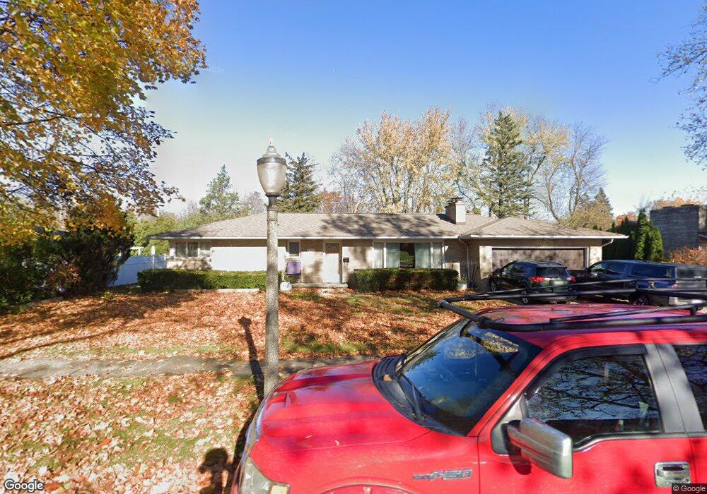
2410 Belaire Dr Lansing, MI 48911
Lewton Rich NeighborhoodEstimated Value: $245,000 - $281,000
3
Beds
3
Baths
2,227
Sq Ft
$115/Sq Ft
Est. Value
About This Home
This home is located at 2410 Belaire Dr, Lansing, MI 48911 and is currently estimated at $255,598, approximately $114 per square foot. 2410 Belaire Dr is a home located in Ingham County with nearby schools including Averill Elementary School, Attwood School, and J.W. Sexton High School.
Ownership History
Date
Name
Owned For
Owner Type
Purchase Details
Closed on
Jul 31, 2014
Sold by
Crowley Shirley Kay
Bought by
Thao Vue and Thao Mary Vang
Current Estimated Value
Home Financials for this Owner
Home Financials are based on the most recent Mortgage that was taken out on this home.
Original Mortgage
$127,645
Outstanding Balance
$41,309
Interest Rate
4.15%
Mortgage Type
FHA
Estimated Equity
$214,289
Purchase Details
Closed on
Apr 4, 1988
Sold by
Lawrence Dorsey E and Lawrence Iola M
Bought by
Lawrence Dorsey E
Create a Home Valuation Report for This Property
The Home Valuation Report is an in-depth analysis detailing your home's value as well as a comparison with similar homes in the area
Home Values in the Area
Average Home Value in this Area
Purchase History
| Date | Buyer | Sale Price | Title Company |
|---|---|---|---|
| Thao Vue | $130,000 | Midstate Title Agency Llc | |
| Lawrence Dorsey E | -- | -- |
Source: Public Records
Mortgage History
| Date | Status | Borrower | Loan Amount |
|---|---|---|---|
| Open | Thao Vue | $127,645 |
Source: Public Records
Tax History Compared to Growth
Tax History
| Year | Tax Paid | Tax Assessment Tax Assessment Total Assessment is a certain percentage of the fair market value that is determined by local assessors to be the total taxable value of land and additions on the property. | Land | Improvement |
|---|---|---|---|---|
| 2025 | $4,234 | $122,200 | $17,800 | $104,400 |
| 2024 | $34 | $110,000 | $17,800 | $92,200 |
| 2023 | $3,968 | $96,900 | $17,800 | $79,100 |
| 2022 | $3,574 | $85,100 | $15,400 | $69,700 |
| 2021 | $3,499 | $78,500 | $14,300 | $64,200 |
| 2020 | $3,478 | $75,300 | $14,300 | $61,000 |
| 2019 | $3,336 | $68,200 | $14,300 | $53,900 |
| 2018 | $3,124 | $63,100 | $14,300 | $48,800 |
| 2017 | $2,992 | $63,100 | $14,300 | $48,800 |
| 2016 | $3,728 | $55,500 | $14,300 | $41,200 |
| 2015 | $3,728 | $52,200 | $28,500 | $23,700 |
| 2014 | $3,728 | $50,500 | $28,500 | $22,000 |
Source: Public Records
Map
Nearby Homes
- 2505 Hanover Dr
- 2200 Rossiter Place
- 2201 Pamela Place
- 1533 Cambridge Rd
- 1740 Wellington Rd Unit 103
- 2409 Victor Ave
- 2812 Pleasant Grove Rd
- 2710 Bedford Rd
- 3310 W Mount Hope Ave
- 2920 Pleasant Grove Rd Unit 1
- 2039 Holly Way
- 3333 Moores River Dr Unit 812
- 1618 Loraine Ave
- 2905 S Catherine St
- 1420 Poxson Ave
- 3508 Muirfield Dr
- 3125 Boston Blvd
- 3421 Troon Cir Unit 29
- 3425 Cooley Dr
- 3601 Muirfield Dr
- 2400 Belaire Dr
- 2418 Belaire Dr
- 2417 W Mount Hope Ave
- 2411 W Mount Hope Ave
- 2425 W Mount Hope Ave
- 2322 Belaire Dr
- 2401 W Mount Hope Ave
- 2411 Belaire Dr
- 2401 Belaire Dr
- 2506 Belaire Dr
- 2419 Belaire Dr
- 2505 W Mount Hope Ave
- 2501 Belaire Dr
- 2314 Belaire Dr
- 2010 Wellesley Dr
- 2315 W Mount Hope Ave
- 2512 Belaire Dr
- 2315 Belaire Dr
- 2511 Belaire Dr