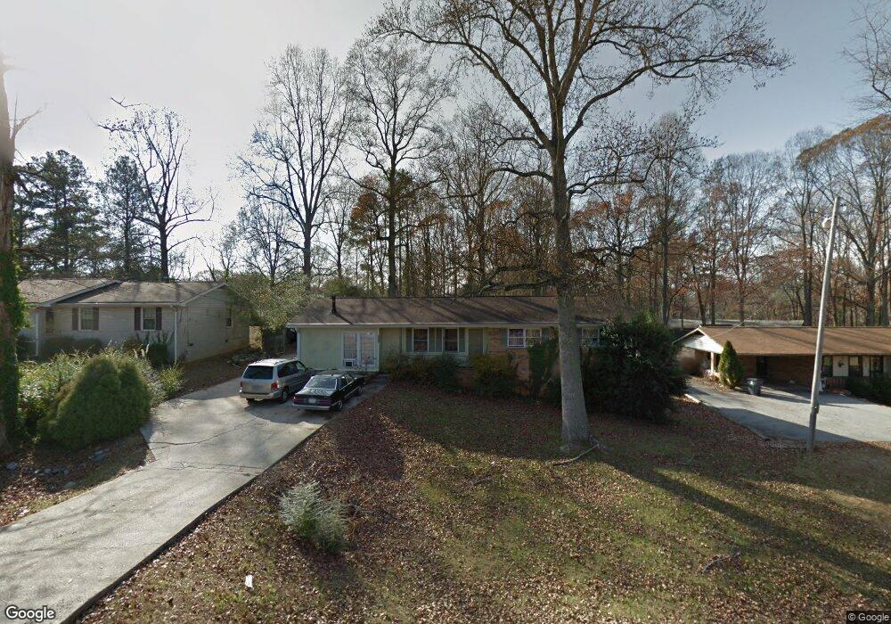
2410 Bobo Rd Unit 5 Dallas, GA 30132
East Paulding County NeighborhoodEstimated Value: $264,211 - $305,000
--
Bed
2
Baths
1,729
Sq Ft
$168/Sq Ft
Est. Value
About This Home
This home is located at 2410 Bobo Rd Unit 5, Dallas, GA 30132 and is currently estimated at $291,053, approximately $168 per square foot. 2410 Bobo Rd Unit 5 is a home located in Paulding County with nearby schools including C. A. Roberts Elementary School, East Paulding Middle School, and East Paulding High School.
Ownership History
Date
Name
Owned For
Owner Type
Purchase Details
Closed on
Aug 7, 2003
Sold by
Coleman Kenneth A and Coleman Lisa R
Bought by
Hall Edward J
Current Estimated Value
Home Financials for this Owner
Home Financials are based on the most recent Mortgage that was taken out on this home.
Original Mortgage
$105,760
Outstanding Balance
$46,233
Interest Rate
5.52%
Mortgage Type
FHA
Estimated Equity
$244,820
Purchase Details
Closed on
Jun 6, 2002
Sold by
Adams John P and Adams Deborah S
Bought by
Coleman Kenneth A
Purchase Details
Closed on
Jan 22, 1999
Sold by
Adams John P
Bought by
Adams John P and Adams Deborah S
Home Financials for this Owner
Home Financials are based on the most recent Mortgage that was taken out on this home.
Original Mortgage
$72,899
Interest Rate
6.84%
Mortgage Type
FHA
Create a Home Valuation Report for This Property
The Home Valuation Report is an in-depth analysis detailing your home's value as well as a comparison with similar homes in the area
Home Values in the Area
Average Home Value in this Area
Purchase History
| Date | Buyer | Sale Price | Title Company |
|---|---|---|---|
| Hall Edward J | $107,500 | -- | |
| Coleman Kenneth A | $92,000 | -- | |
| Adams John P | -- | -- | |
| Adams John P | $73,500 | -- |
Source: Public Records
Mortgage History
| Date | Status | Borrower | Loan Amount |
|---|---|---|---|
| Open | Hall Edward J | $105,760 | |
| Previous Owner | Adams John P | $72,899 |
Source: Public Records
Tax History Compared to Growth
Tax History
| Year | Tax Paid | Tax Assessment Tax Assessment Total Assessment is a certain percentage of the fair market value that is determined by local assessors to be the total taxable value of land and additions on the property. | Land | Improvement |
|---|---|---|---|---|
| 2024 | $2,494 | $103,492 | $12,000 | $91,492 |
| 2023 | $2,545 | $100,164 | $12,000 | $88,164 |
| 2022 | $2,616 | $81,696 | $12,000 | $69,696 |
| 2021 | $2,449 | $68,092 | $8,000 | $60,092 |
| 2020 | $2,342 | $64,820 | $8,000 | $56,820 |
| 2019 | $2,027 | $51,952 | $8,000 | $43,952 |
| 2018 | $1,571 | $54,012 | $8,000 | $46,012 |
| 2017 | $1,649 | $48,484 | $8,000 | $40,484 |
| 2016 | $1,056 | $36,788 | $8,000 | $28,788 |
| 2015 | $996 | $34,228 | $8,000 | $26,228 |
| 2014 | $971 | $32,620 | $8,000 | $24,620 |
| 2013 | -- | $25,200 | $8,000 | $17,200 |
Source: Public Records
Map
Nearby Homes
- 14 Minor Ct
- 116 Gail St
- 318 Dublin Way
- 292 Dublin Way
- 354 Dublin Way
- 364 Dublin Way
- 255 Dublin Way
- 375 Dublin Way
- 384 Dublin Way
- 395 Dublin Way
- Oconee Plan at Mount Tabor Pointe
- Tybee Plan at Mount Tabor Pointe
- Lanier Plan at Mount Tabor Pointe
- Juliette Plan at Mount Tabor Pointe
- Rabun Plan at Mount Tabor Pointe
- Davenport Plan at Mount Tabor Pointe
- 138 Donegal Way
- 406 Dublin Way
- 61 Donegal Way
- 443 Dublin Way