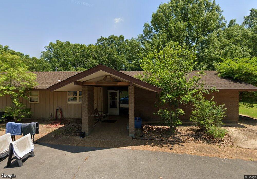
2410 Brookfield Dr Conway, AR 72032
Estimated Value: $426,000 - $642,933
Studio
4
Baths
4,654
Sq Ft
$113/Sq Ft
Est. Value
About This Home
This home is located at 2410 Brookfield Dr, Conway, AR 72032 and is currently estimated at $527,983, approximately $113 per square foot. 2410 Brookfield Dr is a home located in Faulkner County with nearby schools including Theodore Jones Elementary School, Conway Junior High School, and Conway High School.
Ownership History
Date
Name
Owned For
Owner Type
Purchase Details
Closed on
Dec 8, 2020
Sold by
Emil And Mary Farm Llc
Bought by
Nabholz Tim and Nabholz Brenda
Current Estimated Value
Purchase Details
Closed on
May 22, 2018
Sold by
Nabholz Properties Inc
Bought by
Emil And Mary Farm Llc
Purchase Details
Closed on
Jan 30, 2008
Bought by
Nabholz Prop
Purchase Details
Closed on
Jan 5, 1996
Bought by
Robert Nabholz Trust
Purchase Details
Closed on
Nov 14, 1994
Bought by
Water Esmt
Create a Home Valuation Report for This Property
The Home Valuation Report is an in-depth analysis detailing your home's value as well as a comparison with similar homes in the area
Home Values in the Area
Average Home Value in this Area
Purchase History
| Date | Buyer | Sale Price | Title Company |
|---|---|---|---|
| Nabholz Tim | $60,000 | Faulkner County Title Co | |
| Emil And Mary Farm Llc | $604,800 | Faulkner County Title Co | |
| Nabholz Prop | $450,000 | -- | |
| Nabholz Prop | $450,000 | -- | |
| Robert Nabholz Trust | -- | -- | |
| Trust Agreement | -- | -- | |
| Water Esmt | -- | -- |
Source: Public Records
Tax History
| Year | Tax Paid | Tax Assessment Tax Assessment Total Assessment is a certain percentage of the fair market value that is determined by local assessors to be the total taxable value of land and additions on the property. | Land | Improvement |
|---|---|---|---|---|
| 2025 | $5,988 | $118,340 | $20,680 | $97,660 |
| 2024 | $5,988 | $118,340 | $20,680 | $97,660 |
| 2023 | $4,679 | $92,480 | $20,680 | $71,800 |
| 2022 | $4,679 | $92,480 | $20,680 | $71,800 |
| 2021 | $4,679 | $92,480 | $20,680 | $71,800 |
| 2020 | $3,987 | $78,790 | $20,680 | $58,110 |
| 2019 | $3,987 | $78,790 | $20,680 | $58,110 |
| 2018 | $3,987 | $78,790 | $20,680 | $58,110 |
| 2017 | $3,787 | $74,850 | $20,680 | $54,170 |
| 2016 | $3,787 | $74,850 | $20,680 | $54,170 |
| 2015 | $3,789 | $74,880 | $12,440 | $62,440 |
| 2014 | $3,789 | $74,880 | $12,440 | $62,440 |
Source: Public Records
Map
Nearby Homes
- 1810 Angeline Dr
- 1012 Woodside Dr
- 2365 E Oak St
- 2415 E Oak St
- 00 Caskay Dr
- 13 Martha Ln
- 000 E German Ln
- 7 Ginger Dr
- 82 Addi Ln
- 2485 E Oak St
- 137 Union Rd
- 24 Lots Hays Add
- 0 Hidden Valley Rd Unit 26009095
- 2275 Victory Ln
- 1225 Bird Song Dr
- 1200 Andrews Dr
- 278-I U S Highway 64
- 278-H U S Highway 64
- 278 Hwy 64 E
- 278 C U S Highway 64 E
- 2415 Brookfield Dr
- 1440 Brookfield Dr
- 2325 Brookfield Dr
- 0 Strandlund Dr
- 1480 Strandlund Dr
- 2590 Brookfield Dr
- 2590 Brookfield Dr
- 1335 Brookfield Dr
- 2500 Brookfield Dr
- 1485 Strandlund Dr
- 1430 Brookfield Dr
- 1430 Brookfield Dr
- 1340 Strandlund Dr
- 1325 Brookfield Dr
- 1455 Strandlund Dr
- 1320 Brookfield Dr
- 2115 Rumker Rd
- 2010 Rich Smith Ln
- 2010 Rich Smith Ln
- 1310 Brookfield Dr
Your Personal Tour Guide
Ask me questions while you tour the home.