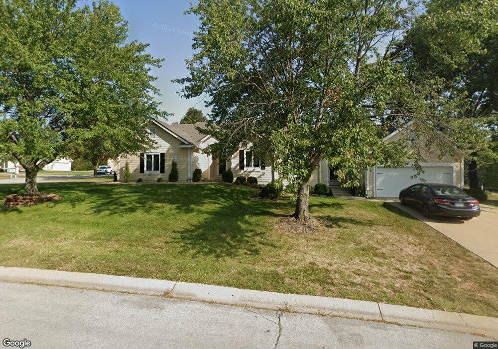
2410 NW Ashurst Dr Lees Summit, MO 64081
Estimated Value: $319,255 - $359,000
2
Beds
2
Baths
1,349
Sq Ft
$250/Sq Ft
Est. Value
About This Home
This home is located at 2410 NW Ashurst Dr, Lees Summit, MO 64081 and is currently estimated at $337,314, approximately $250 per square foot. 2410 NW Ashurst Dr is a home located in Jackson County with nearby schools including Cedar Creek Elementary School, Pleasant Lea Middle School, and Lee's Summit Senior High School.
Ownership History
Date
Name
Owned For
Owner Type
Purchase Details
Closed on
Apr 22, 2026
Sold by
Mcgraw Patricia
Bought by
Mcgraw Suzanne
Current Estimated Value
Purchase Details
Closed on
Aug 31, 2010
Sold by
Mcgraw Patricia L
Bought by
Mcgraw Patricia L
Home Financials for this Owner
Home Financials are based on the most recent Mortgage that was taken out on this home.
Original Mortgage
$135,583
Interest Rate
4.51%
Mortgage Type
FHA
Purchase Details
Closed on
Dec 26, 2002
Sold by
Mcgraw Patricia L
Bought by
Mcgraw Patricia L and Patricia L Mcgraw Trust
Home Financials for this Owner
Home Financials are based on the most recent Mortgage that was taken out on this home.
Original Mortgage
$98,000
Interest Rate
5.96%
Mortgage Type
Purchase Money Mortgage
Purchase Details
Closed on
Sep 1, 1999
Bought by
Mcgraw Patricia
Home Financials for this Owner
Home Financials are based on the most recent Mortgage that was taken out on this home.
Original Mortgage
$114,000
Interest Rate
7.58%
Mortgage Type
New Conventional
Create a Home Valuation Report for This Property
The Home Valuation Report is an in-depth analysis detailing your home's value as well as a comparison with similar homes in the area
Home Values in the Area
Average Home Value in this Area
Purchase History
We collect this data history from publicly available records. To have your information removed, we recommend requesting removal directly through your county’s website.
| Date | Buyer | Sale Price | Title Company |
|---|---|---|---|
| Mcgraw Suzanne | -- | None Listed On Document | |
| Mcgraw Patricia L | -- | Accommodation | |
| Mcgraw Patricia L | -- | Accommodation | |
| Mcgraw Patricia L | -- | -- | |
| Mcgraw Patricia L | -- | -- | |
| Mcgraw Patricia | -- | -- |
Source: Public Records
Mortgage History
We collect this data history from publicly available records. To have your information removed, we recommend requesting removal directly through your county’s website.
| Date | Status | Borrower | Loan Amount |
|---|---|---|---|
| Previous Owner | Mcgraw Patricia L | $135,583 | |
| Previous Owner | Mcgraw Patricia L | $98,000 | |
| Previous Owner | Mcgraw Patricia | $114,000 | |
| Closed | Mcgraw Patricia L | $24,500 |
Source: Public Records
Tax History
| Year | Tax Paid | Tax Assessment Tax Assessment Total Assessment is a certain percentage of the fair market value that is determined by local assessors to be the total taxable value of land and additions on the property. | Land | Improvement |
|---|---|---|---|---|
| 2025 | $4,204 | $49,751 | $14,679 | $35,072 |
| 2024 | $4,204 | $58,216 | $6,675 | $51,541 |
| 2023 | $4,173 | $58,216 | $7,991 | $50,225 |
| 2022 | $3,037 | $37,620 | $5,149 | $32,471 |
| 2021 | $3,100 | $37,620 | $5,149 | $32,471 |
| 2020 | $2,742 | $32,950 | $5,149 | $27,801 |
| 2019 | $2,667 | $32,950 | $5,149 | $27,801 |
| 2018 | $2,447 | $28,063 | $2,736 | $25,327 |
| 2017 | $2,447 | $28,063 | $2,736 | $25,327 |
| 2016 | $2,411 | $27,360 | $2,394 | $24,966 |
| 2014 | $2,529 | $28,134 | $2,234 | $25,900 |
Source: Public Records
Map
Nearby Homes
- 202 NW Ambersham Dr
- 2635 NW Ashurst Ln
- 2648 NW Ashurst Ln
- 416 NW Highcliffe Dr
- 2224 NW Summerfield Dr
- 920 NW High Point Dr
- 433 NW Kaylea Ct
- 2110 NW Ashurst Dr
- 2448 NW Valley View Dr
- 336 NW Thoreau Cir
- 2074 NW O'Brien Rd
- 2070 NW O'Brien Rd
- 917 NW Winterset St
- 2127 NW Killarney Ln
- 2123 NW Killarney Ln
- 321 NW Nutall Dr
- 129 NW Morton Dr
- 3121 SW Merriam Dr
- 2809 NW Audubon Ln
- 980 NW High Point Dr
- 2412 NW Ashurst Dr
- 2408 NW Ashurst Dr
- 505 NW Ashurst Ct
- 2413 NW Ashurst Dr
- 2411 NW Ashurst Dr
- 2406 NW Ashurst Dr
- 2418 NW Ashurst Dr
- 2415 NW Ashurst Dr
- 2402 NW Ashurst Dr
- 2417 NW Ashurst Dr
- 511 NW Ashurst Ct
- 2407 NW Ashurst Dr
- 506 NW Ashurst Ct
- 509 NW Ashurst Ct
- 504 NW Ashurst Ct
- 2419 NW Ashurst Dr
- 2420 NW Ashurst Dr
- 516 NW Ashley Ave
- 510 NW Ashley Ave
- 514 NW Ashley Ave
Your Personal Tour Guide
Ask me questions while you tour the home.