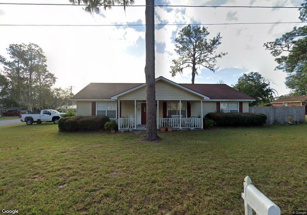
2410 Wister St Waycross, GA 31501
Estimated Value: $182,177 - $220,000
3
Beds
2
Baths
1,848
Sq Ft
$107/Sq Ft
Est. Value
About This Home
This home is located at 2410 Wister St, Waycross, GA 31501 and is currently estimated at $198,044, approximately $107 per square foot. 2410 Wister St is a home located in Ware County with nearby schools including Center Elementary School, Waycross Middle School, and Ware County High School.
Ownership History
Date
Name
Owned For
Owner Type
Purchase Details
Closed on
Aug 14, 2014
Sold by
Gruver Michael Glen
Bought by
Hayes Ronald L and Hayes Iris A
Current Estimated Value
Home Financials for this Owner
Home Financials are based on the most recent Mortgage that was taken out on this home.
Original Mortgage
$93,900
Outstanding Balance
$71,839
Interest Rate
4.2%
Mortgage Type
VA
Estimated Equity
$126,205
Purchase Details
Closed on
Jul 9, 2001
Sold by
Lowman Timothy and Lowman Misty
Bought by
Gruver Michael Glenn and Christina La
Purchase Details
Closed on
Mar 31, 1995
Sold by
Bryson William G
Bought by
Lowman Timothy and Lowman Misty
Create a Home Valuation Report for This Property
The Home Valuation Report is an in-depth analysis detailing your home's value as well as a comparison with similar homes in the area
Home Values in the Area
Average Home Value in this Area
Purchase History
| Date | Buyer | Sale Price | Title Company |
|---|---|---|---|
| Hayes Ronald L | $93,900 | -- | |
| Gruver Michael Glenn | $70,000 | -- | |
| Lowman Timothy | -- | -- |
Source: Public Records
Mortgage History
| Date | Status | Borrower | Loan Amount |
|---|---|---|---|
| Open | Hayes Ronald L | $93,900 |
Source: Public Records
Tax History Compared to Growth
Tax History
| Year | Tax Paid | Tax Assessment Tax Assessment Total Assessment is a certain percentage of the fair market value that is determined by local assessors to be the total taxable value of land and additions on the property. | Land | Improvement |
|---|---|---|---|---|
| 2024 | -- | $70,940 | $2,070 | $68,870 |
| 2023 | $0 | $51,534 | $2,188 | $49,346 |
| 2022 | $1,488 | $51,534 | $2,188 | $49,346 |
| 2021 | $1,364 | $43,542 | $2,188 | $41,354 |
| 2020 | $1,218 | $38,428 | $2,188 | $36,240 |
| 2019 | $1,101 | $34,059 | $2,188 | $31,871 |
| 2018 | $0 | $32,621 | $2,188 | $30,433 |
| 2017 | -- | $32,621 | $2,188 | $30,433 |
| 2016 | -- | $32,621 | $2,188 | $30,433 |
| 2015 | -- | $32,621 | $2,188 | $30,433 |
| 2014 | $907 | $32,621 | $2,188 | $30,433 |
| 2013 | -- | $32,621 | $2,188 | $30,432 |
Source: Public Records
Map
Nearby Homes
- 2706 Alice St
- 404 Community Dr
- 2108 Screven Ave
- 601 Community Dr
- 1206 Morningside Dr
- 1103 Kontz Ave
- 1715 City Blvd
- 607 Linden Dr
- 2509 Tebeau St
- 1703 Rainbow Dr
- 1011 Cherokee Cir
- Lot 3 City Blvd
- 1002 Cherokee Cir
- 2202 Pioneer St
- 2099 Ridge Rd
- 1621 Camellia Dr
- 2120 Tebeau St
- 1400 E Cherokee Dr
- 00 Pineview Dr
- 0 Pineview Dr
- 103 Lisbon Dr
- 2409 Wister St
- 104 Lisbon Dr
- 2406 Wister St
- 202 Lisbon Dr
- 102 Lisbon Dr
- 203 Lisbon Dr
- 2407 Wister St
- 106 Pinehurst Dr
- 204 Lisbon Dr
- 112 Pinehurst Dr
- 205 Lisbon Dr
- 202 Pinehurst Dr
- 212 Lisbon Dr
- 2509 Plant Ave
- 206 Pinehurst Dr
- 2402 Camden Dr
- 209 Lisbon Dr
- 105 Community Dr
- 107 Community Dr