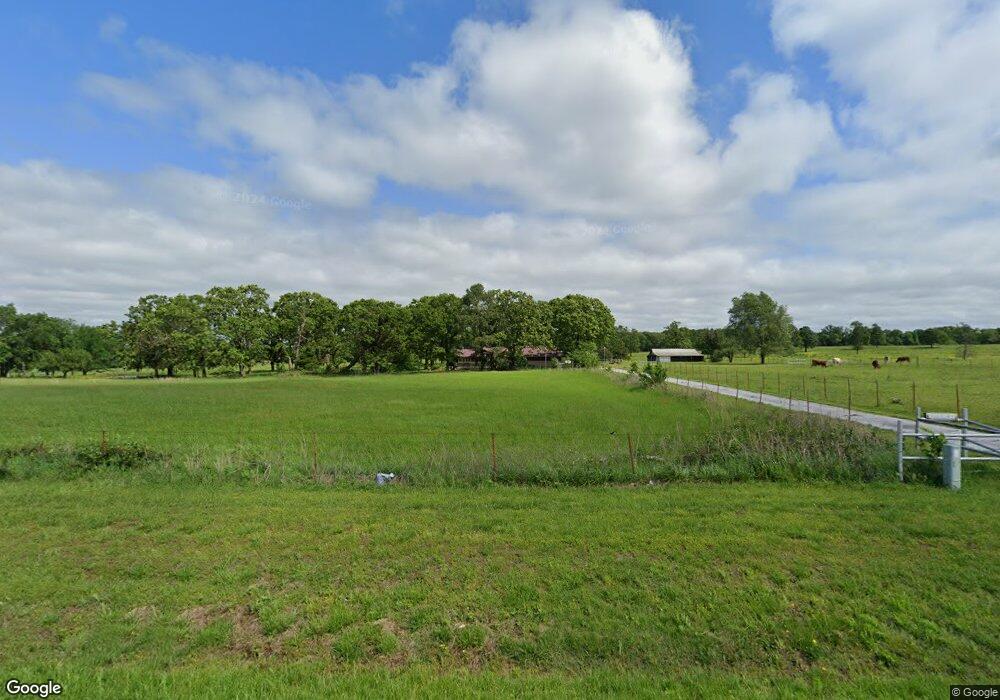
24100 W Highway 102 Gravette, AR 72736
Estimated Value: $322,556 - $396,000
--
Bed
1
Bath
2,068
Sq Ft
$177/Sq Ft
Est. Value
About This Home
This home is located at 24100 W Highway 102, Gravette, AR 72736 and is currently estimated at $366,389, approximately $177 per square foot. 24100 W Highway 102 is a home with nearby schools including Glenn Duffy Elementary School, Gravette Upper Elementary School, and Gravette Middle School.
Ownership History
Date
Name
Owned For
Owner Type
Purchase Details
Closed on
Feb 9, 2022
Sold by
Martindale Leslie W
Bought by
Sperry Shawn R and Sperry Melinda
Current Estimated Value
Home Financials for this Owner
Home Financials are based on the most recent Mortgage that was taken out on this home.
Original Mortgage
$198,671
Outstanding Balance
$59,919
Interest Rate
3.56%
Mortgage Type
New Conventional
Estimated Equity
$306,470
Purchase Details
Closed on
Oct 22, 1982
Bought by
Martindale
Create a Home Valuation Report for This Property
The Home Valuation Report is an in-depth analysis detailing your home's value as well as a comparison with similar homes in the area
Home Values in the Area
Average Home Value in this Area
Purchase History
| Date | Buyer | Sale Price | Title Company |
|---|---|---|---|
| Sperry Shawn R | $195,000 | Realty Title | |
| Martindale | $73,000 | -- |
Source: Public Records
Mortgage History
| Date | Status | Borrower | Loan Amount |
|---|---|---|---|
| Open | Sperry Shawn R | $198,671 |
Source: Public Records
Tax History Compared to Growth
Tax History
| Year | Tax Paid | Tax Assessment Tax Assessment Total Assessment is a certain percentage of the fair market value that is determined by local assessors to be the total taxable value of land and additions on the property. | Land | Improvement |
|---|---|---|---|---|
| 2025 | $2,277 | $57,535 | $6,963 | $50,572 |
| 2024 | $2,027 | $57,535 | $6,963 | $50,572 |
| 2023 | $1,843 | $41,601 | $1,872 | $39,729 |
| 2022 | $910 | $46,410 | $6,680 | $39,730 |
| 2021 | $906 | $46,410 | $6,680 | $39,730 |
| 2020 | $911 | $30,530 | $4,100 | $26,430 |
| 2019 | $911 | $30,530 | $4,100 | $26,430 |
| 2018 | $936 | $30,530 | $4,100 | $26,430 |
| 2017 | $867 | $30,530 | $4,100 | $26,430 |
| 2016 | $693 | $27,560 | $1,130 | $26,430 |
| 2015 | $1,061 | $32,810 | $2,100 | $30,710 |
| 2014 | $711 | $32,810 | $2,100 | $30,710 |
Source: Public Records
Map
Nearby Homes
- 10918 Blue Bird Rd
- 10604 Arkansas 43
- 0 Tucker Rd
- 40ac Tucker Rd
- . Tucker Rd
- 11228 Benson Rd
- TBD Georgia Flat Rd
- 22083 W Mountain Rd
- 0 Arkansas 43
- 11138 Georgia Flat Rd
- 0 Arkansas 43
- . Arkansas 43
- 0 W Mountain Rd Unit 1318276
- 12087 Georgia Flat Rd
- 0 Carlton Dr Unit 1312560
- 22842 Carlton Dr
- Tract A School House Rd
- Tract D School House Rd
- Tract D S School House Rd
- 0 E Hwy 102 Hwy Unit 363634
- 0 E Hwy 102 Hwy Unit 1258877
- 0 E Hwy 102 Hwy Unit 647991
- 0 E Hwy 102 Hwy Unit 686370
- 10576 Sperry Rd
- 23938 W Highway 102
- 23938 W Highway 102
- 10480 Sperry Rd
- 23934 W Highway 102
- Hy 102 Wes 123880 Weast Hyway 102 Maysville Ar Hwy
- 0 Hwy 102 Hwy Unit 656365
- 24356 W Highway 102
- 10904 Jaybird Rd
- 10916 and 10918 Jaybird Rd
- 24374 Arkansas 102
- 24374 Arkansas 102
- 10908 Blue Bird Rd
- 0 Blue Bird Rd
- 10914 Jaybird Rd
- Tract 1 Blue Bird Rd
