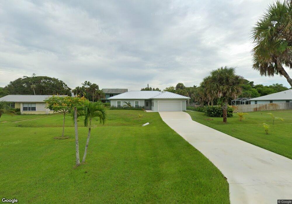
2411 Atlantic Beach Blvd Fort Pierce, FL 34949
Hutchinson Island North NeighborhoodEstimated Value: $468,000 - $650,468
4
Beds
2
Baths
1,506
Sq Ft
$387/Sq Ft
Est. Value
About This Home
This home is located at 2411 Atlantic Beach Blvd, Fort Pierce, FL 34949 and is currently estimated at $582,367, approximately $386 per square foot. 2411 Atlantic Beach Blvd is a home located in St. Lucie County with nearby schools including Chester A. Moore Elementary School, St. Lucie Elementary School, and Lawnwood Elementary School.
Ownership History
Date
Name
Owned For
Owner Type
Purchase Details
Closed on
Apr 9, 2024
Sold by
Linden William A and Linden Helene J
Bought by
William A Linden 2017 Revocable Trust and Helene J Linden 2017 Revocable Trust
Current Estimated Value
Purchase Details
Closed on
Jan 17, 2020
Sold by
Linden William N
Bought by
Linden William N
Purchase Details
Closed on
Nov 10, 2010
Sold by
Linden Adolf W
Bought by
Linden William A
Create a Home Valuation Report for This Property
The Home Valuation Report is an in-depth analysis detailing your home's value as well as a comparison with similar homes in the area
Home Values in the Area
Average Home Value in this Area
Purchase History
| Date | Buyer | Sale Price | Title Company |
|---|---|---|---|
| William A Linden 2017 Revocable Trust | $100 | None Listed On Document | |
| William A Linden 2017 Revocable Trust | $100 | None Listed On Document | |
| Linden William N | -- | None Available | |
| Linden William A | -- | None Available |
Source: Public Records
Tax History Compared to Growth
Tax History
| Year | Tax Paid | Tax Assessment Tax Assessment Total Assessment is a certain percentage of the fair market value that is determined by local assessors to be the total taxable value of land and additions on the property. | Land | Improvement |
|---|---|---|---|---|
| 2024 | $5,112 | $620,500 | $358,800 | $261,700 |
| 2023 | $5,112 | $292,300 | $292,300 | $0 |
| 2022 | $5,534 | $347,200 | $265,800 | $81,400 |
| 2021 | $4,920 | $229,100 | $159,500 | $69,600 |
| 2020 | $4,523 | $206,900 | $146,200 | $60,700 |
| 2019 | $2,994 | $172,706 | $0 | $0 |
| 2018 | $2,791 | $169,486 | $0 | $0 |
| 2017 | $2,757 | $165,400 | $133,400 | $32,000 |
| 2016 | $3,116 | $142,700 | $114,300 | $28,400 |
| 2015 | $3,149 | $141,000 | $114,300 | $26,700 |
| 2014 | $3,027 | $137,400 | $0 | $0 |
Source: Public Records
Map
Nearby Homes
- 0 Tamarind Dr
- 2325 Tamarind Dr
- 0 N Ocean Dr
- 2504 Atlantic Beach Blvd Unit 2b
- 2504 Atlantic Ave Unit 2b
- 2507 N Ocean Dr
- 2600 N Highway A1a
- 1000 Shorewinds Dr
- 2611 Flotilla Terrace
- 2700 N Highway A1a Unit 207
- 2700 N Highway A1a Unit 806
- 2700 N Highway A1a Unit 1308
- 2700 N Highway A1a
- 2700 N Highway A1a Unit 506
- 2700 N Highway A1a Unit 307
- 2801 N Highway A1a Unit E
- 2800 N Highway A1a Unit 408
- 2800 N Highway A1a Unit 302
- 2800 N Highway A1a Unit 401
- 2800 N Highway A1a
- 2409 Atlantic Beach Blvd
- 2415 Atlantic Beach Blvd
- 2410 Oak Dr
- 2414 Oak Dr
- 2407 Atlantic Beach Blvd
- 2428 Oak Dr
- 2416 Oak Dr
- 2408 Oak Dr
- 2403 Atlantic Beach Blvd
- 2412 Atlantic Beach Blvd Unit 1
- 2406 Oak Dr
- 2414 Atlantic Beach Blvd
- 2416 Atlantic Beach Blvd
- 2408 Atlantic Beach Blvd
- 2421 Atlantic Beach Blvd
- 2418 Atlantic Beach Blvd
- 2401 Atlantic Beach Blvd
- 2406 Atlantic Beach Blvd
- 2402 Oak Dr
- 2420 Atlantic Beach Blvd