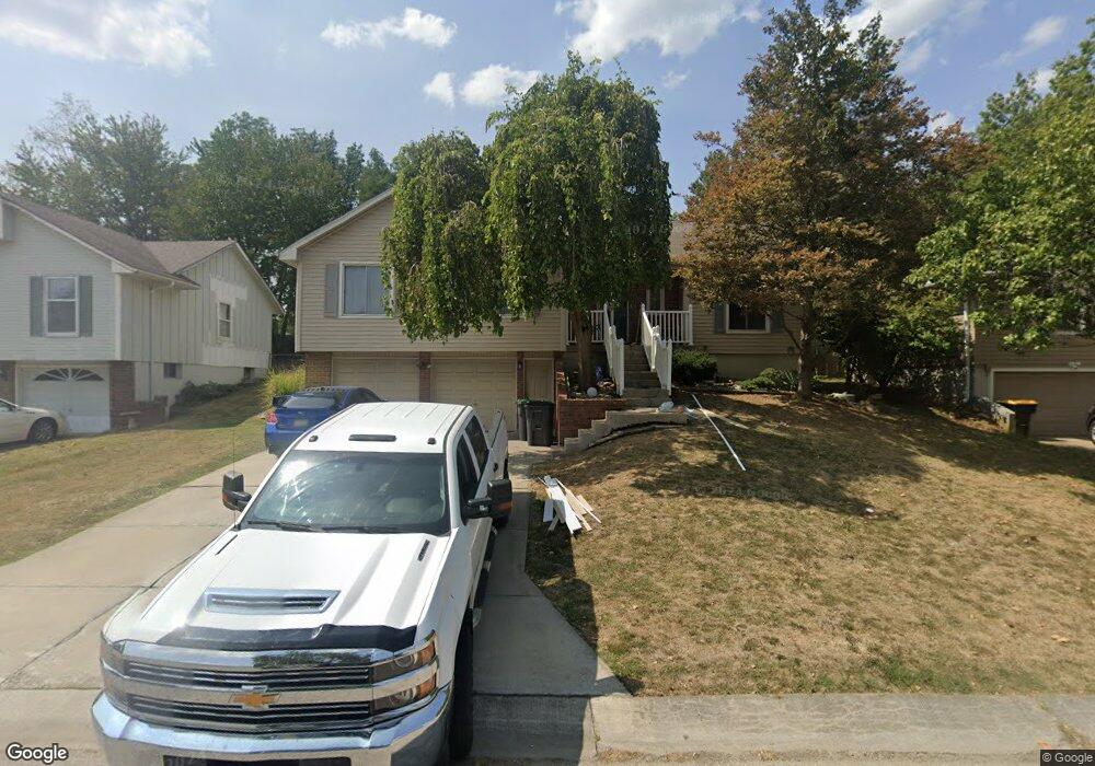
2411 NW 8th St Blue Springs, MO 64015
Estimated Value: $275,156 - $297,000
3
Beds
2
Baths
1,304
Sq Ft
$221/Sq Ft
Est. Value
About This Home
This home is located at 2411 NW 8th St, Blue Springs, MO 64015 and is currently estimated at $287,789, approximately $220 per square foot. 2411 NW 8th St is a home located in Jackson County with nearby schools including James Lewis Elementary School, Brittany Hill Middle School, and Blue Springs High School.
Ownership History
Date
Name
Owned For
Owner Type
Purchase Details
Closed on
Nov 22, 2013
Sold by
Kaub Steven
Bought by
Kaub Debra and Alabano Debra A
Current Estimated Value
Purchase Details
Closed on
Jan 24, 2001
Sold by
Rowe Marty F and Rowe Susan J
Bought by
Kaub Steven R and Kaub Debbie A
Home Financials for this Owner
Home Financials are based on the most recent Mortgage that was taken out on this home.
Original Mortgage
$114,750
Outstanding Balance
$42,001
Interest Rate
7.43%
Mortgage Type
VA
Estimated Equity
$245,788
Create a Home Valuation Report for This Property
The Home Valuation Report is an in-depth analysis detailing your home's value as well as a comparison with similar homes in the area
Home Values in the Area
Average Home Value in this Area
Purchase History
| Date | Buyer | Sale Price | Title Company |
|---|---|---|---|
| Kaub Debra | -- | None Available | |
| Kaub Steven R | -- | Security Land Title Company |
Source: Public Records
Mortgage History
| Date | Status | Borrower | Loan Amount |
|---|---|---|---|
| Open | Kaub Steven R | $114,750 |
Source: Public Records
Tax History Compared to Growth
Tax History
| Year | Tax Paid | Tax Assessment Tax Assessment Total Assessment is a certain percentage of the fair market value that is determined by local assessors to be the total taxable value of land and additions on the property. | Land | Improvement |
|---|---|---|---|---|
| 2025 | $2,750 | $36,183 | $6,722 | $29,461 |
| 2024 | $2,698 | $33,712 | $4,017 | $29,695 |
| 2023 | $2,698 | $33,712 | $4,524 | $29,188 |
| 2022 | $2,477 | $27,360 | $3,971 | $23,389 |
| 2021 | $2,475 | $27,360 | $3,971 | $23,389 |
| 2020 | $2,313 | $26,014 | $3,971 | $22,043 |
| 2019 | $2,237 | $26,014 | $3,971 | $22,043 |
| 2018 | $2,215 | $24,800 | $3,306 | $21,494 |
| 2017 | $2,215 | $24,800 | $3,306 | $21,494 |
| 2016 | $2,104 | $23,617 | $3,743 | $19,874 |
| 2014 | $1,997 | $22,345 | $3,739 | $18,606 |
Source: Public Records
Map
Nearby Homes
- 904 NW Oakridge Dr
- 1113 NW Roanoke Dr
- 2100 NW 12th St
- 1201 NW Burr Oak Ct
- 2100 NW Parker Ct
- 912 NW Forest Dr
- 2105 NW 5th St
- 2904 NW 5th St
- 2323 NW Acorn Dr
- 1000 NW Forest Dr
- 516 NW Brett Cir
- 2400 NW 1st St
- 1912 NW Manor Dr
- 105 NE Leann Dr
- 1504 NW Weatherstone Dr
- 1601 NW Weatherstone Ct
- 25609 E 31st Terrace S
- 3021 S Argonne Ct
- 2515 NE Springbrook St
- 204 NW Golfview Dr