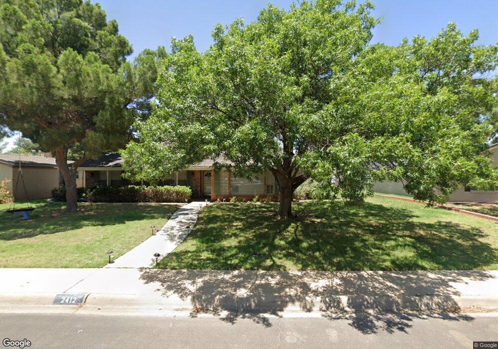
2412 Maxwell Dr Midland, TX 79705
Goddard Heights NeighborhoodEstimated Value: $399,000 - $453,000
--
Bed
2
Baths
2,441
Sq Ft
$171/Sq Ft
Est. Value
About This Home
This home is located at 2412 Maxwell Dr, Midland, TX 79705 and is currently estimated at $416,976, approximately $170 per square foot. 2412 Maxwell Dr is a home located in Midland County with nearby schools including Midland High School, Robert H. Goddard Junior High School, and The Hillander School.
Ownership History
Date
Name
Owned For
Owner Type
Purchase Details
Closed on
Apr 28, 2016
Sold by
Dagenhart Keith A and Dagenhart Karen C
Bought by
Bawcum James and Davey Jacquelyn
Current Estimated Value
Home Financials for this Owner
Home Financials are based on the most recent Mortgage that was taken out on this home.
Original Mortgage
$276,400
Outstanding Balance
$219,349
Interest Rate
3.73%
Mortgage Type
FHA
Estimated Equity
$197,627
Purchase Details
Closed on
Aug 26, 2009
Sold by
Pfannenstiel Toby
Bought by
Dagenhart Keith A and Dagenhart Karen C
Home Financials for this Owner
Home Financials are based on the most recent Mortgage that was taken out on this home.
Original Mortgage
$188,491
Interest Rate
5.16%
Mortgage Type
FHA
Purchase Details
Closed on
Jun 16, 1975
Bought by
Bawcum James
Create a Home Valuation Report for This Property
The Home Valuation Report is an in-depth analysis detailing your home's value as well as a comparison with similar homes in the area
Home Values in the Area
Average Home Value in this Area
Purchase History
| Date | Buyer | Sale Price | Title Company |
|---|---|---|---|
| Bawcum James | -- | West Tx Abstract & Title Co | |
| Dagenhart Keith A | -- | None Available | |
| Bawcum James | -- | -- |
Source: Public Records
Mortgage History
| Date | Status | Borrower | Loan Amount |
|---|---|---|---|
| Open | Bawcum James | $276,400 | |
| Previous Owner | Dagenhart Keith A | $188,491 |
Source: Public Records
Tax History Compared to Growth
Tax History
| Year | Tax Paid | Tax Assessment Tax Assessment Total Assessment is a certain percentage of the fair market value that is determined by local assessors to be the total taxable value of land and additions on the property. | Land | Improvement |
|---|---|---|---|---|
| 2025 | $3,873 | $327,450 | $36,160 | $291,290 |
| 2024 | $3,880 | $333,360 | $36,160 | $297,200 |
| 2023 | $3,814 | $333,360 | $36,160 | $297,200 |
| 2022 | $5,170 | $330,930 | $36,160 | $294,770 |
| 2021 | $5,765 | $330,930 | $36,160 | $294,770 |
| 2020 | $5,184 | $340,100 | $36,160 | $303,940 |
| 2019 | $5,943 | $313,900 | $36,160 | $303,940 |
| 2018 | $5,548 | $285,360 | $36,160 | $249,200 |
| 2017 | $5,606 | $288,330 | $36,160 | $252,170 |
| 2016 | $4,878 | $250,420 | $36,160 | $214,260 |
| 2015 | -- | $253,900 | $36,160 | $217,740 |
| 2014 | -- | $249,860 | $36,160 | $213,700 |
Source: Public Records
Map
Nearby Homes
- 2409 Stutz Place
- 2406 Stutz Place
- 2406 Dartmouth Dr
- 2505 Maxwell Dr
- 2305 Auburn Place
- 19 Winchester Ct
- 2400 Metz Ct
- 5 Chatham Ct
- 63 Ironwood Ct Unit 91
- 63 Ironwood Ct
- 2613 Haynes Dr
- 2605 Inwood Ct
- 2502 Goddard Dr
- 2806 Auburn Dr
- 4 Amhurst Ct
- 2811 Durant Dr
- 2400 W Dengar Ave
- 2817 Maxwell Dr
- 2604 Emerson Dr
- 2601 W Dengar Ave
- 2410 Maxwell Dr
- 2414 Maxwell Dr
- 2411 Stutz Place
- 2413 Stutz Place
- 2408 Maxwell Dr
- 2413 Maxwell Dr
- 2415 Maxwell Dr
- 2411 Maxwell Dr
- 2407 Stutz Place
- 2500 Maxwell Dr
- 2409 Maxwell Dr
- 2406 Maxwell Dr
- 2501 Stutz Place
- 2405 Stutz Place
- 2501 Maxwell Dr
- 2407 Maxwell Dr
- 2410 Stutz Place
- 2410 Dartmouth Dr
- 2408 Stutz Place
- 2404 Maxwell Dr