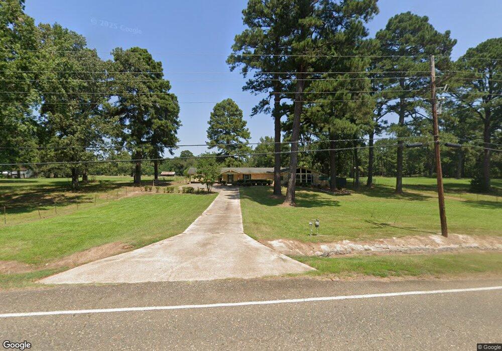
24130 Highway 157 Springhill, LA 71075
Estimated Value: $150,000 - $243,514
3
Beds
2
Baths
2,555
Sq Ft
$71/Sq Ft
Est. Value
About This Home
This home is located at 24130 Highway 157, Springhill, LA 71075 and is currently estimated at $180,129, approximately $70 per square foot. 24130 Highway 157 is a home located in Webster Parish with nearby schools including Browning Elementary School, Brown Upper Elementary School, and North Webster High School.
Ownership History
Date
Name
Owned For
Owner Type
Purchase Details
Closed on
Jun 2, 2022
Sold by
Secretary Of Housing And Urban Developme
Bought by
Alhashash Abdel
Current Estimated Value
Home Financials for this Owner
Home Financials are based on the most recent Mortgage that was taken out on this home.
Original Mortgage
$114,950
Outstanding Balance
$93,382
Interest Rate
4.38%
Mortgage Type
New Conventional
Estimated Equity
$86,747
Purchase Details
Closed on
Sep 16, 2021
Sold by
Home Point Mortgage Accep
Bought by
Usa Hud
Purchase Details
Closed on
Aug 23, 2021
Sold by
Simmons Eric C and Webster Parish Of
Bought by
Home Point Mortgage
Create a Home Valuation Report for This Property
The Home Valuation Report is an in-depth analysis detailing your home's value as well as a comparison with similar homes in the area
Purchase History
We collect this data history from publicly available records. To have your information removed, we recommend requesting removal directly through your county’s website.
| Date | Buyer | Sale Price | Title Company |
|---|---|---|---|
| Alhashash Abdel | -- | New Title Company Name | |
| Usa Hud | $153,391 | None Available | |
| Home Point Mortgage | -- | None Available |
Source: Public Records
Mortgage History
We collect this data history from publicly available records. To have your information removed, we recommend requesting removal directly through your county’s website.
| Date | Status | Borrower | Loan Amount |
|---|---|---|---|
| Open | Alhashash Abdel | $114,950 |
Source: Public Records
Tax History
| Year | Tax Paid | Tax Assessment Tax Assessment Total Assessment is a certain percentage of the fair market value that is determined by local assessors to be the total taxable value of land and additions on the property. | Land | Improvement |
|---|---|---|---|---|
| 2025 | $664 | $12,820 | $180 | $12,640 |
| 2024 | $1,136 | $9,280 | $180 | $9,100 |
| 2023 | $936 | $8,430 | $160 | $8,270 |
| 2022 | $940 | $8,430 | $160 | $8,270 |
| 2021 | $940 | $8,430 | $160 | $8,270 |
| 2020 | $957 | $8,430 | $160 | $8,270 |
| 2019 | $941 | $8,420 | $150 | $8,270 |
| 2018 | $969 | $8,420 | $150 | $8,270 |
| 2017 | $962 | $8,420 | $150 | $8,270 |
| 2016 | $1,021 | $6,900 | $650 | $6,250 |
| 2010 | $777 | $6,900 | $650 | $6,250 |
Source: Public Records
Map
Nearby Homes
- 894 Percy Burns Rd
- 165 Rosewood Rd
- 203 Airport Loop
- 214 Springhill Airport Rd
- 00 Percy Burns Rd
- 000 Percy Burns Rd
- 0 Percy Burns Rd
- 0 Jd Clayton Rd
- 900 MacHen Dr
- 810 Baker St
- 423 11th St NE
- 201 8th St NE
- 501 Center Park Dr
- 507 4th St SE
- 403 N Park Dr
- 404 4th St SE
- 204 3rd St SE
- 607 5th St NE
- 901 2nd St SE
- 206 North St
- 24130 Highway 157
- 24096 Highway 157
- 1015 Percy Burns Rd
- 24133 Highway 157
- 24149 Highway 157
- 1035 Percy Burns Rd
- 24123 Highway 157
- 995 Percy Burns Rd
- 1001 Percy Burns Rd
- 1014 Percy Burns Rd
- 24083 Highway 157
- 24044 Highway 157
- 960 Percy Burns Rd
- 138 Brown Rd
- 1097 Percy Burns Rd
- 157 Brown Rd
- 24028 Highway 157
- 152 Brown Rd
- 175 Brown Rd
- 170 Brown Rd
Your Personal Tour Guide
Ask me questions while you tour the home.