
Seller's Agent in 2025
Nick Campo
Campo Realty, Inc.
(217) 622-7889
278 Total Sales
Estimated Value: $109,637 - $114,000
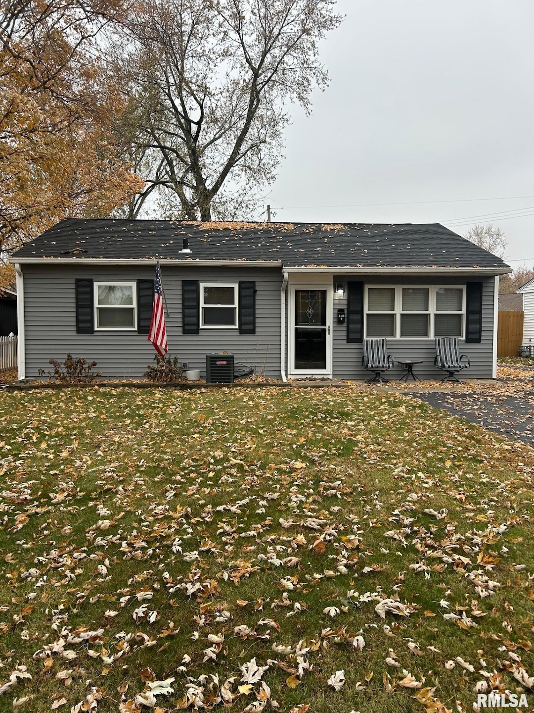
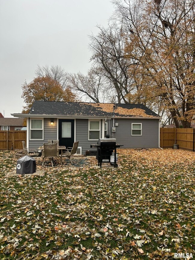
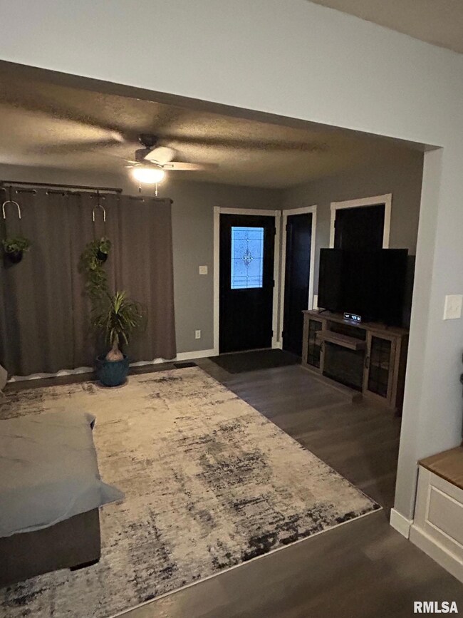
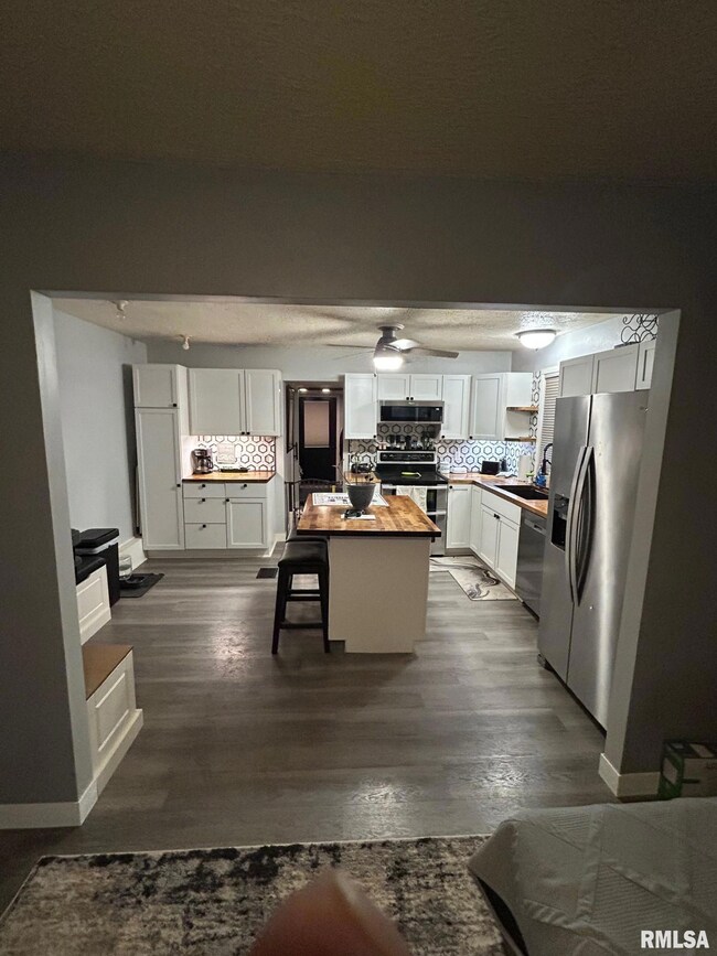
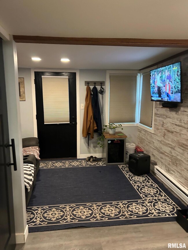
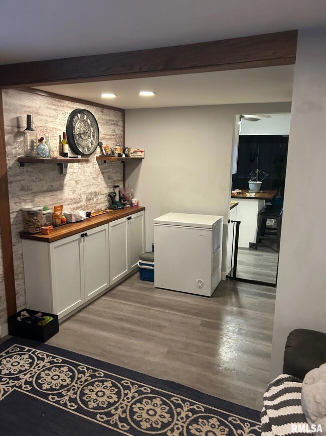
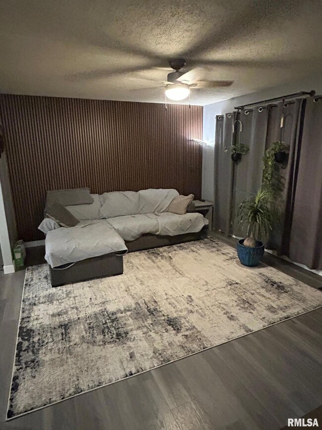
Don't miss your opportunity to own this updated and affordable 2 bedroom 1 bathroom ranch home! Several updates have been made in the last 2-3 years including LVP flooring that runs throughout the home, interior paint, interior light fixtures, updated kitchen cabinetry, HVAC System, vinyl windows, exterior vinyl siding, a new blacktop driveway installed, and even a new roof! Exterior features include the large fenced-in backyard, shed, back patio space, and great curb appeal! Whether you are a looking for an affordable space or an investor opportunity-this home is perfect for you!
Last Agent to Sell the Property
Campo Realty, Inc. Brokerage Phone: 217-625-4663 License #471001427 Listed on: 11/24/2025
Last Buyer's Agent
Campo Realty, Inc. Brokerage Phone: 217-625-4663 License #471001427 Listed on: 11/24/2025
| Date | Buyer | Sale Price | Title Company |
|---|---|---|---|
| Lcgc Properties Llc | $114,000 | None Listed On Document | |
| Matulis Michael T | -- | Mays Walden & Anastas Pc | |
| -- | -- | -- | |
| -- | $56,000 | -- | |
| -- | $53,500 | -- |
| Date | Status | Borrower | Loan Amount |
|---|---|---|---|
| Open | Lcgc Properties Llc | $91,200 | |
| Previous Owner | Matulis Michael T | $51,113 |
| Date | Event | Price | List to Sale | Price per Sq Ft |
|---|---|---|---|---|
| 12/19/2025 12/19/25 | Sold | $114,000 | 0.0% | $108 / Sq Ft |
| 11/25/2025 11/25/25 | Pending | -- | -- | -- |
| 11/24/2025 11/24/25 | For Sale | $114,000 | -- | $108 / Sq Ft |
| Year | Tax Paid | Tax Assessment Tax Assessment Total Assessment is a certain percentage of the fair market value that is determined by local assessors to be the total taxable value of land and additions on the property. | Land | Improvement |
|---|---|---|---|---|
| 2024 | $1,969 | $24,346 | $7,158 | $17,188 |
| 2023 | $1,937 | $22,543 | $6,628 | $15,915 |
| 2022 | $1,860 | $21,333 | $6,272 | $15,061 |
| 2021 | $1,796 | $20,497 | $6,026 | $14,471 |
| 2020 | $1,642 | $20,274 | $5,960 | $14,314 |
| 2019 | $1,582 | $19,920 | $5,856 | $14,064 |
| 2018 | $1,529 | $19,835 | $5,831 | $14,004 |
| 2017 | $1,492 | $19,530 | $5,741 | $13,789 |
| 2016 | $1,447 | $19,026 | $5,593 | $13,433 |
| 2015 | $1,420 | $18,597 | $5,467 | $13,130 |
| 2014 | $1,396 | $18,442 | $5,421 | $13,021 |
| 2013 | $1,375 | $18,639 | $5,479 | $13,160 |
Seller's Agent in 2025
Nick Campo
Campo Realty, Inc.
(217) 622-7889
278 Total Sales
Source: RMLS Alliance
MLS Number: CA1040722
APN: 22-14.0-206-010
Disclaimer: Certain information contained herein is derived from information provided by parties other than Homes.com. All information provided is deemed reliable, but is not guaranteed to be accurate and should be independently verified.
![]() Based on information submitted to the MLS GRID. All data is obtained from various sources and may not have been verified by broker or MLS GRID. Supplied Open House Information is subject to change without notice. All information should be independently reviewed and verified for accuracy. Properties may or may not be listed by the office/agent presenting the information. Some IDX listings have been excluded from this website.IDX information is provided exclusively for personal, non-commercial use, and may not be used for any purpose other than to identify prospective properties consumers may be interested in purchasing. Information is deemed reliable but not guaranteed.
Based on information submitted to the MLS GRID. All data is obtained from various sources and may not have been verified by broker or MLS GRID. Supplied Open House Information is subject to change without notice. All information should be independently reviewed and verified for accuracy. Properties may or may not be listed by the office/agent presenting the information. Some IDX listings have been excluded from this website.IDX information is provided exclusively for personal, non-commercial use, and may not be used for any purpose other than to identify prospective properties consumers may be interested in purchasing. Information is deemed reliable but not guaranteed.
Based on information submitted to the MLS GRID
Ask me questions while you tour the home.