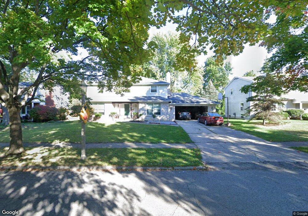
2414 Newport Dr Lansing, MI 48906
Northwestside NeighborhoodEstimated Value: $296,748 - $335,000
--
Bed
2
Baths
2,360
Sq Ft
$132/Sq Ft
Est. Value
About This Home
This home is located at 2414 Newport Dr, Lansing, MI 48906 and is currently estimated at $312,437, approximately $132 per square foot. 2414 Newport Dr is a home located in Ingham County with nearby schools including Cumberland Elementary School, Pattengill Academy, and J.W. Sexton High School.
Ownership History
Date
Name
Owned For
Owner Type
Purchase Details
Closed on
Jun 17, 2020
Sold by
Underhill Martin J
Bought by
Underhill Martin J and Underhill Deborah C
Current Estimated Value
Purchase Details
Closed on
Oct 6, 2004
Sold by
Cook Steven L and Cook Kristen M
Bought by
Underhill Martin J
Home Financials for this Owner
Home Financials are based on the most recent Mortgage that was taken out on this home.
Original Mortgage
$140,000
Outstanding Balance
$59,387
Interest Rate
3.66%
Mortgage Type
Purchase Money Mortgage
Estimated Equity
$253,050
Purchase Details
Closed on
May 7, 1999
Sold by
Hruska Thomas J and Hruska Luanna M
Bought by
Cook Steven L and Cook Kristen M
Home Financials for this Owner
Home Financials are based on the most recent Mortgage that was taken out on this home.
Original Mortgage
$115,900
Interest Rate
6.99%
Mortgage Type
Purchase Money Mortgage
Create a Home Valuation Report for This Property
The Home Valuation Report is an in-depth analysis detailing your home's value as well as a comparison with similar homes in the area
Home Values in the Area
Average Home Value in this Area
Purchase History
| Date | Buyer | Sale Price | Title Company |
|---|---|---|---|
| Underhill Martin J | -- | None Available | |
| Underhill Martin J | $175,500 | Crossroads Title | |
| Cook Steven L | $144,900 | -- |
Source: Public Records
Mortgage History
| Date | Status | Borrower | Loan Amount |
|---|---|---|---|
| Open | Underhill Martin J | $140,000 | |
| Previous Owner | Cook Steven L | $115,900 |
Source: Public Records
Tax History Compared to Growth
Tax History
| Year | Tax Paid | Tax Assessment Tax Assessment Total Assessment is a certain percentage of the fair market value that is determined by local assessors to be the total taxable value of land and additions on the property. | Land | Improvement |
|---|---|---|---|---|
| 2025 | $6,601 | $168,100 | $16,000 | $152,100 |
| 2024 | $56 | $141,800 | $16,000 | $125,800 |
| 2023 | $6,207 | $121,100 | $16,000 | $105,100 |
| 2022 | $5,454 | $105,300 | $13,300 | $92,000 |
| 2021 | $5,327 | $104,700 | $10,200 | $94,500 |
| 2020 | $4,108 | $98,300 | $10,200 | $88,100 |
| 2019 | $3,942 | $92,100 | $10,200 | $81,900 |
| 2018 | $3,689 | $82,200 | $10,200 | $72,000 |
| 2017 | $3,533 | $82,200 | $10,200 | $72,000 |
| 2016 | $3,379 | $70,200 | $10,200 | $60,000 |
| 2015 | $3,379 | $64,100 | $20,487 | $43,613 |
| 2014 | $3,379 | $61,000 | $28,682 | $32,318 |
Source: Public Records
Map
Nearby Homes
- 2515 Kuerbitz Dr
- 2524 Newport Dr
- 3500 Colchester Rd
- 2400 Beacon Hill Dr
- 3116 Colchester Rd
- 3314 Sunnylane
- 3733 Colchester Rd
- 3016 Westmont Ave
- 1649 Boynton Dr
- 3031 Amherst Dr
- 2400 Leon Ave
- 3709 Pino Dr
- 2921 Tecumseh River Rd
- 2722 Tecumseh River Rd
- 3515 Wilson Ave
- 1610 Ravenswood Dr
- 2316 Barstow Rd
- 3319 Westmont Ave
- 3212 Belgian Dr
- 3331 Pickwick Place
- 2420 Newport Dr
- 2406 Newport Dr
- 2405 Kuerbitz Dr
- 3323 Colchester Rd
- 2319 Kuerbitz Dr
- 2413 Kuerbitz Dr
- 3327 Cambrey Dr
- 2402 Newport Dr
- 2415 Newport Dr
- 2313 Kuerbitz Dr
- 2423 Newport Dr
- 3400 Cambrey Dr
- 3311 Colchester Rd
- 3405 Colchester Rd
- 2305 Kuerbitz Dr
- 3335 Cambrey Dr
- 3418 Cambrey Dr
- 3401 Cambrey Dr
- 3322 Colchester Rd