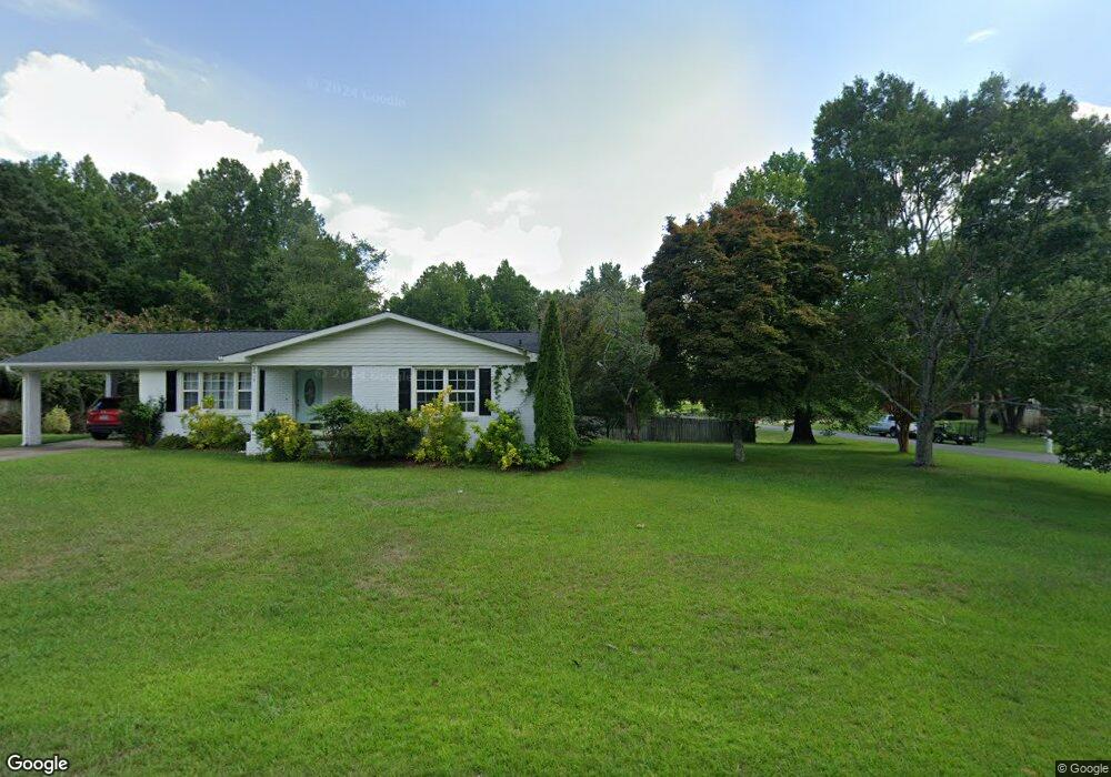
2415 Colvin Cir N Gadsden, AL 35907
Estimated Value: $207,000 - $230,000
--
Bed
2
Baths
1,269
Sq Ft
$173/Sq Ft
Est. Value
About This Home
This home is located at 2415 Colvin Cir N, Gadsden, AL 35907 and is currently estimated at $220,000, approximately $173 per square foot. 2415 Colvin Cir N is a home located in Etowah County with nearby schools including Southside High School, Southside Elementary School, and Rainbow Middle School.
Ownership History
Date
Name
Owned For
Owner Type
Purchase Details
Closed on
Oct 2, 2019
Sold by
Glenn Properties And Development Llc
Bought by
Davenport Chris and Davenport Angela G
Current Estimated Value
Purchase Details
Closed on
Oct 9, 2018
Bought by
Waldrop Donald E and Waldrop Christina
Home Financials for this Owner
Home Financials are based on the most recent Mortgage that was taken out on this home.
Original Mortgage
$24,700
Interest Rate
4.71%
Create a Home Valuation Report for This Property
The Home Valuation Report is an in-depth analysis detailing your home's value as well as a comparison with similar homes in the area
Home Values in the Area
Average Home Value in this Area
Purchase History
| Date | Buyer | Sale Price | Title Company |
|---|---|---|---|
| Davenport Chris | $18,000 | None Available | |
| Waldrop Donald E | -- | -- |
Source: Public Records
Mortgage History
| Date | Status | Borrower | Loan Amount |
|---|---|---|---|
| Previous Owner | Waldrop Donald E | $24,700 | |
| Previous Owner | Waldrop Donald E | -- |
Source: Public Records
Tax History Compared to Growth
Tax History
| Year | Tax Paid | Tax Assessment Tax Assessment Total Assessment is a certain percentage of the fair market value that is determined by local assessors to be the total taxable value of land and additions on the property. | Land | Improvement |
|---|---|---|---|---|
| 2024 | $602 | $15,880 | $1,520 | $14,360 |
| 2023 | $525 | $15,880 | $1,520 | $14,360 |
| 2022 | $1,074 | $26,200 | $0 | $0 |
| 2021 | $804 | $19,600 | $3,040 | $16,560 |
| 2020 | $804 | $19,600 | $0 | $0 |
| 2019 | $848 | $20,680 | $0 | $0 |
| 2017 | $366 | $10,120 | $0 | $0 |
| 2016 | $366 | $10,120 | $0 | $0 |
| 2015 | $366 | $10,120 | $0 | $0 |
| 2013 | -- | $9,920 | $0 | $0 |
Source: Public Records
Map
Nearby Homes
- 2603 Sunnydale Dr
- 2609 Watson St
- 2126 Evening Dr
- 2651 Powell St
- 2126 Cedar Bend Rd N
- 2172 Brookdale Rd
- 10 Meadowood Dr
- 2130 Meadowood Dr
- 2943 Highway 77
- 1990 Meadowood Dr
- 2573 Western Hills Dr E
- 3381 Alabama 77
- 1609 Pine Place
- 2810 Mountain View Dr
- 2400 Summerchase Dr
- 2245 Waterfront Dr
- 1599 Westwood Ln
- 1691 Jorden Dr
- 2434 Timberlake Dr
- 1508 Western Ln
- 2425 Colvin Cir N
- 2565 Phil St
- 2550 Phil St
- 2410 Colvin Cir N
- 2430 Colvin Cir N
- 2380 Colvin Cir N
- 2458 Colvin Cir N
- 2606 Phil St
- 2360 Colvin Cir N
- 2555 Mcclendon St
- 2462 Colvin Cir N
- 2350 Colvin Cir N
- 2585 Mcclendon St
- 2616 Phil St
- 2330 Colvin Cir N
- 2310 Colvin Cir N
- 2361 Mcclain Ave
- 2526 Robertson St W
- 2502 Robertson St W
- 2661 Mcclendon St