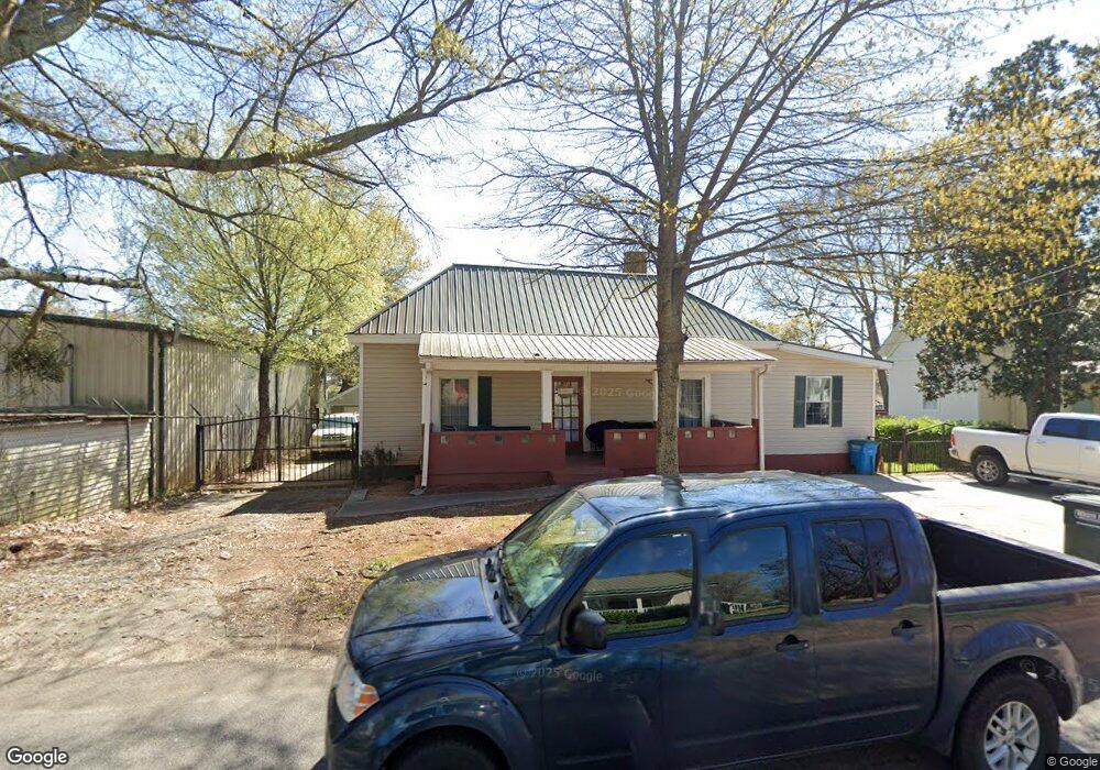
2415 N Broad St Commerce, GA 30529
Estimated Value: $318,739 - $414,000
5
Beds
3
Baths
2,393
Sq Ft
$148/Sq Ft
Est. Value
About This Home
This home is located at 2415 N Broad St, Commerce, GA 30529 and is currently estimated at $353,685, approximately $147 per square foot. 2415 N Broad St is a home located in Jackson County with nearby schools including Commerce Primary School, Commerce Elementary School, and Commerce Middle School.
Ownership History
Date
Name
Owned For
Owner Type
Purchase Details
Closed on
Jun 4, 2021
Sold by
Zelaya Denia
Bought by
Kubiak Christopher A and Kubiak Dana L
Current Estimated Value
Home Financials for this Owner
Home Financials are based on the most recent Mortgage that was taken out on this home.
Original Mortgage
$217,487
Outstanding Balance
$195,616
Interest Rate
2.9%
Mortgage Type
FHA
Estimated Equity
$158,069
Purchase Details
Closed on
Apr 30, 2001
Sold by
Wood Mary L
Bought by
Zelaya Denia
Create a Home Valuation Report for This Property
The Home Valuation Report is an in-depth analysis detailing your home's value as well as a comparison with similar homes in the area
Home Values in the Area
Average Home Value in this Area
Purchase History
| Date | Buyer | Sale Price | Title Company |
|---|---|---|---|
| Kubiak Christopher A | $221,500 | -- | |
| Zelaya Denia | $52,000 | -- |
Source: Public Records
Mortgage History
| Date | Status | Borrower | Loan Amount |
|---|---|---|---|
| Open | Kubiak Christopher A | $217,487 |
Source: Public Records
Tax History
| Year | Tax Paid | Tax Assessment Tax Assessment Total Assessment is a certain percentage of the fair market value that is determined by local assessors to be the total taxable value of land and additions on the property. | Land | Improvement |
|---|---|---|---|---|
| 2025 | $4,242 | $163,700 | $59,040 | $104,660 |
| 2024 | $4,242 | $146,460 | $41,800 | $104,660 |
| 2023 | $4,025 | $135,340 | $41,800 | $93,540 |
| 2022 | $2,800 | $86,340 | $12,520 | $73,820 |
| 2021 | $1,130 | $37,820 | $9,400 | $28,420 |
| 2020 | $1,136 | $31,940 | $9,400 | $22,540 |
| 2019 | $1,153 | $31,940 | $9,400 | $22,540 |
| 2018 | $1,135 | $31,756 | $9,400 | $22,356 |
| 2017 | $1,156 | $31,760 | $9,409 | $22,351 |
| 2016 | $1,161 | $31,760 | $9,409 | $22,351 |
| 2015 | $1,045 | $28,004 | $4,414 | $23,590 |
| 2014 | $1,034 | $27,505 | $4,414 | $23,091 |
| 2013 | -- | $27,504 | $4,414 | $23,090 |
Source: Public Records
Map
Nearby Homes
- 2140 N Broad St
- 44 Troy St
- 191 Orchard Cir
- 0 Ridgeway St
- 245 Hospital Rd
- 83 Ridgeway Dr
- 304 Hill St
- 321 Pine Ave
- 51 Pine Ave
- 92 Duncan St Unit LOT 1 AND 2
- 8569 Jefferson Rd
- 178 Cole Court Dr
- 25 Beckett Way
- 177 Bolton Dr
- 31 Coles Court Dr
- 96 Magnolia Place
- 0 Martin Luther King Junior Dr Unit CL336436
- 0 Martin Luther King Junior Dr
- 64 College Ave
- 392 Katie Ln
- 2435 N Broad St
- 2414 N Broad St
- 2402 N Broad St
- 2459 N Broad St
- 2459 N Broad St
- 2436 N Broad St
- 2370 N Broad St
- 2458 N Broad St
- 2355 N Elm St Unit 103
- 2355 N Elm St Unit 106
- 2355 N Elm St
- 2353 N Broad St
- 2353 N Elm St
- 49 Forest Ave
- 49 Forest Dr
- 2481 N Broad St
- 88 Brookwood Ave
- 171 Peach St
- 185 Peach St
- 157 Peach St
Your Personal Tour Guide
Ask me questions while you tour the home.