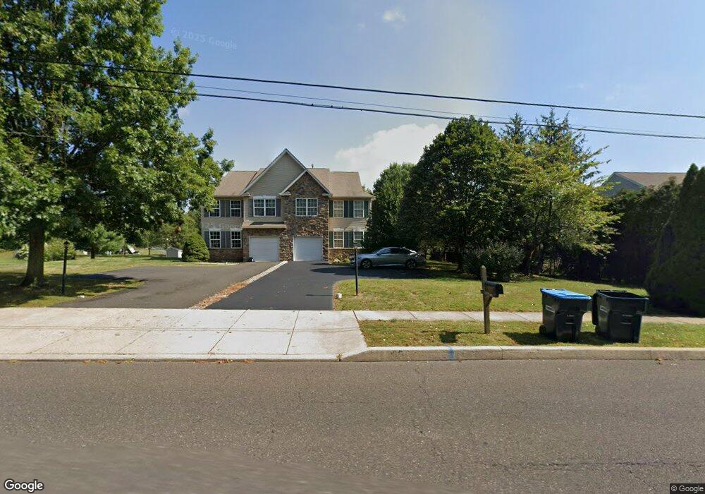
2415 School Rd Hatfield, PA 19440
Estimated Value: $459,407 - $506,000
3
Beds
3
Baths
1,960
Sq Ft
$245/Sq Ft
Est. Value
About This Home
This home is located at 2415 School Rd, Hatfield, PA 19440 and is currently estimated at $479,852, approximately $244 per square foot. 2415 School Rd is a home located in Montgomery County with nearby schools including A. M. Kulp Elementary School, Pennfield Middle School, and North Penn Senior High School.
Ownership History
Date
Name
Owned For
Owner Type
Purchase Details
Closed on
May 28, 2004
Sold by
Lapio Sal Inc
Bought by
Misczak John W and Misczak Diane C
Current Estimated Value
Purchase Details
Closed on
Oct 24, 2003
Sold by
Hatfield Twp
Bought by
Hatfield Twp and Lapio Sal Inc
Purchase Details
Closed on
Oct 3, 2003
Sold by
Lapio Sal Inc
Bought by
Ppl Electric Util Corp and Verizon Pa Inc
Purchase Details
Closed on
Jun 2, 2000
Sold by
Renner Naomi K and Byers Ruth K
Bought by
Cruz Bay Properties Inc
Purchase Details
Closed on
Jul 24, 1997
Sold by
Landis Norman S
Bought by
Telvil Corp
Create a Home Valuation Report for This Property
The Home Valuation Report is an in-depth analysis detailing your home's value as well as a comparison with similar homes in the area
Home Values in the Area
Average Home Value in this Area
Purchase History
| Date | Buyer | Sale Price | Title Company |
|---|---|---|---|
| Misczak John W | $261,325 | -- | |
| Hatfield Twp | -- | -- | |
| Ppl Electric Util Corp | -- | -- | |
| Cruz Bay Properties Inc | $160,000 | -- | |
| Telvil Corp | $50,000 | -- |
Source: Public Records
Tax History Compared to Growth
Tax History
| Year | Tax Paid | Tax Assessment Tax Assessment Total Assessment is a certain percentage of the fair market value that is determined by local assessors to be the total taxable value of land and additions on the property. | Land | Improvement |
|---|---|---|---|---|
| 2025 | $6,046 | $151,020 | $44,510 | $106,510 |
| 2024 | $6,046 | $151,020 | $44,510 | $106,510 |
| 2023 | $5,787 | $151,020 | $44,510 | $106,510 |
| 2022 | $5,598 | $151,020 | $44,510 | $106,510 |
| 2021 | $5,439 | $151,020 | $44,510 | $106,510 |
| 2020 | $5,311 | $151,020 | $44,510 | $106,510 |
| 2019 | $5,222 | $151,020 | $44,510 | $106,510 |
| 2018 | $5,221 | $151,020 | $44,510 | $106,510 |
| 2017 | $5,023 | $151,020 | $44,510 | $106,510 |
| 2016 | $4,963 | $151,020 | $44,510 | $106,510 |
| 2015 | $4,765 | $151,020 | $44,510 | $106,510 |
| 2014 | $4,765 | $151,020 | $44,510 | $106,510 |
Source: Public Records
Map
Nearby Homes
- 2331 Cambridge Cir
- 333 Union St Unit 4
- 0 Fairmount St
- 3 Diamond St
- 138 Diamond St Unit 31
- 142 Orchard Ln
- 105 S Main St
- 27 W School St
- 2031 Oak Ave
- 1533 School Rd
- 453 S Main St
- 43 June Dr
- 302 W Broad St
- 2317 E Orvilla Rd
- 1717 Lisa Ct
- 1520 Fairgrounds Rd
- 1503 Emily Ct
- 2689 Jean Dr
- 10 Queen Anne Way
- 10 Brighton Place
- 2417 School Rd
- 2407 School Rd
- 2419 School Rd
- 2405 School Rd
- 2384 Cambridge Cir
- 2388 Cambridge Cir
- 2392 Cambridge Cir
- 2380 Cambridge Cir
- 2701 Unionville Pike
- 2396 Cambridge Cir
- 2421 School Rd
- 2403 School Rd
- 2703 Unionville Pike
- 2376 Cambridge Cir
- 2400 Cambridge Cir
- 2404 Cambridge Cir
- 2705 Unionville Pike
- 2372 Cambridge Cir
- 2401 School Rd
- 2371 Cambridge Cir