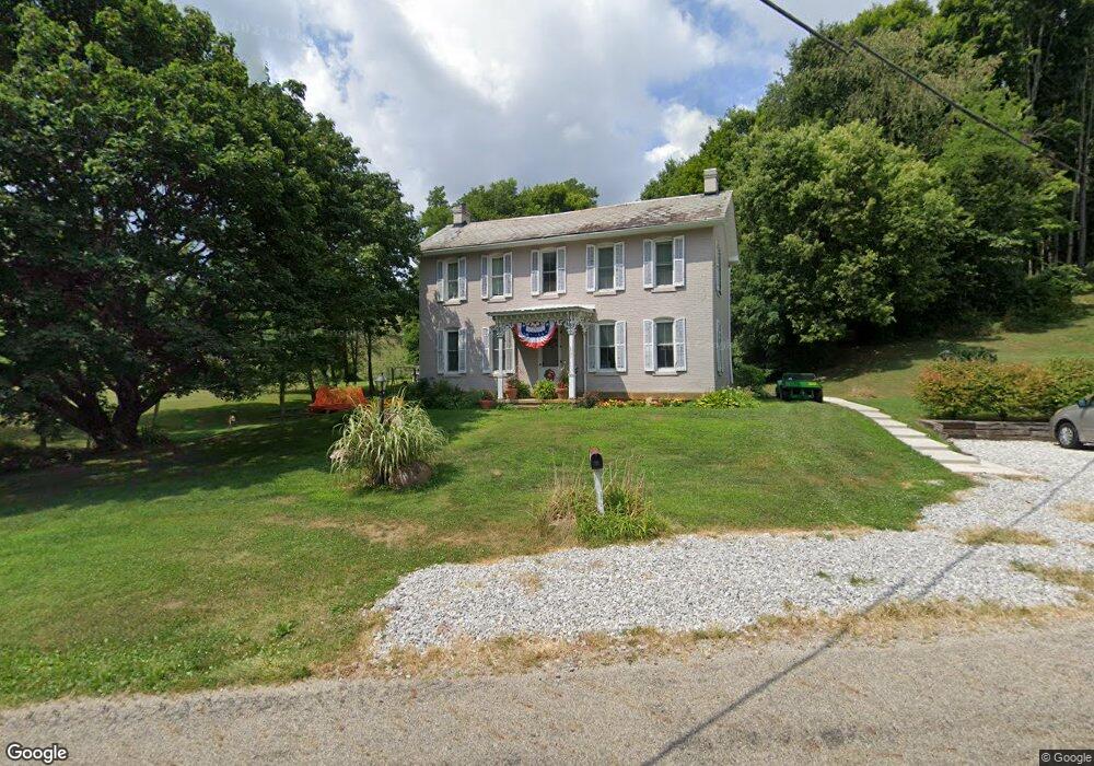
2415 Stringtown Rd NE Lancaster, OH 43130
Estimated Value: $377,000 - $550,000
4
Beds
4
Baths
2,700
Sq Ft
$173/Sq Ft
Est. Value
About This Home
This home is located at 2415 Stringtown Rd NE, Lancaster, OH 43130 and is currently estimated at $467,608, approximately $173 per square foot. 2415 Stringtown Rd NE is a home located in Fairfield County with nearby schools including St Mary Elementary School and William V Fisher Catholic High School.
Ownership History
Date
Name
Owned For
Owner Type
Purchase Details
Closed on
Oct 31, 2013
Sold by
Fletcher Kimberley S and Fletcher Raymond E
Bought by
Meadow Lane Farms Llc
Current Estimated Value
Purchase Details
Closed on
May 11, 2006
Sold by
Duncan Alan
Bought by
Duncan Kimberly S and Fletcher Raymond E
Home Financials for this Owner
Home Financials are based on the most recent Mortgage that was taken out on this home.
Original Mortgage
$175,600
Interest Rate
6.54%
Mortgage Type
Fannie Mae Freddie Mac
Purchase Details
Closed on
Dec 29, 2004
Sold by
Ritter Carol A
Bought by
Duncan Alan and Duncan Kimberley S
Home Financials for this Owner
Home Financials are based on the most recent Mortgage that was taken out on this home.
Original Mortgage
$125,200
Interest Rate
5.62%
Mortgage Type
Construction
Create a Home Valuation Report for This Property
The Home Valuation Report is an in-depth analysis detailing your home's value as well as a comparison with similar homes in the area
Home Values in the Area
Average Home Value in this Area
Purchase History
| Date | Buyer | Sale Price | Title Company |
|---|---|---|---|
| Meadow Lane Farms Llc | $210,000 | None Available | |
| Duncan Kimberly S | -- | The Talon Group | |
| Duncan Alan | $44,500 | -- |
Source: Public Records
Mortgage History
| Date | Status | Borrower | Loan Amount |
|---|---|---|---|
| Previous Owner | Duncan Kimberly S | $175,600 | |
| Previous Owner | Duncan Alan | $125,200 |
Source: Public Records
Tax History Compared to Growth
Tax History
| Year | Tax Paid | Tax Assessment Tax Assessment Total Assessment is a certain percentage of the fair market value that is determined by local assessors to be the total taxable value of land and additions on the property. | Land | Improvement |
|---|---|---|---|---|
| 2024 | $8,238 | $84,840 | $30,100 | $54,740 |
| 2023 | $3,485 | $84,840 | $30,100 | $54,740 |
| 2022 | $3,528 | $84,840 | $30,100 | $54,740 |
| 2021 | $2,938 | $68,690 | $27,360 | $41,330 |
| 2020 | $2,827 | $68,690 | $27,360 | $41,330 |
| 2019 | $2,701 | $68,690 | $27,360 | $41,330 |
| 2018 | $2,415 | $58,000 | $27,360 | $30,640 |
| 2017 | $2,416 | $58,000 | $27,360 | $30,640 |
| 2016 | $2,231 | $57,670 | $27,360 | $30,310 |
| 2015 | $2,250 | $56,400 | $27,360 | $29,040 |
| 2014 | $2,149 | $56,400 | $27,360 | $29,040 |
| 2013 | $2,149 | $56,400 | $27,360 | $29,040 |
Source: Public Records
Map
Nearby Homes
- 2865 Stringtown Rd NW
- 0 Coonpath Rd NW Unit Tract 4 224028093
- 0 Coonpath Rd NW Unit Tract 7 224028097
- 173 Lakeview Dr NE
- 626 Rainbow Dr NW
- 0 Stringtown Rd NW
- 2149 Pleasantview Dr NE
- 2195 William T Cir
- 1801 Pleasantview Dr NE
- 0 Tschopp Rd NE Unit Lot 17 225027320
- 0 Tschopp Rd NE Unit Lot 33 225027324
- 1916 Country Place
- 465 Ginder Rd NW
- 1080 Coonpath Rd NW
- 1101 Beechwood Dr NE
- 1195 Longwood Dr NE
- 0 Old Millersport Rd NE Unit Tract 8 224028101
- 0 Old Millersport Rd NE Unit Lot 10 225033491
- 0 Old Millersport Rd NE Unit 225010386
- 2444 Sheridan Dr
- 2522 Stringtown Rd NE
- 2545 Stringtown Rd NE
- 2550 Stringtown Rd NE
- 2620 Stringtown Rd NE
- 2300 Stringtown Rd NE
- 2690 Stringtown Rd NE
- 2730 Stringtown Rd NE
- 100 Rainbow Dr NE
- 40 Rainbow Dr NE
- 2850 Stringtown Rd NE
- 120 Rainbow Dr NE
- 2752 Stringtown Rd NE
- 000 Rainbow Dr NE
- 0 Rainbow Dr NE
- 0 Rainbow Dr NE Unit 2652940
- 0 Rainbow Dr NE Unit 2609414
- 0 Rainbow Dr NE Unit 2330754
- 0 Rainbow Dr NE Unit 2131131
- 0 Rainbow Dr NE Unit 2118673
- 0 Rainbow Dr NE Unit 2030689